Walischeben - Großenberg (Packalpe) (below the Ameringkogel summit)
Starting point: Walischeben (1603 m)
| Latitude/Longitude: | 47,04940°N 14,79840°E |
| |
Route name: below the Ameringkogel summit
Walking time: 2 h 20 min
Difficulty: easy marked way
Elevation gain: 549 m
Elevation difference along the route: 600 m
Map: WK 212 (Seetaler & Seckauer Alpen 1:50.000)
Recommended equipment (summer):
Recommended equipment (winter): ice axe, crampons
Views: 2.650
 | 1 person like this post |
Access to starting point:
A) From the Gorenjska side we go over the border crossing Ljubelj to Celovec / Klagenfurt or through the Karawanks Tunnel to Beljak / Villach. Next we head onto the motorway in the direction of the signs for Gradec / Graz. We leave the motorway before the approximately 2 km long tunnel in the direction of Bad St. Leonhard. Further, we drive past the village of St. Peter to the settlement Obdach. From the main road, the signs for Obdach direct us to the left and soon we come to the industrial zone. Before the underpass we turn right, where after a few dozen meters we cross the railway track. We follow the road, which becomes macadam at all junctions, towards the signs for Weißenstein Hütte. We park at a suitable spot by the road at the sign prohibiting further driving (there is also a junction in the immediate vicinity of the parking area).
B) From the Koroška side we first drive to Dravograd and further into Austria. We follow the road ahead towards St. Paul, St. Andrä and Volšperk / Wolfsberg. In Volšperk we head towards Bad St. Leonhard and continue towards St. Peter. Further, we follow description A.
C) From the Štajerska side we drive to Maribor and further over the border crossing Šentilj into Austria. We follow the motorway in the direction of Celovec / Klagenfurt. We leave the motorway at the exit Bad St. Leonhard. Further, we follow description A.
Route description:
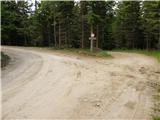
From the starting point, we head onto the left road, marked with signs for the Weißensteinhütte cottage. We continue along the road, which moderately ascends, and after a few minutes leads us out of the forest onto scenic slopes, offering a beautiful view. Ahead, we soon notice the mountain cottage, which we reach in a few minutes of further walking.
From the cottage, we turn sharply right and proceed along the marked path, which first crosses a grazing fence and then continues on a wider cart track. After a few minutes of ascent, we reach a junction where we turn left toward the Speikkogel peak (straight leads to Peterer Sattel) and we follow a rougher, partly grassy cart track. After a short diagonal climb across a scenic grassy slope, we reach the edge of the forest, where the path splits once more.
We turn left again, now toward the Weißenstein and Ameringkogel peaks (straight leads to Speikkogel), ascending first along a grazing fence, then through thinning forest, and further up an increasingly scenic grassy slope. Higher up, the path begins to fade, splitting into several smaller footpaths, but we follow the wide grassy ridge, which gently curves slightly to the right. We follow the increasingly scenic path to the main ridge, reaching it at the Weißenstein summit.
A few steps ahead we notice hiking signposts, and we continue slightly to the left of the signs for Ameringkogel.
We continue on a poorer, partly pathless marked trail, which bypasses Ameringkogel on the left side. Further on, several smaller footpaths merge into one relatively easy-to-follow trail, which continues to traverse the scenic western slopes of Ameringkogel. When we reach the saddle between Ameringkogel and Großenberg a little further, we proceed straight toward the summit of Großenberg (sharply to the right for Ameringkogel). Further on, we first ascend gently, then moderately, and we follow this trail all the way to the nearby peak.
Walischeben - Weißensteinhütte 0:20, Weißensteinhütte - Weißenstein 1:25, Weißenstein - Großenberg 0:35.
The description and images refer to conditions in July 2007 and July 2023.

Photos:
 1
1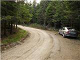 2
2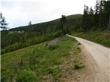 3
3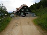 4
4 5
5 6
6 7
7 8
8 9
9 10
10 11
11 12
12 13
13 14
14 15
15 16
16 17
17 18
18 19
19 20
20 21
21 22
22 23
23 24
24 25
25 26
26 27
27 28
28 29
29 30
30 31
31 32
32 33
33 34
34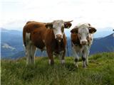 35
35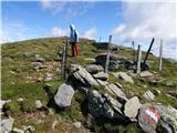 36
36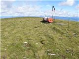 37
37 38
38
Discussion about the trip Walischeben - Großenberg (Packalpe) (below the Ameringkogel summit)
To post a comment you must log in:
If you do not yet have a username, you must first
register.