Adergas - Apnišče (via Šterna)
Starting point: Adergas (424 m)
| Latitude/Longitude: | 46,27060°N 14,46430°E |
| |
Route name: via Šterna
Walking time: 1 h
Difficulty: easy unmarked way
Elevation gain: 316 m
Elevation difference along the route: 316 m
Map:
Recommended equipment (summer):
Recommended equipment (winter):
Views: 1.370
 | 2 people like this post |
Access to starting point:
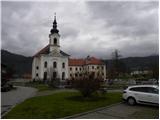
A) From the Ljubljana–Jesenice highway, we take the Vodice exit, then continue driving towards Krvavec and Cerklje na Gorenjskem. From the roundabout at Spodnji Brnik, we take the exit towards Krvavec and Cerklje na Gorenjskem. Through Cerklje na Gorenjskem, we follow the main road, then arrive at the settlement of Češnjevek and a little further at the settlement of Trata, where we turn right towards Adergas. We then drive along a somewhat narrower road, which we follow to the Adergas monastery, where we park in the large parking lot.
B) We leave the Gorenjska highway at the Kranj–east or Brnik exit, then continue driving towards Šenčur. We drive through Šenčur, where in the middle of the settlement we turn slightly right towards Srednje vasi. The route then takes us along Velesova Road; at the junction where the road to Velesovo branches left, we continue straight along the main road. A little further, we reach a junction with a priority road, where at the stop sign we continue left (right to Praprotna Polica). When we reach the main road Visoko–Cerklje na Gorenjskem, we continue right, then immediately left onto the road to Adergas (practically just crossing the main road). We then drive along a somewhat narrower road, which we follow to the Adergas monastery, where we park in the large parking lot.
Route description:
From the parking lot, we continue on the asphalt road, which continues along the left side of the wall of the former monastery. We follow the mentioned road to the first left bend, where signs for Štefanja gora direct us right onto a footpath. After some 10 steps of further walking, the marked path turns left and begins to ascend more steeply. Soon the gradient eases, and from the left a path from the water intake joins us. We continue slightly right past a small marker, along a gentle path that continues on and beside the cart track, which is usually quite muddy a few days after rain. A little further, a path from Velesovo also joins from the left side, and we continue along the wide and gentle cart track. The easy path then brings us to a marked junction, beside which there is a small chapel.
We continue left in the direction of "šterne" (right "klopce") along a path that for some time still follows a gentle cart track. The cart track soon turns into a wide and somewhat steeper footpath, which higher up joins another wider cart track. We continue the moderate ascent through the forest, and from the left a marked path from the village Olševek joins us. Just a little above the mentioned junction, we reach the "šterna", where the path turns sharply right and after a further short ascent brings us to a small saddle, where there is the next junction with direction signs for Olševek, Adergas and Možjanca.
We continue along the left cart track (the far-right path leads to the church of St. Štefan on Štefanja gora), from which we soon go left onto a well-trodden but unmarked path. A little further, the path brings us out of the forest onto a meadow, from which a nice view opens towards Kalški greben and Krvavec. When the path returns to the forest, only a short ascent remains, and the path brings us to the summit of Apnišče.

The trip can be extended to the following destinations: Štefanja gora
Photos:
 1
1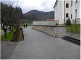 2
2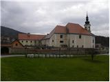 3
3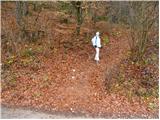 4
4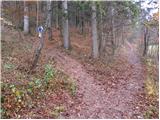 5
5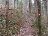 6
6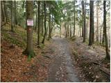 7
7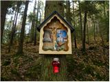 8
8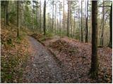 9
9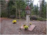 10
10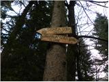 11
11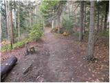 12
12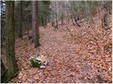 13
13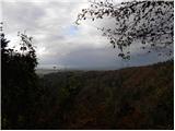 14
14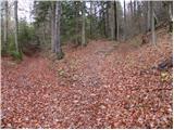 15
15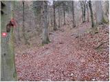 16
16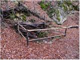 17
17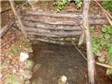 18
18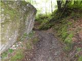 19
19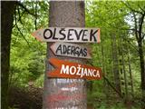 20
20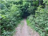 21
21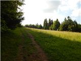 22
22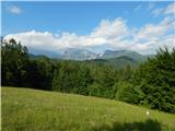 23
23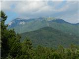 24
24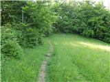 25
25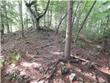 26
26 27
27
Discussion about the trip Adergas - Apnišče (via Šterna)
To post a comment you must log in:
If you do not yet have a username, you must first
register.