Aljažev dom v Vratih - Cmir (via Prag)
Starting point: Aljažev dom v Vratih (987 m)
| Latitude/Longitude: | 46,41280°N 13,84660°E |
| |
Route name: via Prag
Walking time: 6 h 30 min
Difficulty: very difficult marked way
Elevation gain: 1406 m
Elevation difference along the route: 1610 m
Map: Triglav 1:25.000
Recommended equipment (summer): helmet, self belay set
Recommended equipment (winter): helmet, self belay set, ice axe, crampons
Views: 11.800
 | 3 people like this post |
Access to starting point:
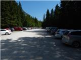
We drive to Mojstrana, then follow the signs for Vrata Valley. We continue along the toll road, which is closed to public traffic in winter, following it to the large parking lot located a few minutes before Aljažev dom v Vratih.
Route description:
From the parking lot, we continue along the gravel road closed to public traffic, passing Šlajmerjev dom to quickly reach Aljažev dom v Vratih.
We bypass Aljažev dom on the right and continue straight towards Triglav, Sovatna, Luknja... (right Škrlatica, bivak na Rušju...). We continue on the poorer gravel road, which takes us past the winter room to a marked junction at the famous peg (monument to fallen partisan mountaineers).
We continue straight again (left Tominškova pot), a gentle path leading with beautiful views of Triglav and the Triglav North Face. After a few minutes of walking, we enter a beech forest, where the path to Sovatna branches right; we continue straight towards Luknja and Triglav - the path over Prag. A short ascent on the cart track follows, then the markers direct us left to a path approaching the bed of Triglavska Bistrica. Here the path passes a memorial to mountain victims, and shortly after we reach the next marked junction.
Straight continues the path to Luknja, but we go left towards the path over Prag, first crossing the Triglavska Bistrica stream (the source of Bistrica is a bit higher).
On the other side of the stream, we quickly reach the first steep section, aided by the first pegs; after a few minutes, the difficulty eases, but we continue steeply ascending, with increasingly beautiful views across the valley from the path.
This section is partly overgrown with brush, higher up safety gear reappears, and soon we reach probably the most difficult part of the path over Prag, where with the help of brackets and cables we climb a nearly vertical 15-meter chimney. The path gradually becomes easier again, Tominškova pot joins from the left, and a few steps further we reach Begunjski studenec.
We continue steeply ascending; the path is not technically demanding here, after about 15 minutes we reach the next junction near Kotla.
We go left towards Staničev dom pod Triglavom (slightly right Triglav and Triglavski dom na Kredarici) and traverse the high karst terrain, bypassing the Kotel valley on the left; the path leads along fissures and sinkholes, so extra caution is needed especially in fog and snow, but otherwise not technically demanding. Higher, we cross a short scree slope transversely, then reach the plateau, ascending with beautiful views of Triglav and surrounding peaks to Dom Valentina Staniča.
From the hut, we go left towards Begunjski vrh, Visoke Vrbanove špice and Cmir (straight dolina Kot, right dolina Krma and Rjavina, sharply right Triglavski dom na Kredarici and Triglav). A fairly gentle path brings us to Begunjski preval after a few minutes, where the path to Vrbanove špice branches right; we continue straight on a path that soon splits into two.
We go straight (left Begunjski vrh) along the path crossing the northeast slopes of Begunjski vrh (possible snow patches in early summer) and then to a small saddle behind the mentioned peak. Here we get a beautiful view into Vrata Valley and the surrounding mountains.
The path then turns right and crosses a well-protected smooth rock slab. We ascend steeply further, reaching a very scenic ridge which we follow northeast. The pleasant scenic path is then stopped by a steep rock step, down which we descend vertically on an excellently protected path (10 m). The path, now somewhat easier, descends a bit longer, then begins ascending towards Rjavčeve glave. After a few minutes of ascent, we step onto the mentioned peak, from which the path descends steeply down a grassy slope (risk of slipping). Further, in a moderate ascent, it reaches a narrow and exposed ridge, descending into the notch below the main summit of Cmir. On the other side, the path turns slightly left and begins steeply ascending the summit slope. After about 15 minutes of steep ascent, we reach the summit of Cmir, offering a very beautiful view.
Starting point - Aljažev dom 0:05, Aljažev dom - source of Bistrica 0:55, source of Bistrica - Begunjski studenec 2:45, Begunjski studenec - Kotel 0:15, Kotel - Dom Valentina Staniča 0:30, Dom Valentina Staniča - Cmir 2:00.

Along the route: Aljažev dom v Vratih (1001m), Spomenik padlim partizanom gornikom (1020m), V Plazičih (1040m), Izvir Bistrice (1160m), Begunjski studenec (2091m), Kotel (2166m),
Dom Valentina Staniča (2332m), Begunjska vratca (2342m), Rjavčeve glave (2360m)
Photos:
 1
1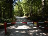 2
2 3
3 4
4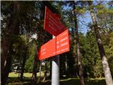 5
5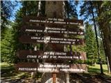 6
6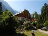 7
7 8
8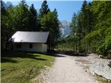 9
9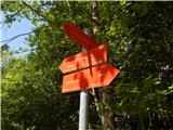 10
10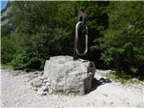 11
11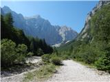 12
12 13
13 14
14 15
15 16
16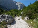 17
17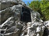 18
18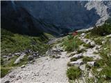 19
19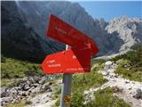 20
20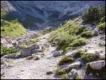 21
21 22
22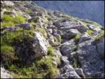 23
23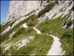 24
24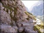 25
25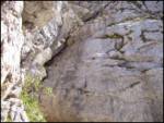 26
26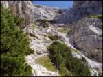 27
27 28
28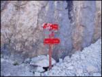 29
29 30
30 31
31 32
32 33
33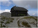 34
34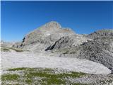 35
35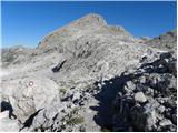 36
36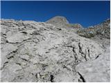 37
37 38
38 39
39 40
40 41
41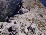 42
42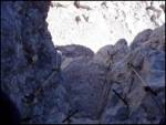 43
43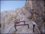 44
44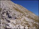 45
45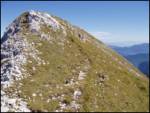 46
46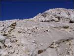 47
47 48
48
Discussion about the trip Aljažev dom v Vratih - Cmir (via Prag)
|
| bo_zl26. 08. 2020 |
Over Prag, from the junction with Tominškova to the turn-off for Staničev dom, it seems to me more and more ruined year by year. Am I wrong?
the signpost in picture 29 is barely peeking out from the rocks.
from Stanič onwards to Cmir it's pure enjoyment, peace and just the right amount of scrambling. Descent down the valley behind Cmir to Vrata. First time.
Just before the start of the first climbing section, looking from the summit direction towards Stanič, I turned left, kept to the right scree under the wall and then along natural ledges and again scree to the path that leads down the valley Za Cmirom.
|
|
|
To post a comment you must log in:
If you do not yet have a username, you must first
register.