Aljažev dom v Vratih - Dolkova špica (eastern way)
Starting point: Aljažev dom v Vratih (987 m)
| Latitude/Longitude: | 46,41280°N 13,84660°E |
| |
Route name: eastern way
Walking time: 5 h 30 min
Difficulty: very difficult marked way
Elevation gain: 1604 m
Elevation difference along the route: 1680 m
Map: Triglav 1.25.000
Recommended equipment (summer): helmet
Recommended equipment (winter): helmet, ice axe, crampons
Views: 25.125
 | 6 people like this post |
Access to starting point:
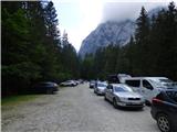
We drive to Mojstrana, then follow the signs for Vrata Valley. We continue along the toll road, which is closed to public traffic in winter, following it to the large parking lot located a few minutes before Aljažev dom v Vratih.
Route description:
From the parking lot, continue along the gravel road closed to public traffic, passing Šlajmerjev dom and quickly reaching Aljažev dom v Vratih.
At Aljažev dom, head right towards Škrlatica, Dolkova špica, Stenar, Križ and Kriška stena (straight to Triglav, Luknja, Bovški Gamsovec, Pogačnikov dom via Sovatna, Stenar, Križ and Razor) on the path that leads across the meadow into the forest. The path ascends first along a gentle cart track, higher up transitioning into a gradually steeper footpath, which takes us to the bed of a mountain torrent, but we do not follow it long. Higher up, the path temporarily turns right and ascends steeply through the forest, later beginning to turn left, crossing a short scree slope, and approaching the slopes below the mighty Stenar. We quickly reach these slopes and ascend through dwarf pines and past individual larches. Upon leaving the dwarf pine belt, we reach a small valley separating Stenar from Križ, ascending it briefly, after which the marked path turns right (straight to Stenarska vratca and Križ and Stenar via the mentioned gates).
A short ascent follows in increasingly high-mountain terrain and about 100 elevation meters higher we arrive at a slightly larger junction, where the path to Škrlatica continues right, and a path branches left to the nearby Bivak Na rušju, Križ and Kriška stena.
Continue right towards Škrlatica (left to bivouac 2 minutes and Križ 1:30).
The path crosses a small scree and then turns sharply right. Next, cross a slightly exposed slope (slip hazard) after which we reach pastures below Dolkova špica. The path slowly begins to descend, but only to a steeper section. In early summer, snow patches may be encountered here (caution). The path then rises again and soon reaches the cirque Zadnji Dolek, located between Škrlatica and Dolkova špica.
Here at the junction, go slightly left to the path towards Rdeča škrbina and further to Dolkova špica or Križ and Pogačnikov dom (right to Škrlatica).
The path further bypasses peak Kucelj on the right and cirque Zadnji Dolek on the left, then becomes steeper and transitions to screes below Dolkova špica. Here the path turns slightly right and begins ascending through quite ruined and friable terrain, where due to scree on the path there is high slip hazard and falling rocks. The path, leading in a traversing ascent to the right, approaches Rdeča škrbina, where the slope becomes even steeper; in the final part of the ascent to Rdeča škrbina, separating Dolkova špica on the left and Rogljica on the right, there is also a short secured section with a chain (the unsecured section to Rdeča škrbina is particularly dangerous for slipping on descent, and in late summer this part may still be snow-covered).
From the junction at Rdeča škrbina, head left towards Dolkova špica (straight down to Bivak na Rušju, Križ, Pogačnikov dom and Kriška stena) along a path that is technically demanding in places, leading along the northwest ridge of Dolkova špica.
Difficult spots on the ridge are unsecured but routed through natural passages so there are no serious difficulties, reaching the summit after about 15 minutes walking from Rdeča škrbina.
Starting point - Aljažev dom 0:05, Aljažev dom - Bivak Na rušju 2:55, Bivak na Rušju - Zadnji Dolek 1:30, Zadnji Dolek - Rdeča škrbina 0:45, Rdeča škrbina - Dolkova špica 0:15.

Photos:
 1
1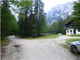 2
2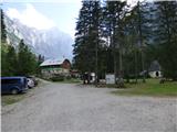 3
3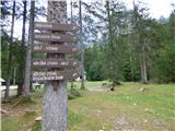 4
4 5
5 6
6 7
7 8
8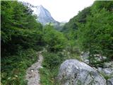 9
9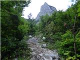 10
10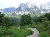 11
11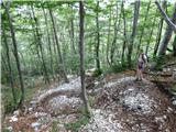 12
12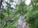 13
13 14
14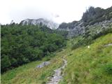 15
15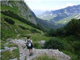 16
16 17
17 18
18 19
19 20
20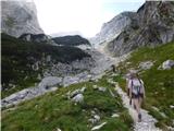 21
21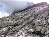 22
22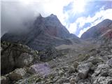 23
23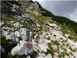 24
24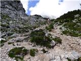 25
25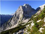 26
26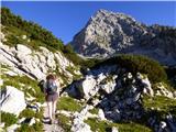 27
27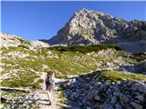 28
28 29
29 30
30 31
31 32
32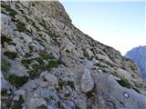 33
33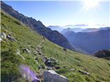 34
34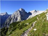 35
35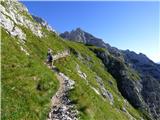 36
36 37
37 38
38 39
39 40
40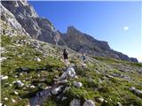 41
41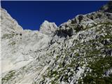 42
42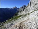 43
43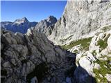 44
44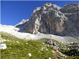 45
45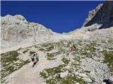 46
46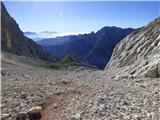 47
47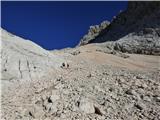 48
48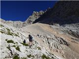 49
49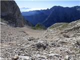 50
50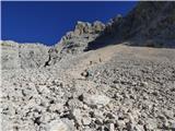 51
51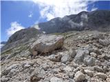 52
52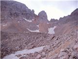 53
53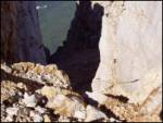 54
54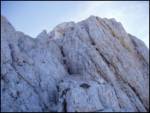 55
55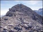 56
56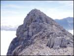 57
57 58
58
Discussion about the trip Aljažev dom v Vratih - Dolkova špica (eastern way)
|
| pohodnik3815. 09. 2012 |
A week ago I walked this path, it is really beautiful with wonderful views of the surrounding peaks. The last part is very demanding as there are no markings, cairns show the path to the summit. From the summit I continued the path to Križ-2410m.
PICTURES
Lp!
|
|
|
|
| ljubitelj gora29. 06. 2014 |
Yesterday on Dolkova špica this path is really "very demanding marked", because if compared to the one from Krška stena direction I'd say it's just "demanding marked path" this upper one. True there's no hut along the path, but it's west and east paths with different difficulties. At Rdeča škrbina there's only a sign Dolkova špica, then I didn't spot markings, but there are cairns.
|
|
|
|
| svetilnik12. 08. 2016 |
Hello. I would go to Dolkova špica from Aljažev dom on the eastern side and return down the western side and also visit Stenar, and descend via Sovatna to the starting point (Aljažev dom).
Now I'm wondering how demanding this eastern side to Dolkova špica should be, how the markings are currently, and if the passage on the steel cables is very demanding and if self-protection is needed.
Thanks for answers.
|
|
|
|
| Jakacius18. 09. 2018 |
Today I went along the eastern path to Škrlatica, then also to Dolkova špica and down the western one. But I won't write about the path ...
The stamp at Dolkova špica is smashed practically beyond recognition - probably with a stone, the box torn out of the concrete base and twisted, and of course no trace of the book. I really don't understand how anyone can enjoy such outrageous destruction! I mean, I really want to meet that idiot. I'd gladly rip his balls off. Not cut them off, rip them off!
|
|
|
|
| Hribovc919. 08. 2020 |
Regarding the path hiked yesterday (ascent) - the path through Rdeča škrbina is very crumbly and unpleasant. At the summit, as already mentioned, quite devastated. Descent definitely recommended via the other side (western path).
|
|
|
To post a comment you must log in:
If you do not yet have a username, you must first
register.