Aljažev dom v Vratih - Glava v Zaplanji (via Plemenice)
Starting point: Aljažev dom v Vratih (987 m)
| Latitude/Longitude: | 46,41280°N 13,84660°E |
| |
Route name: via Plemenice
Walking time: 5 h 35 min
Difficulty: very difficult marked way, easy unmarked way
Elevation gain: 1569 m
Elevation difference along the route: 1575 m
Map: Triglav 1 : 25.000
Recommended equipment (summer): helmet, self belay set
Recommended equipment (winter): helmet, self belay set, ice axe, crampons
Views: 9.786
 | 3 people like this post |
Access to starting point:
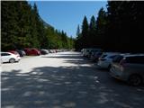
We drive to Mojstrana, then follow the signs for Vrata Valley. We continue along the toll road, which is closed to public traffic in winter, following it to the large parking lot a few minutes before Aljažev dom v Vratih.
Route description:
From the parking lot, continue along the gravel road closed to public traffic, passing Šlajmerjev dom to quickly reach Aljažev dom v Vratih.
Bypass Aljažev dom on the right and continue straight towards Triglav, Sovatne, Luknja... (right Škrlatica, bivouac on Rušje...). Continue on the rough gravel road past the winter room to the marked junction at the famous peg (monument to fallen partisan climbers).
Continue straight again (left Tominšek's path), a gentle path leads with fine views of Triglav and Triglav North Face. After a few minutes of further walking into the beech forest, the path over Sovatne branches right; we go straight towards Luknja and Triglav - path over Prag. Short ascent on cart track, then markers lead left to path approaching Triglavska Bistrica bed. The path passes the memorial to mountain victims, then to the next marked junction.
Left across the stream continues path over Prag; we go straight, path gradually steepens visibly. Path to Luknja ascends moderately for a while, higher steeper and more scenic. Higher, through shrub and sparse forest belt, small path to nearby bivouac branches right; continue on wider path out of forest soon. Path steepens more, leads to screes under Luknja. Path over scree slippery; at wall foot, cables help (easy dry, useful descent). Short steep climb by wall, then turns right to junction at Luknja with fine view over mountains above Zadnjica.
Path very demanding, starts near-vertical climb on cable. After initial wall, levels slightly but difficulties continue. Few protections ahead, occasional trail over deep drop. High slip risk wet! Difficulties ease, turns left to ridge with east view. Continue scenic ridge, soon demanding again. Steep climbs on cable/pegs few times, short steep descent. Left view to famous Sphinx (steepest Triglav pillar).
Path less steep, rocky terrain. Trail less visible, left of Glava v Zaplanji and Triglavska vojašnica Viktorja Emanuela III. (formerly wrongly Morbegna), ahead. Possible snow patches summer, not steep, no crampons usually needed.
Path to junction on Western Triglav Plateau.
Right (left Triglav, slight right Dolič) unmarked path, 10 min more to vojašnica Viktorja Emanuela III. (sometimes wrongly Morbegna).
From vojašnica Viktorja Emanuela III. to summit Glava v Zaplanji few minutes up summit slope.
Start - Aljažev dom 0:05, Aljažev dom - Bistrica source 0:55, Bistrica source - Luknja 1:35, Luknja - Plemenice 2:00, Plemenice - Zaplanja junction 0:45, Zaplanja junction - vojašnica Viktorja Emanuela III. 0:10, vojašnica Viktorja Emanuela III. - Glava v Zaplanji 0:05.

Along the route: Aljažev dom v Vratih (1001m), Spomenik padlim partizanom gornikom (1020m), V Plazičih (1040m), Izvir Bistrice (1160m),
Luknja (1766m), Plemenice (2373m), Zaplanja (2428m), Triglavska vojašnica Viktorja Emanuela III. (2520m)
Photos:
 1
1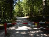 2
2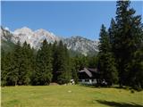 3
3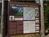 4
4 5
5 6
6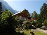 7
7 8
8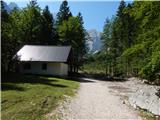 9
9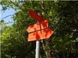 10
10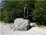 11
11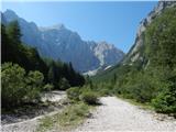 12
12 13
13 14
14 15
15 16
16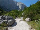 17
17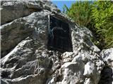 18
18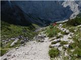 19
19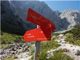 20
20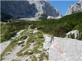 21
21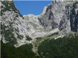 22
22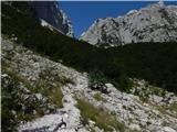 23
23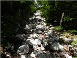 24
24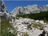 25
25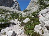 26
26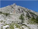 27
27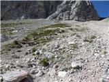 28
28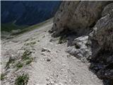 29
29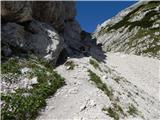 30
30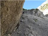 31
31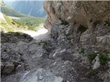 32
32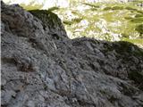 33
33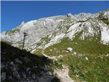 34
34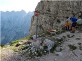 35
35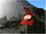 36
36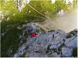 37
37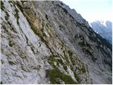 38
38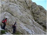 39
39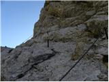 40
40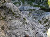 41
41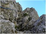 42
42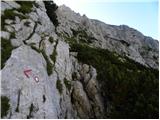 43
43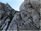 44
44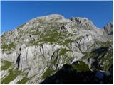 45
45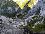 46
46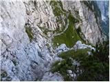 47
47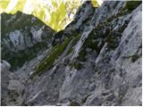 48
48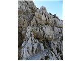 49
49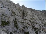 50
50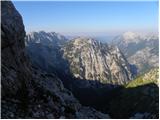 51
51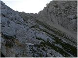 52
52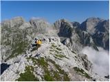 53
53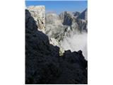 54
54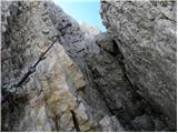 55
55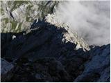 56
56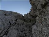 57
57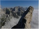 58
58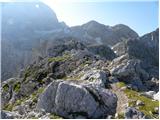 59
59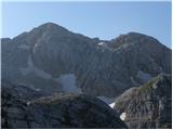 60
60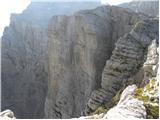 61
61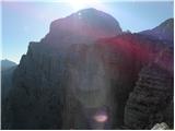 62
62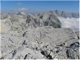 63
63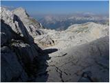 64
64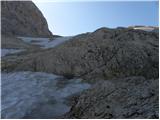 65
65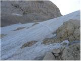 66
66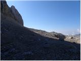 67
67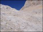 68
68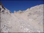 69
69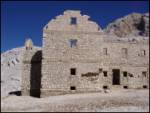 70
70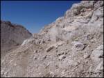 71
71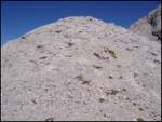 72
72
Discussion about the trip Aljažev dom v Vratih - Glava v Zaplanji (via Plemenice)
|
| ben12. 02. 2009 |
Everything is fine and well, but since when is the path through Plemenice a very difficult UNMARKED trail? And that you walk exactly 5 hours and 32 minutes... And that you walk exactly 5 hours and 32 minutes...
|
|
|
|
| Tadej12. 02. 2009 |
To Morbegna the estimated time is 5 hours and 30 minutes. But that to Glava v Zaplanji is not the same as to Morbegna, symbolically 2 minutes are added.
The difficulty of the path is indeed somewhat awkwardly described. Through Plemenice it is a very difficult marked path, the ascent to Glava v Zaplanji follows an unmarked path, which however is not technically difficult.
|
|
|
To post a comment you must log in:
If you do not yet have a username, you must first
register.