Aljažev dom v Vratih - Kanjavec
Starting point: Aljažev dom v Vratih (987 m)
| Latitude/Longitude: | 46,41280°N 13,84660°E |
| |
Walking time: 7 h
Difficulty: difficult marked way
Elevation gain: 1582 m
Elevation difference along the route: 1900 m
Map: TNP 1:50.000
Recommended equipment (summer): helmet
Recommended equipment (winter): helmet, ice axe, crampons
Views: 5.430
 | 1 person like this post |
Access to starting point:
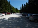
We drive to Mojstrana, then follow the signs for Vrata Valley. Initially still asphalted, subsequently mostly gravel road takes us after about 12 km from the center of Mojstrana to a large parking lot in Vrata Valley. During the summer season, parking fees are collected.
Route description:
From the parking lot, we continue along the gravel road closed to public traffic, passing Šlajmerjev dom and quickly reaching Aljažev dom v Vratih.
We bypass Aljažev dom on the right side and continue straight towards Triglav, Sovatna, Luknja... (right Škrlatica, bivouac at Rušje...). We continue along the poor gravel road, which takes us past the winter room to the marked junction at the famous peg (monument to fallen partisan miners).
We continue straight again (left Tominšek's path), as the gentle path leads with beautiful views of Triglav and the Triglav North Face. After a few minutes of further walking, we arrive in a beech forest, where the path over Sovatna branches right; we continue straight towards Luknja and Triglav - the Prag path. A short ascent along the cart track follows, then the markers direct us left onto the path approaching the bed of Triglavska Bistrica. Here the path leads past the memorial to mountain victims, a little further to the next marked junction.
Left, across the stream, the Prag path continues; we go straight on the path that gradually begins to ascend more noticeably. The path to Luknja moderately ascends for some time, higher up it becomes steeper and more scenic. A bit higher, the path leads through a belt of shrubs and sparse forest, where a trail to the nearby bivouac branches right; we continue on the wider path, which soon takes us out of the forest belt. The path then becomes somewhat steeper, gradually leading to the scree slopes below Luknja. The path across the scree is quite slippery, but when we reach the foot of the walls, iron cables assist (easy when dry, especially useful on descent). For a short time, we ascend steeply right by the wall, then the path turns slightly right and leads us a bit higher to the junction at Luknja, from where a nice view opens to the mountains above Zadnjica.
From Luknja, we continue straight down (left Triglav via Plemenice (Bamberg path), right Bovški Gamsovec and pathless approach to Pihavec) and begin descending along the old mule track. Initially, the path leads across a smaller landslide, where some caution is needed due to increased risk of falling rocks. The descent above the steep Koriti follows; we descend along the wide path, as the old mule track is relatively well preserved despite considerable steepness. After about 40 minutes of descent, losing more than 300 meters of elevation, we reach the marked junction.
From the junction, we continue slightly left towards Dolič (slightly right Zadnjica) and begin ascending again. Further on, we mostly ascend moderately along the mule track, which leads across steep and occasionally exposed precipitous slopes. Since the path is wide and well constructed, it is not technically demanding, but it is exposed to falling rocks and due to occasional deep views mostly unsuitable for those with vertigo. The path occasionally makes some switchbacks, otherwise ascending diagonally to the right most of the time, thus getting closer to the mighty wall of Kanjavec.
Higher up, a climbing path from Zadnjica via Komar joins from the right; a bit further, the path of Mira Marko Debelak (path via Kanjavec ledges) branches right. The increasingly scenic path makes a few more switchbacks higher up, from which a path towards Triglav branches left.
We continue straight, then quickly reach Koča na Doliču.
At the hut, the path forks; we continue right down towards Kanjavec, descending towards the west (straight to Dolič saddle and Dom Planika pod Triglavom, Vodnikov dom na Velem polju, Hribarice...) and follow the marked hiking path. The descent ends quickly, and we begin ascending the stony slopes of Kanjavec, with wider views opening with each step. Higher up, the path goes through a series of indistinct valleys, then diagonally ascends across scree to the technically demanding section, where some fixed protections assist. With the help of fixed protections, we ascend above the rock step; the steepest part of the ascent is quite challenging as the path is very steep over a short section.
Above the step, the steepness eases, and we join the technically easier path leading over the Hribarice saddle.
Here we go right and quickly reach the panoramic summit of Kanjavec.
Starting point - Aljažev dom 0:05, Aljažev dom - Bistrica spring 0:55, Bistrica spring - Luknja 1:35, Luknja - Below the wall 1:55, Below the wall - Koča na Doliču 1:00, Koča na Doliču - Kanjavec 1:30.

Photos:
 1
1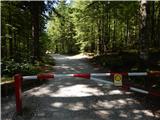 2
2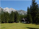 3
3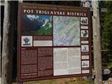 4
4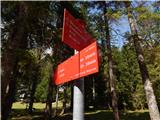 5
5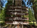 6
6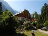 7
7 8
8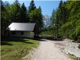 9
9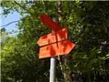 10
10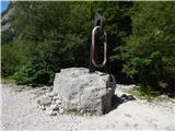 11
11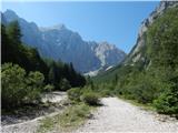 12
12 13
13 14
14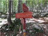 15
15 16
16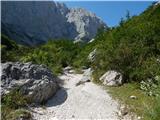 17
17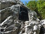 18
18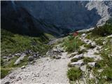 19
19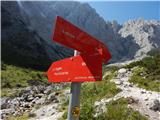 20
20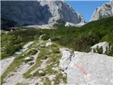 21
21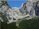 22
22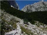 23
23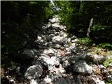 24
24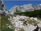 25
25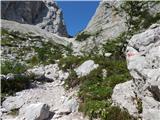 26
26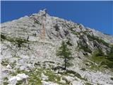 27
27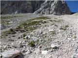 28
28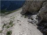 29
29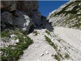 30
30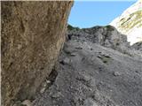 31
31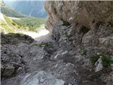 32
32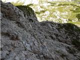 33
33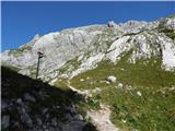 34
34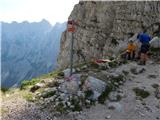 35
35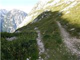 36
36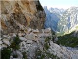 37
37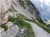 38
38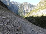 39
39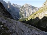 40
40 41
41 42
42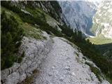 43
43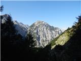 44
44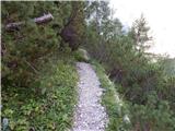 45
45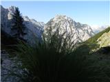 46
46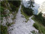 47
47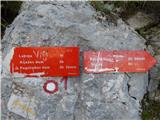 48
48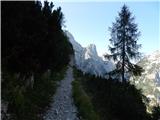 49
49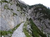 50
50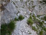 51
51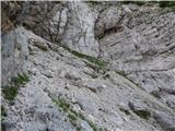 52
52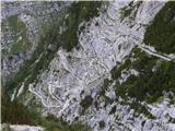 53
53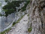 54
54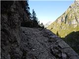 55
55 56
56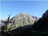 57
57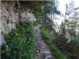 58
58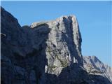 59
59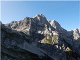 60
60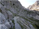 61
61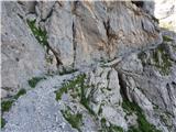 62
62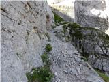 63
63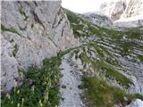 64
64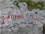 65
65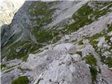 66
66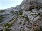 67
67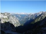 68
68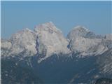 69
69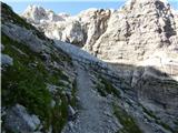 70
70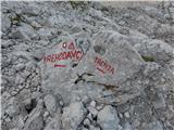 71
71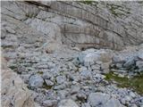 72
72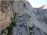 73
73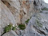 74
74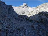 75
75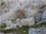 76
76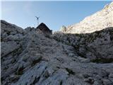 77
77 78
78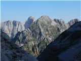 79
79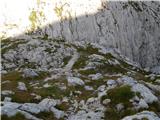 80
80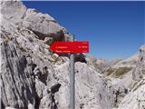 81
81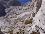 82
82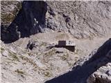 83
83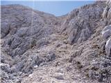 84
84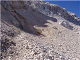 85
85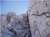 86
86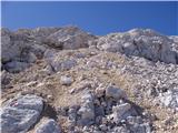 87
87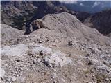 88
88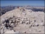 89
89
Discussion about the trip Aljažev dom v Vratih - Kanjavec
|
| Evjuna19. 07. 2022 08:59:55 |
Isn't this description the same as the description of the easy marked trail from Vrata?
|
|
|
To post a comment you must log in:
If you do not yet have a username, you must first
register.