Aljažev dom v Vratih - Križ (via bivak na Rušju)
Starting point: Aljažev dom v Vratih (987 m)
| Latitude/Longitude: | 46,41280°N 13,84660°E |
| |
Route name: via bivak na Rušju
Walking time: 4 h 30 min
Difficulty: partly demanding marked way
Elevation gain: 1423 m
Elevation difference along the route: 1425 m
Map: Triglav 1:25.000
Recommended equipment (summer):
Recommended equipment (winter): ice axe, crampons
Views: 48.801
 | 6 people like this post |
Access to starting point:
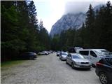
We drive to Mojstrana, then follow the signs for Vrata valley. Continuing on the toll road closed to public traffic in winter, we follow it to the large parking lot a few minutes before Aljažev dom v Vratih.
Route description:
From the parking lot we continue along the gravel road closed to public traffic, passing Šlajmerjev dom and quickly arriving at Aljažev dom v Vratih.
At Aljažev dom we head right towards Škrlatica, Dolkove špice, Stenar, Križ and Kriška stena (straight to Triglav, Luknja, Bovški Gamsovec, Pogačnikov dom via Sovatna, Stenar, Križ and Razor) on the path that leads us across the meadow into the forest. The path ascends first along a gentle cart track, higher up turning into a gradually steeper hiking trail that brings us to the bed of a torrent, which we do not follow for long. Higher up the path temporarily turns right and ascends steeply through the forest, later turning left, crossing a short scree slope, getting closer to the slopes below mighty Stenar. We soon reach these slopes, ascending through dwarf pines and past individual larches. Leaving the dwarf pine belt we reach the small valley separating Stenar from Križ, ascending along it briefly, then the marked path turns right (straight to Stenarska vratca and Križ and Stenar via the mentioned gates).
A bit more ascent follows in increasingly alpine terrain and about 100 elevation meters higher we arrive at a slightly larger junction where the path to Škrlatica continues right, we go left towards the nearby Bivak na Rušju, Križ and Kriška stena.
From the junction only a short easy ascent remains and we arrive at Bivak na Rušju, also called bivak IV na Rušju.
The marked path bypasses the bivouac on the right and behind it ascends steeply for a short while, then the gradient eases, leading us through karst terrain full of sinkholes, cracks and pits. A beautiful alpine path offering nice views especially of the mighty surrounding peaks brings us higher to the next junction.
We continue left towards Pogačnikov dom na Kriških podih (right Dolkova špica and Škrlatica via Rdeča škrbina) on the path that higher up brings us to the edge of Kriška stena, i.e. Kriški prelaz.
We continue left towards Križ (right Krnica via Kriška stena) and the path transitioning to a wide ridge quickly brings us to Bovška vratca, from which a view opens to Kriške pode where we can see the highest Slovenian mountain lake, Zgornje Kriško jezero at 2159 m elevation.
We continue left to the summit of Križ (straight Pogačnikov dom, Zadnjica and Razor), only 10 minutes away. The path first ascends gently along the narrowing ridge, then with the aid of a fixed cable steeply up a slightly exposed rocky slab, behind which we reach an interesting passage through a natural gully. With some skill we climb through the narrow gully to panoramic Križ.
Starting point - Aljažev dom 0:05, Aljažev dom - Bivak Na rušju 2:55, Bivak na Rušju - Na rušju 0:45, Na rušju - Vrh Kriške stene 0:15, Vrh Kriške stene - Bovška vratca 0:15, Bovška vratca - Križ 0:15.

The trip can be extended to the following destinations: Križ,
Stenar
Photos:
 1
1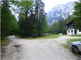 2
2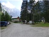 3
3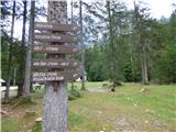 4
4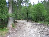 5
5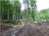 6
6 7
7 8
8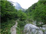 9
9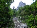 10
10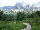 11
11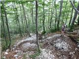 12
12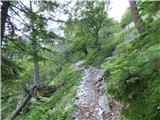 13
13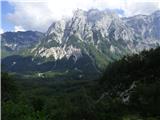 14
14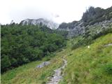 15
15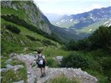 16
16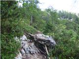 17
17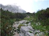 18
18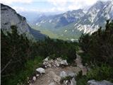 19
19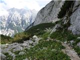 20
20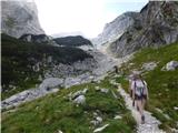 21
21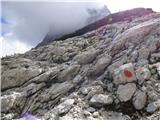 22
22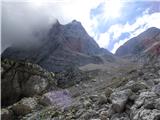 23
23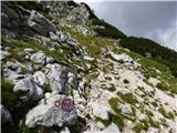 24
24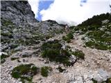 25
25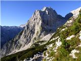 26
26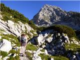 27
27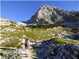 28
28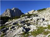 29
29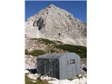 30
30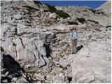 31
31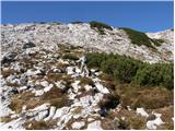 32
32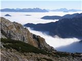 33
33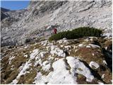 34
34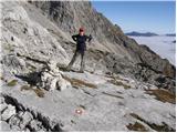 35
35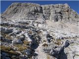 36
36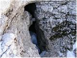 37
37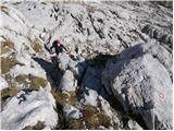 38
38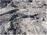 39
39 40
40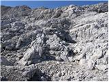 41
41 42
42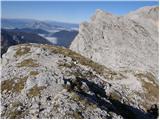 43
43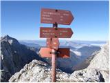 44
44 45
45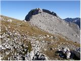 46
46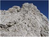 47
47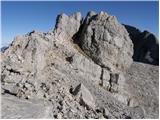 48
48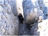 49
49 50
50
Discussion about the trip Aljažev dom v Vratih - Križ (via bivak na Rušju)
|
| Enka16. 09. 2019 |
Nice path, slightly more demanding just below the summit. Views from Križ are magnificent.
|
|
|
|
| plaNinaPirsMajcen11. 08. 2025 18:47:23 |
Hi,
I agree with Enko, just below the summit a short not difficult section secured with a cable and an interesting narrow passage through which you "squeeze" to the top.
Also a video from Kriški Podi, this described route filmed from 0.00 to 2.55 minutes. Showing the harder parts:
https://youtu.be/3rU42vQnPUI?si=9h98qlvb2WJVJcpi
To me a very nice route anyway, wonderful plateau-like rocky world with views of Stenar, Križ, Dolkova Špica, from the summit to Pogačnikov Dom and Srednje Kriško lake.
Best, Nina
|
|
|
To post a comment you must log in:
If you do not yet have a username, you must first
register.