Aljažev dom v Vratih - Križ (via Sovatna)
Starting point: Aljažev dom v Vratih (987 m)
| Latitude/Longitude: | 46,41280°N 13,84660°E |
| |
Route name: via Sovatna
Walking time: 5 h
Difficulty: difficult marked way
Elevation gain: 1423 m
Elevation difference along the route: 1430 m
Map: Triglav 1:25.000
Recommended equipment (summer): helmet
Recommended equipment (winter): helmet, ice axe, crampons
Views: 23.062
 | 4 people like this post |
Access to starting point:
We drive to Mojstrana, then follow the signs for Vrata Valley. We continue along the toll road, which is closed to public traffic in winter, up to the large parking lot a few minutes before Aljažev dom v Vratih.
Route description:
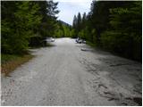
From the large parking lot in Vrata Valley, continue along the gravel road, reaching Aljažev dom v Vratih in a few minutes of walking.
From the hut, continue straight towards Triglav, Stenar and Kriške pode (right Škrlatica) along the wide tourist path. The path ahead rises slightly through a band of forest, bypassing the winter bivouac on the right, then the forest thins out and after a few more minutes we reach a large memorial plaque (dedicated to fallen partisan mountaineers). From the memorial, continue straight (left Tominškova pot) along the path that gradually returns to the forest and leads us a bit higher to a marked junction, where we continue right towards Pogačnikov dom (straight to Triglav and Luknja). From the junction, the path begins to climb more steeply through beech forest (area called Bukovlje), which brings us just above 1300 m.a.s.l. to a pleasant spring that dries up in dry periods. A few more minutes of walking through forest or higher scrub follow, and the path leads us out of the forest to the foot of Sovatna, where a quite overgrown path from the bivouac below Luknja joins us.
From here, the path becomes steeper and more scenic. The path offers beautiful views of the north face of Triglav and higher up leads to a short slightly exposed passage, where extra caution is needed especially when wet. The path ahead flattens slightly but continues to ascend relatively steeply. A climb through scree follows, then the valley narrows and the path leads to a short rocky step over which we climb with the aid of reliable fixed protection.
Above the step, the slope flattens, and the path leads across a series of small valleys where ibex herds are often spotted. Higher up, the path crosses to the left side of the valley, then traverses across a wide and on a short section slightly exposed ledge. From there, a few dozen more steps lead to a marked junction at Dovška vrata.
From here, continue right towards Stenar and Križ (left Bovški Gamsovec and Pogačnikov dom) and continue the ascent along an initially gentle then increasingly steep path, quickly reaching the junction below Stenarska vratca.
Continue left towards Križ (straight up Stenarska vratca, right Stenar) and from the scree cross to slightly exposed slopes, which we traverse at moderate ascent towards the northwest. The path, which is also quite slippery, leads us higher below the summit slope of Križ, where it forks again. The left path bypasses the summit of Križ, but we go slightly right and steeply ascend to the exposed ridge, where with the aid of a peg and cable we climb to the panoramic summit.
Starting point - Aljažev dom 0:05, Aljažev dom - spring in Bukovlje 1:25, spring in Bukovlje - Dovška vrata 2:30, Dovška vrata - Stenarska vratca 0:20, Stenarska vratca - Križ 0:40.

Along the route: Aljažev dom v Vratih (1001m), Spomenik padlim partizanom gornikom (1020m), V Plazičih (1040m), Izvir v Bukovlju (1317m), Bukovlje (1418m), Dovška vrata (2176m), Stenarska vratca (2288m)
The trip can be extended to the following destinations: Križ,
Stenar
Photos:
 1
1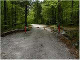 2
2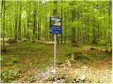 3
3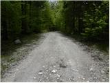 4
4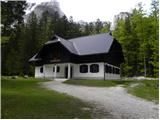 5
5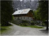 6
6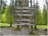 7
7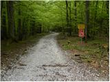 8
8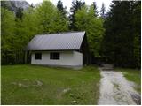 9
9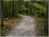 10
10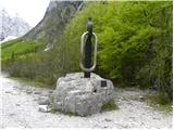 11
11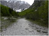 12
12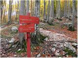 13
13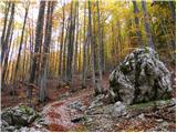 14
14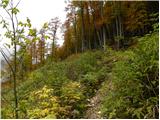 15
15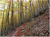 16
16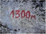 17
17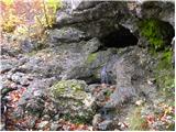 18
18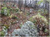 19
19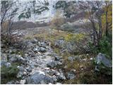 20
20 21
21 22
22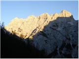 23
23 24
24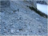 25
25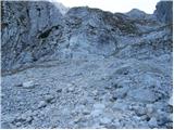 26
26 27
27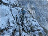 28
28 29
29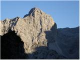 30
30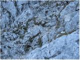 31
31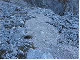 32
32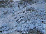 33
33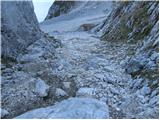 34
34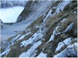 35
35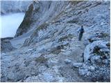 36
36 37
37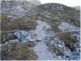 38
38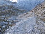 39
39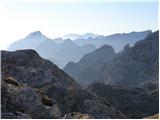 40
40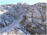 41
41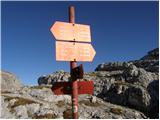 42
42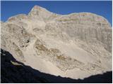 43
43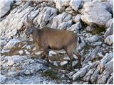 44
44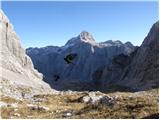 45
45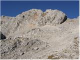 46
46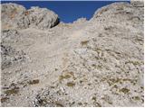 47
47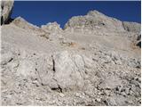 48
48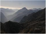 49
49 50
50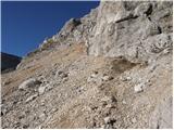 51
51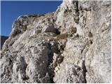 52
52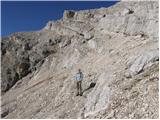 53
53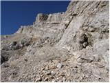 54
54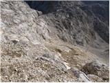 55
55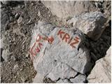 56
56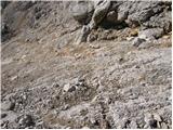 57
57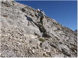 58
58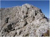 59
59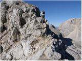 60
60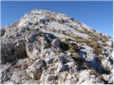 61
61 62
62
Discussion about the trip Aljažev dom v Vratih - Križ (via Sovatna)
|
| TincaPRR28. 08. 2011 |
I recommend it, from the top of Križ there are wonderful views :-)
|
|
|
|
| Ornitolog17. 07. 2013 |
Hello,
if the weather holds, I would do this tour over the weekend: Vrata - Luknja - Bovški Gamsovec - Križ - Pogačnikov dom - Vrata.
I'm mainly interested if there is still any snow on the path that would require an ice axe.
Thank you and best regards.
|
|
|
|
| xtomaz3. 11. 2013 |
The wire rope on the ridge just below the summit of Križ was torn on Friday. It would also be right to mention (and draw on new hiking maps, which unfortunately usually just copy errors from old editions), that there is also a direct marked connection that from the foot of the summit of Križ across the gravelly western slope goes directly to Bovška vratca and thus avoids the ascent to Križ. Can be useful in uncertain weather, if you have small children with you or are hiking with a dog.
|
|
|
|
| pohodnik383. 11. 2013 |
That steel cable on picture 58 was already torn last September when I was wandering around there.
|
|
|
|
| roberthr31. 08. 2014 |
We were here the day before yesterday. This via ferrata cable is quite torn this year. But this time it also carried away part of the wall to the left of it, along with the markings and a considerable part of the path below it.
|
|
|
|
| StyLa18. 07. 2016 |
Yesterday we descended this path and I can confirm that the cable is still torn, that the marks are so sparse and worn out that quite some ingenuity is needed to find the way down. A bit unpleasant. LP
|
|
|
|
| zalaz8. 07. 2018 |
The trail is nicely maintained and marked, so I recommend it. Regards
|
|
|
|
| Lisica17. 09. 2018 |
Picture 54 - the path to the right to Križ is closed due to a landslide. Go a bit further left and from the other side. There's a huge amount of scree on this lower path anyway. I preferred the path from Pogačnikov dom, which goes directly up behind the hut.
|
|
|
|
| Lazo24. 09. 2021 20:47:15 |
|
|
|
To post a comment you must log in:
If you do not yet have a username, you must first
register.