Aljažev dom v Vratih - Planja (via Sovatna)
Starting point: Aljažev dom v Vratih (987 m)
| Latitude/Longitude: | 46,41280°N 13,84660°E |
| |
Route name: via Sovatna
Walking time: 6 h 5 min
Difficulty: difficult marked way
Elevation gain: 1466 m
Elevation difference along the route: 1615 m
Map: Triglav 1:25.000
Recommended equipment (summer): helmet
Recommended equipment (winter): helmet, ice axe, crampons
Views: 10.253
 | 2 people like this post |
Access to starting point:
We drive to Mojstrana, then follow the signs to Vrata Valley. We continue along the toll road, which is closed to public traffic in winter, following it to the large parking lot located a few minutes before Aljažev dom v Vratih.
Route description:
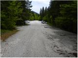
From the large parking lot in Vrata Valley, we continue along the gravel road, reaching Aljažev dom v Vratih in a few minutes of walking.
From the hut, we continue straight towards Triglav, Stenar and Kriške pode (right Škrlatica) and follow the wide tourist path. The path ahead barely ascends noticeably through a belt of forest, where we bypass the winter bivouac on the right side, then the forest thins out and after a few more minutes of walking we reach a large memorial plaque (monument dedicated to fallen partisan climbers). From the monument, we continue straight (left Tominškova pot) along the path that gradually returns to the forest and takes us a bit higher to a marked junction, where we continue right towards Pogačnikov dom (straight Triglav and Luknja). From the junction onwards, the path begins to ascend more steeply through beech forest (the area is called Bukovlje), which takes us just above 1300 m.a.s.l. to a pleasant spring, which however dries up in dry periods. A few more minutes of walking through the forest or higher shrubbery follow, and the path takes us out of the forest at the foot of Sovatna, where a quite overgrown path from Bivak pod Luknjo joins us.
From here on, the path becomes increasingly steep and scenic. The path, from which we have beautiful views of the Triglav north face, takes us higher to a short slightly exposed passage, where extra caution is needed especially when wet. The path ahead flattens slightly but continues to ascend relatively steeply. An ascent through scree follows, then the valley narrows and the path takes us to a short rocky jump over which we ascend with the help of fixed protection.
Above the jump, the slope flattens, and the path ahead leads us across a series of small valleys, where we often spot a herd of ibex. Higher up, the path crosses to the left side of the valley, where it then ascends transversely across a wide and on a short section slightly exposed ledge. From there, a dozen or so steps of walking follow, and the path takes us to a marked junction at Dovška vrata.
We continue straight towards Pogačnikov dom (left Bovški Gamsovec, right Stenar and Križ). The path ahead begins to descend gradually through increasingly beautiful high-mountain terrain. In a slight right bend, we will notice cairns on the left side of the path. Here, an unmarked path branches left, crossing the scree slopes under Bovški Gamsovec, then rejoins the marked path at Pihavec. We continue along the marked path, which continues to descend gently and then takes us to a marked junction.
Here, a marked path to Pihavec branches left, while we continue along the lower path towards Pogačnikov dom na Kriških podih. The path then crosses the slopes above Spodnje Kriško jezero, which we can see left below us. The path ahead descends a bit more and takes us to the next junction, where we join the path from the starting point in Zadnjica Valley.
We continue right uphill (left downhill Zadnjica and Spodnje Kriško jezero) and in less than five minutes of further walking we reach Pogačnikov dom, located on a scenic elevation.
From Pogačnikov dom, we continue towards Razor and Križ along a path that descends slightly and takes us in a few steps to the next junction, where we go left (right Križ, Škrlatica and Krnica).
The path ahead leads us left transversely across scree, where we also descend a bit, then the path is blocked by a rocky jump. We climb it with the help of fixed protection and at the top of the jump continue left along the exposed rock slab. On the other side of the slab, we find ourselves on scree again and continue across it towards the Planja saddle, where the path from Vršič joins us.
We continue left towards Planja (straight downhill Vršič, right Razor) along a path that ascends transversely with the help of fixed protection to the upper slopes of the mountain. Here the steepness eases, and the increasingly scenic path, from which we have beautiful views of the highest peaks of the Julian Alps, takes us to the spacious summit in a few more minutes.
Starting point - Aljažev dom 0:05, Aljažev dom - spring in Bukovlje 1:25, spring in Bukovlje - Dovška vrata 2:30, Dovška vrata - Pogačnikov dom 0:30, Pogačnikov dom - Planja saddle 1:05, Planja saddle - Planja 0:30.

Photos:
 1
1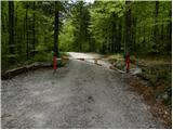 2
2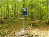 3
3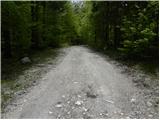 4
4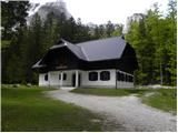 5
5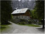 6
6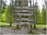 7
7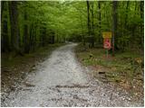 8
8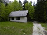 9
9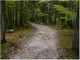 10
10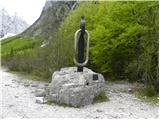 11
11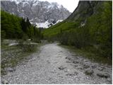 12
12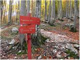 13
13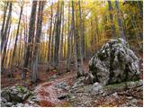 14
14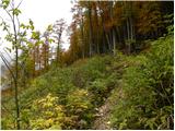 15
15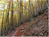 16
16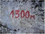 17
17 18
18 19
19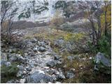 20
20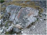 21
21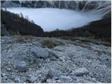 22
22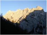 23
23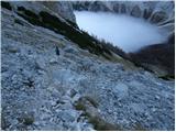 24
24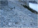 25
25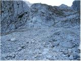 26
26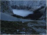 27
27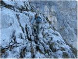 28
28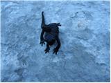 29
29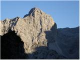 30
30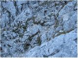 31
31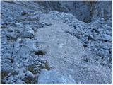 32
32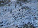 33
33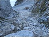 34
34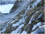 35
35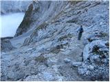 36
36 37
37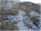 38
38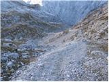 39
39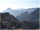 40
40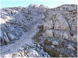 41
41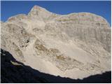 42
42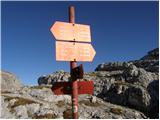 43
43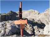 44
44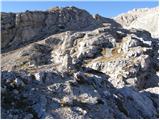 45
45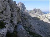 46
46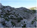 47
47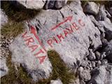 48
48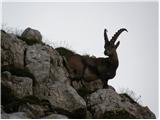 49
49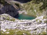 50
50 51
51 52
52 53
53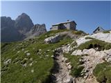 54
54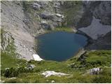 55
55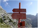 56
56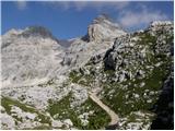 57
57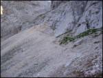 58
58 59
59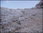 60
60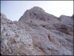 61
61 62
62 63
63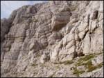 64
64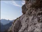 65
65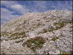 66
66 67
67
Discussion about the trip Aljažev dom v Vratih - Planja (via Sovatna)
To post a comment you must log in:
If you do not yet have a username, you must first
register.