Aljažev dom v Vratih - Stenar (via Stenarska vratca)
Starting point: Aljažev dom v Vratih (987 m)
| Latitude/Longitude: | 46,41280°N 13,84660°E |
| |
Route name: via Stenarska vratca
Walking time: 5 h 5 min
Difficulty: difficult unmarked way
Elevation gain: 1514 m
Elevation difference along the route: 1550 m
Map: Triglav 1:25.000
Recommended equipment (summer): helmet
Recommended equipment (winter): helmet, ice axe, crampons
Views: 25.370
 | 2 people like this post |
Access to starting point:
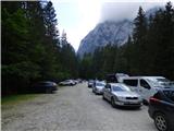
We drive to Mojstrana, then follow the signs for the Vrata valley. We continue along the toll road, which is closed to public traffic in winter, following it to the large parking lot located a few minutes before Aljažev dom v Vratih.
Route description:
From the parking lot, we continue along the gravel road closed to public traffic, passing by Šlajmerjev dom and quickly reaching Aljažev dom v Vratih.
At Aljažev dom v Vratih, we head right towards Škrlatica, Dolkova špica, Stenar, Križ and Kriška stena (straight to Triglav, Luknja, Bovški Gamsovec, Pogačnikov dom via Sovatna, Stenar, Križ and Razor) on the path that leads us across the meadow into the forest. The path then ascends first along a gentle track, higher up it turns into a gradually steeper hiking trail, which brings us to the bed of a torrent, but we do not follow it for long. Higher up, the path temporarily turns right and ascends steeply through the forest, later it starts turning left, where we also cross a short scree slope, and the path gets closer to the slopes below the mighty Stenar. We quickly reach these slopes and ascend through dwarf pines and past individual larches. When we leave the dwarf pine belt, we reach the small valley separating Stenar from Križ, and we ascend along it briefly, then the marked path turns right.
At the point where the marked path turns sharply right, we will notice a small cairn marking the start of the path towards Stenarska vratca. Initially less visible, the path ascends gently to moderately towards the scree fields below the north face of Stenar. Higher up, the path becomes more distinct, first leading us over larger rocks and some scree to the mentioned scree field. Here, the path begins to ascend more steeply across the scree, our goal now being the head of the valley at the foot of Stenarska vratca. When we reach the top of the scree field, a relatively easy access is blocked by a short, unpleasant gravelly wall. Further on, we ascend a series of successive ledges and gullies, taking care not to slip a step lower due to considerable scree and sand (there is also a high risk of falling rocks here, especially if someone is walking ahead of us). After about 20 minutes of difficult ascent, we step onto Stenarska vratca, from which a beautiful view opens towards Bovški Gamsovec and Pihavec.
Here we descend slightly, then continue left (right to Križ), where we quickly join the marked path leading to Stenar. Continuing, we cross the scree field and, with nice views of Triglav, Bovški Gamsovec, Pihavec and the Trenta valley, walk to the somewhat steeper slopes of Stenar. From here, the path begins to ascend steeply (compared to the ascent to Stenarska vratca, this path is much easier) along nicely structured rock, then turns sharply left, where after about 10 meters it suddenly flattens. Here or already about 10 m before, an unmarked approach to Spodnji Stenar branches off to the right, but we continue along the marked path, which begins to ascend more steeply again. Another approximately 15 minutes of walking along the summit slope of the mountain follows, and the increasingly scenic path brings us to the 2501 m high summit.
Starting point - Aljažev dom 0:05, Aljažev dom - small valley below Stenar 2:30, small valley below Stenar - Stenarska vratca 1:30, Stenarska vratca - Stenar 1:00.

Photos:
 1
1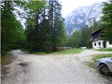 2
2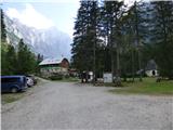 3
3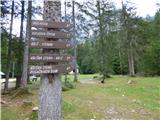 4
4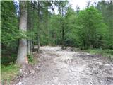 5
5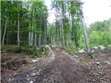 6
6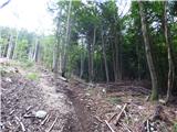 7
7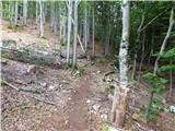 8
8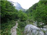 9
9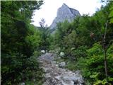 10
10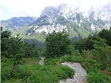 11
11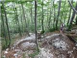 12
12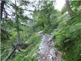 13
13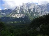 14
14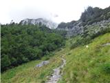 15
15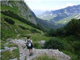 16
16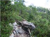 17
17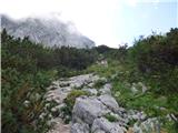 18
18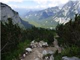 19
19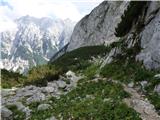 20
20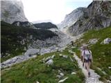 21
21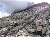 22
22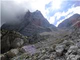 23
23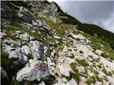 24
24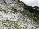 25
25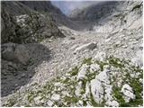 26
26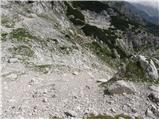 27
27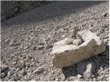 28
28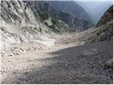 29
29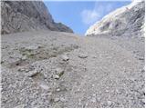 30
30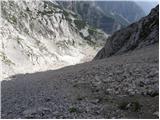 31
31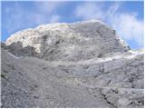 32
32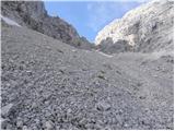 33
33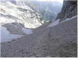 34
34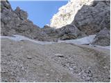 35
35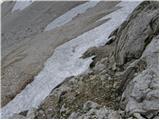 36
36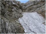 37
37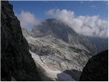 38
38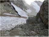 39
39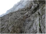 40
40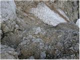 41
41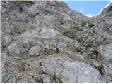 42
42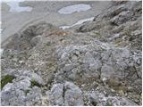 43
43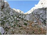 44
44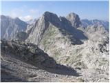 45
45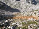 46
46 47
47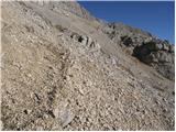 48
48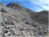 49
49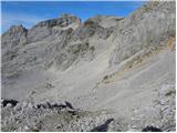 50
50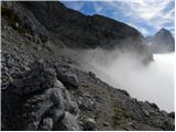 51
51 52
52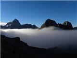 53
53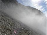 54
54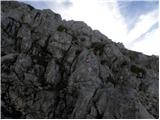 55
55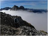 56
56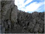 57
57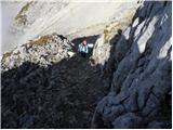 58
58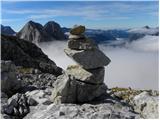 59
59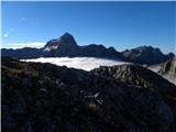 60
60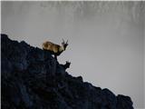 61
61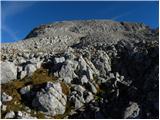 62
62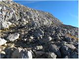 63
63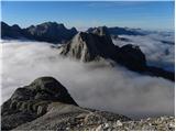 64
64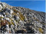 65
65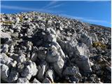 66
66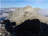 67
67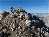 68
68 69
69
Discussion about the trip Aljažev dom v Vratih - Stenar (via Stenarska vratca)
|
| nina47. 07. 2020 |
How difficult is the ascent via Stenarska vratca - orientation, snowfields, risk of slipping? Comparable to which trail - Storžič through the gully, Kriška stena, ...? Thanks. Best, Nina
|
|
|
|
| jbs8. 07. 2020 |
This "path" is not marked, therefore not secured and maintained, so comparisons with marked secured paths make no sense. Otherwise, it's more of a winter variant when it's snowed in, in summer it's more of an emergency route for express descent, but not pleasant... scree below, above a gravelly wall that's quite nasty, there's no path, you climb where it seems possible, everything crumbles and rolls. For a circular variant to Stenar, it's better to go past 4ka on the marked path via Križ, then descent via Sovatna (or vice versa).
|
|
|
|
| nina48. 07. 2020 |
Thanks. That's the info I needed.
|
|
|
|
| nina48. 07. 2020 |
Thanks. That's the info I needed.
|
|
|
|
| capraibex17. 06. 2022 13:52:50 |
Stenarska vratca 12.6.2022, large snowfield, without full winter gear no way. As described by jbs, past bivouac 4 and Križ then to Stenar, entire section snow-free.
|
|
|
|
| panoramik17. 06. 2022 16:23:26 |
Why complicate it, through Sovatna it is
|
|
|
|
| luky6824. 08. 2025 10:12:14 |
More suitable for fast descent (read scree fields) very gravelly up top, need to find a suitable passage over the rock step then it's ok
|
|
|
To post a comment you must log in:
If you do not yet have a username, you must first
register.