Ambrož pod Krvavcem - Dom na Gospincu (Hotel Rozka)
Starting point: Ambrož pod Krvavcem (1085 m)
| Latitude/Longitude: | 46,27550°N 14,52780°E |
| |
Walking time: 1 h 30 min
Difficulty: easy marked way
Elevation gain: 406 m
Elevation difference along the route: 440 m
Map: Kamniške in Savinjske Alpe 1:50.000
Recommended equipment (summer):
Recommended equipment (winter): ice axe, crampons
Views: 4.650
 | 1 person like this post |
Access to starting point:
A) From the highway Ljubljana - Jesenice, take the Vodice exit, then continue driving to the first signalized intersection in Vodice, where we continue left in the direction of Cerklje na Gorenjskem and Brnik. When we arrive at the main roundabout in Spodnji Brnik, we continue driving in the direction of Cerklje and Krvavec ski resort. At the end of the settlement Cerklje na Gorenjskem, we leave the main road, which continues toward Velesovo and Visoko, and continue driving slightly right onto the road in the direction of Krvavec ski resort. Further on, we arrive at the village Grad, where signs for the settlement Ambrož pod Krvavcem direct us right onto a steep asphalt road (straight ahead to the lower station of the circular cable car to Krvavec and Štefanja Gora). When the steepness on the steep road eases a little, we will arrive at an intersection, where we continue left in the direction of the settlement Ambrož pod Krvavcem (straight to settlements Ravne, Apno and Šenturška Gora). A little further ahead, the road temporarily descends a little, then ascends through occasionally quite scenic slopes. Higher up, we arrive at Ambrož pod Krvavcem, where near the open-doors farm at Ambružarju there is a larger parking lot. The parking lot is intended for guests of the mentioned farm; if we ask for permission, they will almost certainly allow us to park.
B) From the highway Jesenice - Ljubljana, take the Kranj - east exit, then continue driving toward Brnik, Komenda and Mengeš. When we arrive at the main roundabout in Spodnji Brnik, we continue driving in the direction of Cerklje and Krvavec ski resort. At the end of the settlement Cerklje na Gorenjskem, we leave the main road, which continues toward Velesovo and Visoko, and continue driving slightly right onto the road in the direction of Krvavec ski resort. Further on, we arrive at the village Grad, where signs for the settlement Ambrož pod Krvavcem direct us right onto a steep asphalt road (straight ahead to the lower station of the circular cable car to Krvavec and Štefanja Gora). When the steepness on the steep road eases a little, we will arrive at an intersection, where we continue left in the direction of the settlement Ambrož pod Krvavcem (straight to settlements Ravne, Apno and Šenturška Gora). A little further ahead, the road temporarily descends a little, then ascends through occasionally quite scenic slopes. Higher up, we arrive at Ambrož pod Krvavcem, where near the open-doors farm at Ambružarju there is a larger parking lot. The parking lot is intended for guests of the mentioned farm; if we ask for permission, they will almost certainly allow us to park.
Route description:
From the tourist farm we return to the main road, from there a few steps further we continue left on the path in the direction of Krvavec. The path further leads us past a patch of wild garlic, higher it crosses the asphalt road. After a fairly steep ascent, which mostly runs through the forest, we once again approach the road very closely or even reach it for a few steps. Immediately we continue right in the direction of mountain pasture Jezerca and ascend gently to moderately. Quickly we reach a cart track, along which we step out of the forest onto mountain pasture Jezerca, where there are some wooden huts.
At the huts we step onto the road, along which we walk to the large parking lot by the mountain pasture.
From the parking lot we continue past the barrier, along the road in the direction of hotel Krvavec and upper station of the cable car. After a few steps, or at the place where the road enters the forest, a mountain path branches off to the left, leading toward Davovec and Štefanja Gora. After approximately 10 minutes, in the middle of the left bend, a road toward Kriška planina branches off to the right, while we continue on the left wider road, which begins to ascend more noticeably. A little higher, on a smaller flat area, another road toward Kriška planina branches off to the right (road to tourist farm Viženčar and mountain hut at Florjan). We continue further on the "main road", which leads us above the watering place for livestock. Further on, the road ascends transversely, leading us partly through the forest, partly across scenic slopes from which a nice view opens toward Gorenjska. When the road flattens, it quickly brings us to the upper station of the circular cable car, opposite which is located the Mountain hut Dom na Gospincu or hut Rozka.

Photos:
 1
1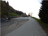 2
2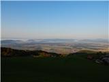 3
3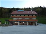 4
4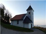 5
5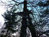 6
6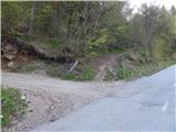 7
7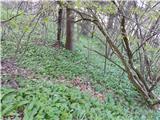 8
8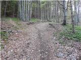 9
9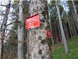 10
10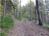 11
11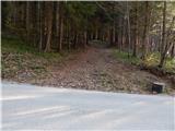 12
12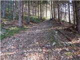 13
13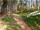 14
14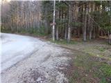 15
15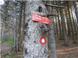 16
16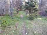 17
17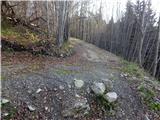 18
18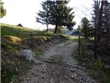 19
19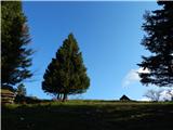 20
20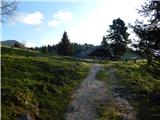 21
21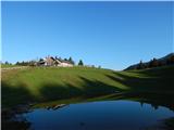 22
22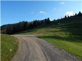 23
23 24
24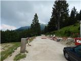 25
25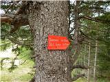 26
26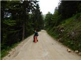 27
27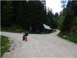 28
28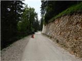 29
29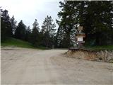 30
30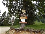 31
31 32
32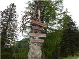 33
33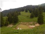 34
34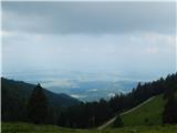 35
35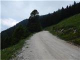 36
36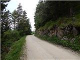 37
37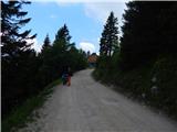 38
38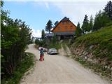 39
39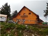 40
40
Discussion about the trip Ambrož pod Krvavcem - Dom na Gospincu (Hotel Rozka)
To post a comment you must log in:
If you do not yet have a username, you must first
register.