Andrejev dom na Slemenu - Uršlja gora (Plešivec)
Starting point: Andrejev dom na Slemenu (1086 m)
| Latitude/Longitude: | 46,43820°N 14,96470°E |
| |
Walking time: 2 h 45 min
Difficulty: easy marked way
Elevation gain: 613 m
Elevation difference along the route: 725 m
Map: Kamniške in Savinjske Alpe 1:50.000
Recommended equipment (summer):
Recommended equipment (winter): ice axe, crampons
Views: 28.138
 | 3 people like this post |
Access to starting point:
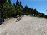
A) First, we drive to Šoštanj (to here from Velenje or Savinja Valley), and then we continue driving towards Črna na Koroškem. Further, the road starts ascending towards the mountain pass Spodnje Sleme (1081 m), which after a few kilometers of winding road we also reach. We can park already at a suitable spot by the mountain pass; otherwise, on the mountain pass we turn left and drive a few hundred meters to the parking lot at the mountain hut Andrejev dom na Slemenu.
B) First, we drive to Črna na Koroškem, and from there we continue driving towards Šoštanj and Velenje. Further, the road starts ascending towards the mountain pass Spodnje Sleme (1081 m), which after a few kilometers of winding road we also reach. We can park already at a suitable spot by the mountain pass; otherwise, on the mountain pass we turn right and drive a few hundred meters to the parking lot at the mountain hut Andrejev dom na Slemenu.
Route description:
From Andrejev dom na Slemenu we return to the mountain pass Spodnje Sleme, and from there we continue in the direction of Naravske ledine, Uršlja gora and the church of St. Vid. For a short time we continue on the main road towards Črna na Koroškem, after which a marked cart track branches off slightly to the right (the turn-off is not specifically marked), which continues parallel with the main road. Through the forest we walk for a minute or two, then we step onto a larger clearing, where on the right side we notice the church of St. Vid, to which only a few steps of ascent separate us.
From the church we walk to the nearby macadam road and continue along it past a smaller cottage, which we bypass on the right side. Only a few steps ahead the road enters the forest, through which it continues without major changes in elevation. A little further from the memorial plaque, which we notice on the right side on a nearby tree, we arrive at a smaller junction, where to the left a road branches off to the homestead Robnik, to the right the road leads towards Zgornji Razbor and Slovenj Gradec, and we continue straight in the direction of Javorje. The wider macadam road a little after that brings us out of the forest, where we arrive at a marked junction at the information boards and religious symbol (starting point Ciganija).
Before the cross we turn right onto a somewhat worse macadam road (slightly left Javorje and Črna na Koroškem), which returns into the forest. The path towards Uršlja gora continues to lead along the macadam road, which in crossing brings us to a smaller saddle west of Kotnikov vrh (1220 m). After the saddle, where temporarily we step out of the forest and by which there is a smaller holiday cottage, the road starts to descend more noticeably, while leading us past two smaller junctions. At the first junction we can somewhat from the path notice a memorial plaque, at the second there is a religious symbol. Both times we continue on the marked road, from which temporarily a nice view opens towards the queen of Koroška - Peca, which a little further brings us to the junction at Križan (to here it is also possible by car, namely from the direction of Sleme, Črna na Koroškem or Podgorje).
From Križan, which is at 1040 m elevation, we continue on the marked path in the direction of Uršlja gora (left Koča na Naravskih ledinah 1:15 and Koča Krivec 300 m). The path ahead goes immediately into the forest and starts to ascend more steeply. Higher the trail levels out somewhat and over a pasture fence brings us to a larger meadow or pasture, through which we continue straight upwards. With nice views on Smrekovec mountain range, Raduha, Olševa, and if we look back at Šaleška dolina valley and surrounding hills, we quickly arrive at the upper part of the pasture, where there is a trough with water, a chapel and the decaying Šišernik homestead.
Above the homestead we cross the road twice in succession (first leads towards the homestead Vernšek, second towards the summit of Uršlja gora, in the other direction both towards Naravske ledine), then at the bench we continue through the forest on a relatively steep, partly cart track path. After a shorter steep ascent the cart track, along which the winter path continues, turns right, and we continue slightly left on the marked and well-trodden mountain path. Further on we steeply ascend the southern slopes of Uršlja gora for quite some time, then the path gradually turns somewhat to the right, where it for some time mostly ascends diagonally to the right. Higher for a few steps we step onto the mountain road that leads towards the summit, but soon leave it as the blazes lead us right onto a moderately steep footpath, to which a few minutes higher also joins the path from Poštarski dom na Plešivcu and the path from Ivarčkovo jezero.
We continue on the still well-trodden and relatively wide path, which gradually brings us out of the forest, where along the path we spot one more of the numerous chapels on our path. A light ascent follows on the grassy slope to the edge of a partly exposed ridge (only the ridge is exposed, not the marked path), from where a nice view opens towards the north. From here we walk another minute or two and we are already at the church of St. Ursula and at Dom na Uršlji gori.
Between the church and the hut we notice the continuation of the mountain path leading towards the nearby summit. From the hut to the summit only good 5 minutes of easy ascent on a well-marked and very panoramic path separate us.

Photos:
 1
1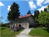 2
2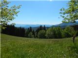 3
3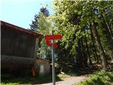 4
4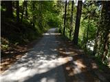 5
5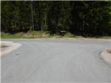 6
6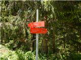 7
7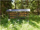 8
8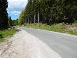 9
9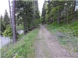 10
10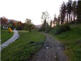 11
11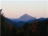 12
12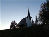 13
13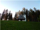 14
14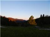 15
15 16
16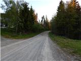 17
17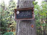 18
18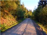 19
19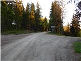 20
20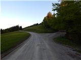 21
21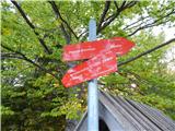 22
22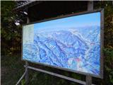 23
23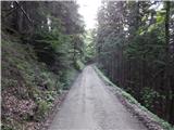 24
24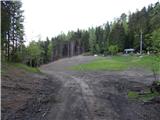 25
25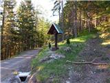 26
26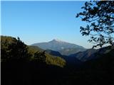 27
27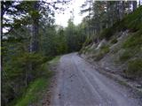 28
28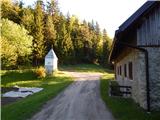 29
29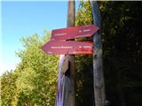 30
30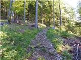 31
31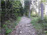 32
32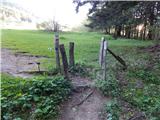 33
33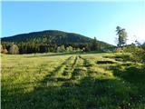 34
34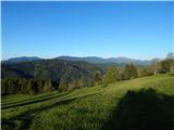 35
35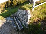 36
36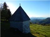 37
37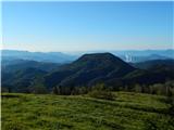 38
38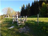 39
39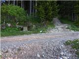 40
40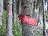 41
41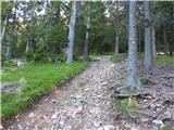 42
42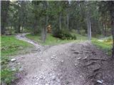 43
43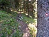 44
44 45
45 46
46 47
47 48
48 49
49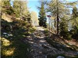 50
50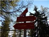 51
51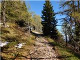 52
52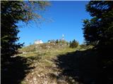 53
53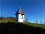 54
54 55
55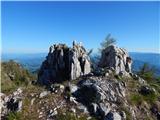 56
56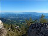 57
57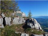 58
58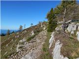 59
59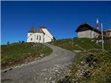 60
60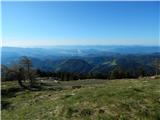 61
61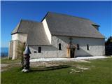 62
62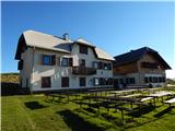 63
63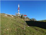 64
64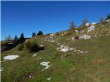 65
65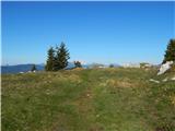 66
66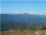 67
67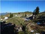 68
68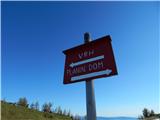 69
69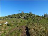 70
70 71
71 72
72
Discussion about the trip Andrejev dom na Slemenu - Uršlja gora (Plešivec)
To post a comment you must log in:
If you do not yet have a username, you must first
register.