Avsa - Mrzli vrh (on Matajur)
Starting point: Avsa (860 m)
| Latitude/Longitude: | 46,20040°N 13,58870°E |
| |
Walking time: 1 h 25 min
Difficulty: easy unmarked way
Elevation gain: 498 m
Elevation difference along the route: 498 m
Map: Julijske Alpe - zahodni del 1:50.000
Recommended equipment (summer):
Recommended equipment (winter): ice axe, crampons
Views: 11.189
 | 1 person like this post |
Access to starting point:
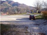
From the Kobarid–Tolmin road, in the village of Idrsko, an asphalt road branches off to the right (to the left in the reverse direction) towards the village of Livek. We head onto this road and follow it to the village of Livek. Here we turn right uphill in the direction of the village of Avsa. We continue driving to the beginning of the village of Avsa, where we notice the signs for Matajur on the right. We park in a suitable place near a smaller intersection (parking in or at the intersection is not allowed).
Route description:
From the parking lot, we head right onto a poorer road, which soon turns into a cart track. The cart track then begins to ascend moderately, meanwhile bypassing a larger number of decaying huts. The cart track then turns into a footpath, which steeply ascends for a short time, meanwhile crossing a pasture fence. The steepness then gradually eases, and the path leads us across a less and less vegetated slope. The path then brings us to a forest road, where a road branches off to the right downhill to the shepherd's hut on the Idrska planina mountain pasture.
We continue straight to the upper part of the mountain pasture along a path that offers increasingly beautiful views. A little further ahead, the road brings us to an intersection, where we continue straight and immediately thereafter notice the hut called Konjarska guta on the left side of the road. It is only a few steps of ascent to it.
From the hut on the mountain pasture, we continue towards Matajur. After a few dozen steps, the path brings us to signposts along the path. Here the sign for Mrzli vrh directs us sharply left uphill along a cart track. The cart track soon ends, and we continue along the crest slope of Mrzli vrh. The last part of the path, which takes about 10 minutes, is not marked but orientation presents no difficulties.

Photos:
 1
1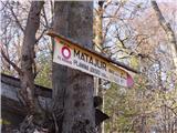 2
2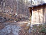 3
3 4
4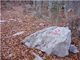 5
5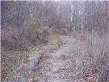 6
6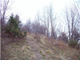 7
7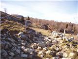 8
8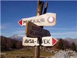 9
9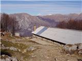 10
10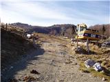 11
11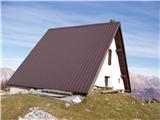 12
12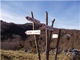 13
13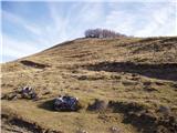 14
14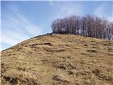 15
15 16
16
Discussion about the trip Avsa - Mrzli vrh (on Matajur)
To post a comment you must log in:
If you do not yet have a username, you must first
register.