B Postaja - Planina Krnica
Starting point: B Postaja (970 m)
| Latitude/Longitude: | 46,34368°N 13,50812°E |
| |
Walking time: 55 min
Difficulty: partly demanding marked way
Elevation gain: 282 m
Elevation difference along the route: 300 m
Map: Julijske Alpe - zahodni del 1:50.000
Recommended equipment (summer): helmet
Recommended equipment (winter): helmet, ice axe, crampons
Views: 10.125
 | 3 people like this post |
Access to starting point:
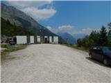
We drive to the center of Bovec, where from the intersection at the main square we continue along the ascending road, which past the post office starts ascending towards the nearby church. We bypass the mentioned church on the left side, then arrive in Kaninska vas. Bovec then ends, and the road leads us for some time towards the west. At a smaller junction we leave the main asphalt road, which leads towards the village Plužna, and continue driving along the road slightly to the right (after the junction signs for the Gozdec road). After the nearby homestead the road forks once more, but this time we choose the road slightly to the left (slightly right Zavrzelno and the starting point of the path for Rombon). We continue ascending along the macadam road, which higher up takes us to the B station of the cable car on Kanin, where we park in a larger macadam parking lot.
The starting point at the B station can also be reached by the gondola cable car.
Route description:
From the parking lot we continue a few steps along the road leading higher, but before the traffic sign that prohibits further driving at certain times we turn right onto the marked footpath. The path initially crosses the cable car route, then enters the forest, through which we ascend gently to moderately at first. The well-trodden path ends at the target point of one of the ziplines, but we continue on a less trodden marked path that gradually transitions onto steep and slippery dangerous slopes, where we also cross a small wooden bridge that is already in questionable condition. After the bridge there follows some more exposed traversing, then the slope becomes less steep, and the trail after crossing the torrent becomes gradually steeper. A few minutes higher we join the path from Bovec, and we continue following the fairly steep path to Planina Krnica, where a shepherd's hut stands.
The description and photos refer to the conditions in 2019 (July).
Photos:
 1
1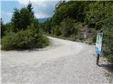 2
2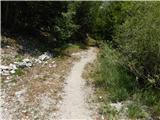 3
3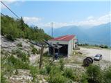 4
4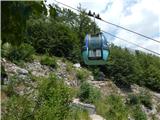 5
5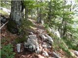 6
6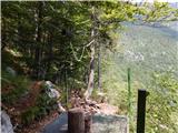 7
7 8
8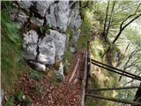 9
9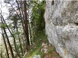 10
10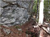 11
11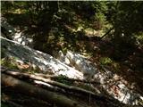 12
12 13
13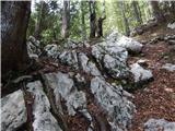 14
14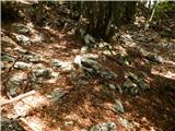 15
15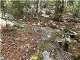 16
16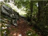 17
17 18
18
Discussion about the trip B Postaja - Planina Krnica
|
| winni1. 03. 2021 |
I recommend rather the marked, maintained and non-exposed path to Krnica, which starts below the cable car station and first goes slightly downhill.
|
|
|
To post a comment you must log in:
If you do not yet have a username, you must first
register.