B postaja - Prestreljenik (via Krnica)
Starting point: B postaja (970 m)
| Latitude/Longitude: | 46,34368°N 13,50812°E |
| |
Route name: via Krnica
Walking time: 4 h 25 min
Difficulty: difficult marked way
Elevation gain: 1529 m
Elevation difference along the route: 1550 m
Map: Julijske Alpe - zahodni del 1:50.000
Recommended equipment (summer): helmet
Recommended equipment (winter): helmet, ice axe, crampons
Views: 18.852
 | 2 people like this post |
Access to starting point:
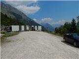
We drive to the center of Bovec, where from the intersection at the main square we continue along the ascending road that begins to climb toward the nearby church past the post office. We bypass the mentioned church on the left side, then arrive in Kanin village. Bovec then ends and the road leads us westward for some time. At a small fork we leave the main asphalt road leading to the village of Plužna and continue on the slightly right-hand road (after the intersection signs for the Gozdec road). After the nearby homestead the road forks again and this time we choose the slightly left road (slightly right to Zavrzelno and the trailhead for Rombon). We continue ascending on the gravel road which higher up brings us to the B station of the Kanin cable car, where we park in the large gravel parking area.
We can also reach the starting point at the B station by the circular cabin cable car.
Route description:
From the parking lot we continue a few steps along the road that leads higher; before the traffic sign that prohibits further driving at certain times we turn right onto the marked footpath. The path first crosses the cable-car line, then enters the forest through which we ascend gently to moderately. The well-trodden path ends at the target of one of the zip-lines; we continue on the less distinct marked trail that gradually leads onto steep and slippery-dangerous slopes, where we also cross a small wooden bridge already in questionable condition. After the bridge follows some exposed traversing, then the slope becomes less steep and after crossing a torrent the path gradually becomes steeper. A few minutes higher we join the path from Bovec and continue on the fairly steep trail to the Krnica pasture where a shepherd's hut stands.
At the hut we step onto a poorer road which we leave after the left hairpin and continue on the marked path that climbs above the pasture and gradually enters the forest. The forest soon ends and the path continues through the pleasant mountain valley Krnica, where the trail is still quite grassy at first and becomes increasingly stony higher up. With fine views left toward Veliki Stador (2165 m) and right toward the walls of Jelenek, Vratni vrh and several neighboring peaks, the path gradually moves onto the slopes of the mighty Lopa. Higher up we ascend slightly to the right of the Krnica valley; as we approach Prevala the path turns right and climbs steeply (here the old path led straight to Prevala, but because of the ski-slope construction it was rerouted slightly more to the right). The steepness quickly eases and we reach the ski slope and the Prevala saddle, where we go left.
From Prevala we ascend along the right edge of the Slovenian ski slope; after a few steps we notice on the right the start of the marked path leading toward Prestreljenik and the upper station of the Kanin cable car (the start is not signposted). The path first climbs quite steeply beside the cable, then the protection ends and the trail remains steep and slippery-dangerous for some time. Soon the path turns left, first ascending transversely beside an old military trench, then levels out and crosses steep, slippery-dangerous slopes. After a few minutes the path moves onto gentler slopes and in a moderate ascent climbs toward the Saddle (between Grdi vršič and Prestreljenik). About half an hour's walk from Prevala we reach the mentioned saddle; a few dozen meters earlier we join the ski run (if the initial climb from Prevala seems too dangerous we can also reach the saddle via the ski run).
From the Saddle, where the exit station of the 4-seater Prevala chairlift is also located, we see a large waymark directing us to the western side of the Saddle. Here the marked path turns right and begins to climb steeply up the steep slope. Higher up the path temporarily levels, then passes at the foot of Prestreljenik where it first ascends over scree. The path continues onto steep slopes and then traverses transversely to the right. A short climb follows over a grassy slope, after which the path enters completely rocky terrain where we must use our hands in several places. Higher up the path brings us to the main ridge where some damaged protection helps us. The path then eases slightly and after a few dozen steps leads us to the panoramic summit.
Starting point – Krnica pasture 0:55, Krnica pasture – Prevala 2:30, Prevala – Prestreljenik 1:00.

The trip can be extended to the following destinations: Prestreljenik
Photos:
 1
1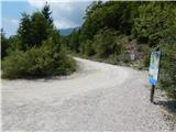 2
2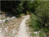 3
3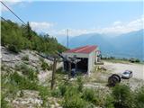 4
4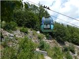 5
5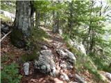 6
6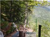 7
7 8
8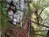 9
9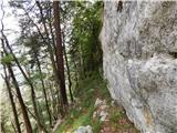 10
10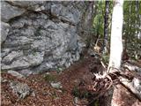 11
11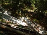 12
12 13
13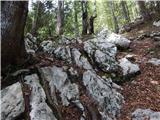 14
14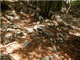 15
15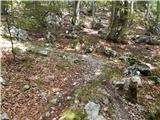 16
16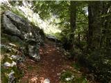 17
17 18
18 19
19 20
20 21
21 22
22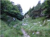 23
23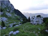 24
24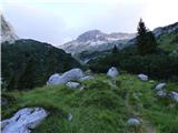 25
25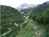 26
26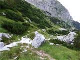 27
27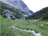 28
28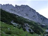 29
29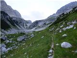 30
30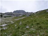 31
31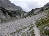 32
32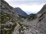 33
33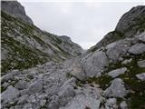 34
34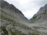 35
35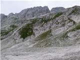 36
36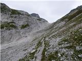 37
37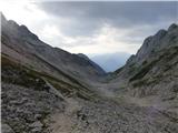 38
38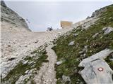 39
39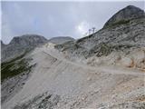 40
40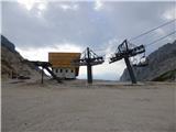 41
41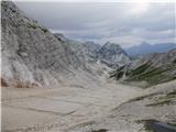 42
42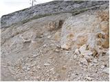 43
43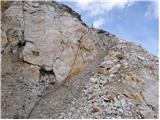 44
44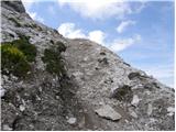 45
45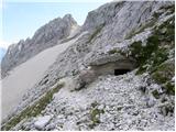 46
46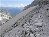 47
47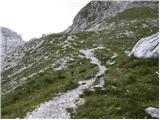 48
48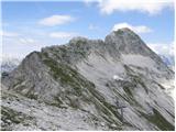 49
49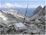 50
50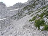 51
51 52
52 53
53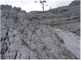 54
54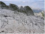 55
55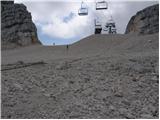 56
56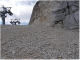 57
57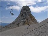 58
58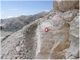 59
59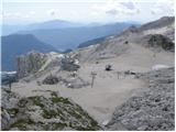 60
60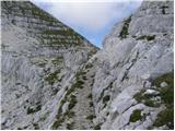 61
61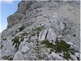 62
62 63
63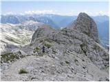 64
64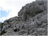 65
65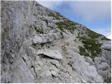 66
66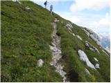 67
67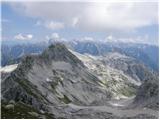 68
68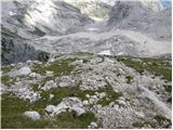 69
69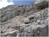 70
70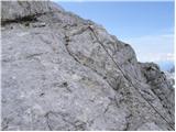 71
71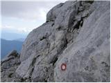 72
72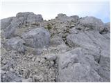 73
73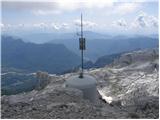 74
74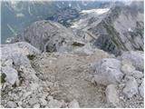 75
75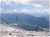 76
76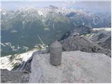 77
77 78
78
Discussion about the trip B postaja - Prestreljenik (via Krnica)
|
| Gost11. 09. 2006 |
 Beautiful path where we have peace. Plenty of alpine flowers, marmots and ibex. Only disturbed by the new Preval track in the upper part. The view from the top is wonderful. Beautiful path where we have peace. Plenty of alpine flowers, marmots and ibex. Only disturbed by the new Preval track in the upper part. The view from the top is wonderful. plp plp
|
|
|
|
| darinka427. 08. 2020 |
Today 27.8.2020 walked this tour. Think I was the only one on this path. Nice interesting path. Marked. Met a marker painting marks from Prevala. Returned the same way. Great views from the top. Just quite cold and windy.
|
|
|
|
| ločanka16. 08. 2023 09:47:48 |
Yesterday we returned via it. Wonderful trail! Nicer than I imagined. No wonder Igor recommended it too
|
|
|
|
| winni16. 08. 2023 13:25:21 |
What is the condition of the initial part of the described trail from Postaja B to Krnica (pictures 9, 10)? The little bridge?
|
|
|
|
| simon1616. 08. 2023 14:27:56 |
Up to Krnica there is a fallen tree on the path, the markings have faded a bit, but it's still passable. The wooden bridge is also passable.
|
|
|
|
| di7. 08. 2025 14:55:19 |
The first part of the path (to Planina Krnica) is quite neglected. In some sections it's hard to find the (marked) continuation.
You'll probably get around this first part of the path more carefree (and faster) by road.
|
|
|
|
| mirank7. 08. 2025 16:19:44 |
The best option is to go to the junction for Gozdec or even better to the junction of the service road for C station.
|
|
|
To post a comment you must log in:
If you do not yet have a username, you must first
register.