Plajberk pri Beljaku / Bad Bleiberg - Traningerwand (BGV Klettersteig)
Starting point: Plajberk pri Beljaku / Bad Bleiberg (980 m)
Route name: BGV Klettersteig
Walking time: 40 min
Difficulty: very difficult marked way
Elevation gain: 220 m
Elevation difference along the route: 220 m
Map:
Recommended equipment (summer): helmet, self belay set
Recommended equipment (winter): helmet, self belay set, ice axe, crampons
Views: 4.200
 | 2 people like this post |
Access to starting point:
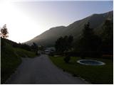
Over the border crossing Korensko sedlo we descend into Austria and when we reach the main road Trbiž / Tarvisio - Beljak / Villach, we continue left towards Trbiž. We follow the main road to the settlement Ziljica / Gailitz, and there at the roundabout, we go on the road towards the settlement Šmohor / Hermagor. From the roundabout we drive on the road towards Šmohor approximately 11 km, and then signs for Plajberk pri Beljaku / Bad Bleiberg point us to the left. Further, we drive through the underpass and the road brings us to the center of the settlement Čajna / Nötsch im Gailtal, from there we continue driving towards Plajberk pri Beljaku. Further, we drive on an ascending road, on which past a quarry we quickly get to the settlement Bleiberg Kreuth, and we drive a few kilometers further to the settlement Plajberk pri Beljaku / Bad Bleiberg. Approximately 100 meters before the thermal baths from the main road we turn left on an ascending road and follow the signs for Hotel Klom. We park near the hotel.
Route description:
We head onto the forest road and follow the signs »Mittagsnock – Hachelnock«. After approximately 10 minutes of walking on the road we come to a junction where a red sign (zum Klettergarten) points us right into the forest. The narrow footpath ascends diagonally and quickly brings us to another junction. We continue slightly left following the red-white blazes (right yellow-red blazes) and the path quickly brings us to yet another junction. We continue left again, while right leads the path towards an extremely demanding climbing path (Extrem Klettersteig). We continue ascending through the forest and the path soon brings us to the first steel cables. After a short ascent with the help of some steel cables the path brings us to a junction. We continue right on the secured climbing path named BGV Klettersteig (Bergmännischer Gesangsverein). The left path is for the return, as it is a circular climbing path. The climbing path at the beginning crosses the wall to the right (difficulty A/B). On some spots the slightly exposed path brings us to a ladder, where a harder path joins from the right.
The ascent over the overhanging ladder is the hardest part of the path and is graded with difficulty level C.
Above the ladder the path turns to the left and crosses the slopes above the wall to the left. The path on this part is not demanding, only on some spots is it slightly exposed. There follows a somewhat steeper descent (difficulty B), then the fixed safety gear ends and the path soon brings us below the wall.

Photos:
 1
1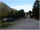 2
2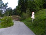 3
3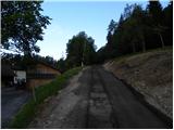 4
4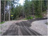 5
5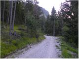 6
6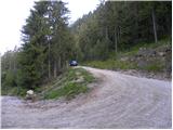 7
7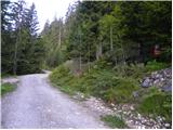 8
8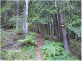 9
9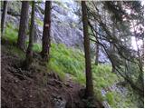 10
10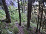 11
11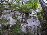 12
12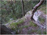 13
13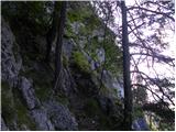 14
14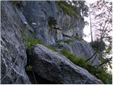 15
15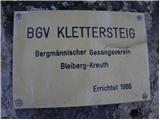 16
16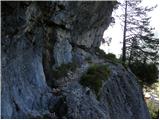 17
17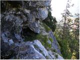 18
18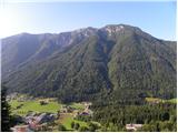 19
19 20
20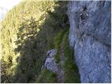 21
21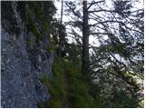 22
22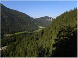 23
23 24
24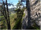 25
25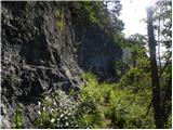 26
26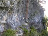 27
27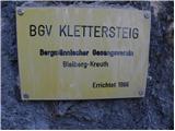 28
28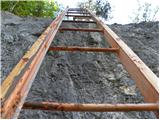 29
29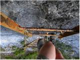 30
30 31
31 32
32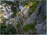 33
33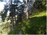 34
34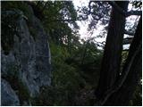 35
35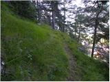 36
36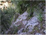 37
37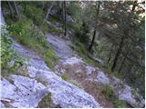 38
38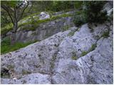 39
39 40
40
Discussion about the trip Plajberk pri Beljaku / Bad Bleiberg - Traningerwand (BGV Klettersteig)
To post a comment you must log in:
If you do not yet have a username, you must first
register.