Baita Sun Bar - Monte Antelao (Via Normale)
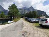
Starting point: Baita Sun Bar (1150 m)
| Latitude/Longitude: | 46,46419°N 12,21575°E |
| |
Route name: Via Normale
Walking time: 7 h
Difficulty: very difficult unmarked way, very difficult marked way
Elevation gain: 2114 m
Elevation difference along the route: 2140 m
Map: Tabacco 03 1:25.000
Recommended equipment (summer): helmet
Recommended equipment (winter): helmet, ice axe, crampons
Views: 7.898
 | 4 people like this post |
Access to starting point:
Access from Gorenjska: Through the border crossing Rateče or Predel to Trbiž / Tarvisio and then continue on the highway in the direction of Videm / Udine to the exit Tolmezzo. From Tolmezzo we follow the road in the direction of the village Ampezzo and mountain pass Passo della Mauria. The road then descends and brings us to a crossroad, where we continue left in the direction of Cortina d'Ampezzo. At all following crossroads, we follow the signs for Cortina d'Ampezzo. We follow the road to San Vito di Cadore where we leave the main road towards Cortina d'Ampezzo and turn right where signs direct us to the mountain hut Rifugio Scotter and ski resort Ski San Vito. On the left side of the road at the crossroad there is a church. The road then turns right and brings us to a crossroad. We turn left uphill and follow the signs for mountain hut Rifugio Scotter. We follow the road to Sun Bar where there are also signs prohibiting further driving. We park on the large parking lot located along the road on the right side.
From Primorska side: We drive on the highway towards Venice / Venezia. At Portogruaro we leave the highway towards Venice and continue right on the highway towards Pordenone. At the next highway junction near Conegliano, we continue right towards Belluno. Near Belluno the highway ends, and we continue at the following crossroads in the direction of Cortina d'Ampezzo. Further, we follow the above description.
Route description:
The road which leads straight ahead and is initially still asphalted was destroyed by the rockfall and is closed. It is also closed to hikers and cyclists. At the starting point, we turn left onto the macadam road. The relatively level road soon crosses the barrier and leads us above the bed of the torrent. The road then turns left and crosses the bed. Here there are also warning signs indicating that crossing the bed in rainy weather is dangerous due to possible sudden large waves. The road then begins to ascend more steeply and is concreted in some places. We ascend mostly through the forest, and a footpath to the hut Rifugio Scotter branches off to the right from the road. Slightly higher up, the road and footpath reunite. The forest then becomes sparser and beautiful views of the surrounding peaks begin to open, where the nearby Monte Antelao stands out especially. Soon we reach a junction where the old closed road also joins from the right.
We continue along the road, which is asphalted on a short section. Just before the hut, we reach a junction where we continue right, and only a few steps remain to the hut.
From the starting point to the hut, transport by vans is also organized. They start at 8:30, the price of the return ticket is 10€ (August 2018).
From the hut, we ascend the stairs to the road leading to the hut Rifugio San Marco. We follow the road only to the first left bend where there is a junction.
At the junction, we turn right onto the footpath where signs direct us to the notch Forcella Piccola and hut Rifugio Galassi. The path continues along the dwarf pines towards the northeast. Slightly higher, we ascend in switchbacks, and the path is newly constructed in places as it was damaged by torrents. When we approach the steeper slopes, we reach a junction where the path from the hut Rifugio San Marco joins from the left.
We continue right and then cross the slopes towards the southeast mostly in a gentle ascent for some time. From the path, we have an increasingly beautiful view to the west where Monte Pelmo is clearly visible. When we approach the slopes of the nearby peak Becchi di Imposponda, the path turns left and begins to ascend up the valley towards the notch Forcella Piccola. The path ascends along the left side of the valley and at the end there is a short descent to the notch where there is a marked junction.
Straight ahead the path leads to the hut Rifugio Galassi, which is a good 10 minutes' descent; we turn right where the signs »Monte Antelao – Via Normale« direct us. From the junction, we begin to ascend southwards on a partly grassy slope. The path then runs up the left side of the valley and brings us to a short flat area where a view to the east opens up. Here the grassy terrain ends and we continue the ascent over scree. The path across the scree turns right and brings us in ascent to the headwall of the cirque where there is a memorial plaque. From here, the path becomes significantly more demanding.
After a short steeper ascent, the path quickly turns right and a traverse across smooth slabs follows. We then ascend a steep slope where some easy climbing (1st grade) is required. The path ascends here on ledges and rugged rock and is mostly somewhat exposed. This path brings us to the ridge where a view to the west opens up.
We continue left along the initially narrow ridge, which quickly brings us to a wide slope with fluted slabs called Le Laste. The slope, which also has quite a bit of scree and rocks, is not overly steep here. We cross it to the right, then the path turns left and ascends along the right side of the slope from where we have a very nice view to the west where Monte Pelmo stands out. The slope narrows slightly later and a short descent to a small notch follows. From the notch, a very short more demanding ascent follows, bringing us to the central part of Le Laste where in November 2014 a huge rockfall occurred that considerably changed the mountain's appearance in this section.
At the beginning, the slope is relatively level and strewn with numerous rocks that are the result of the rockfall. The ascent here is not demanding and the path soon turns left. We cross the slope to the far left side, which is somewhat less exposed to falling rocks. We then ascend straight up along the left edge. Here a view to the glacier Ghiacciaio del Antelao also opens on the left side. The slope we are ascending is not overly steep, but since it runs over smooth slabs with some sand or mud, it is very slippery in places. Along the left edge, we ascend all the way to the top of the rockfall.
At the end of the rockfall, we head into a short rocky gully up which we ascend one level higher. Further on, the path is marked again with red dots and occasionally some easy climbing is required. Slightly higher on the steepest section, a rope assists us, hanging in a steep notch. A short but narrow and very exposed ledge leads to the rope. The demanding ascent is short (approximately 3 meters). A few more short steeper ascents follow, then we soon spot the summit. A short descent and the final ascent to the very panoramic summit follow.
We descend along the ascent path.
The described ascent is suitable only for experienced mountaineers and includes climbing up to 2nd grade. The ascent runs on northern slopes where snow lingers into late summer, and the slope is often damp otherwise. There is also considerable danger of falling rocks in the rockfall area.
The description and photos refer to conditions in 2018 (August).

Photos:
 1
1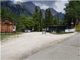 2
2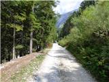 3
3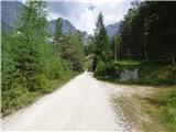 4
4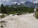 5
5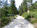 6
6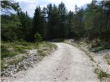 7
7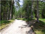 8
8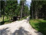 9
9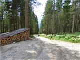 10
10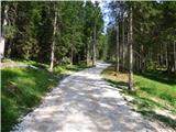 11
11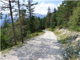 12
12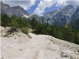 13
13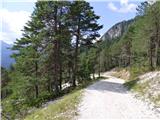 14
14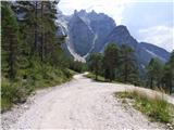 15
15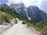 16
16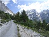 17
17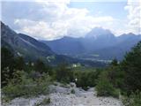 18
18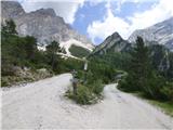 19
19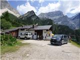 20
20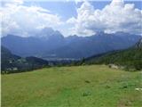 21
21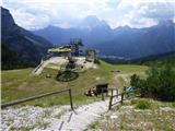 22
22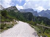 23
23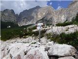 24
24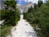 25
25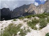 26
26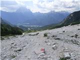 27
27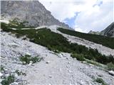 28
28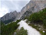 29
29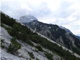 30
30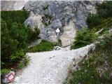 31
31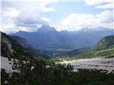 32
32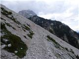 33
33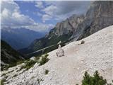 34
34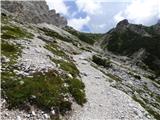 35
35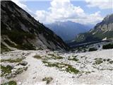 36
36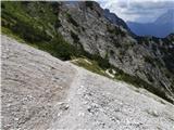 37
37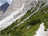 38
38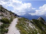 39
39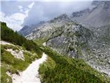 40
40 41
41 42
42 43
43 44
44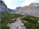 45
45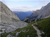 46
46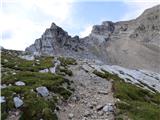 47
47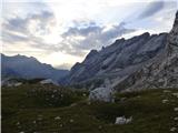 48
48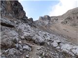 49
49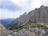 50
50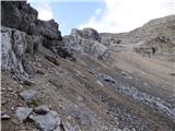 51
51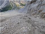 52
52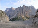 53
53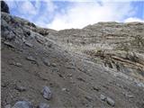 54
54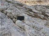 55
55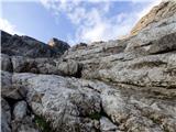 56
56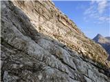 57
57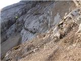 58
58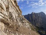 59
59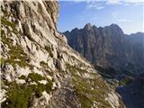 60
60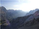 61
61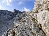 62
62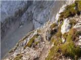 63
63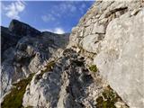 64
64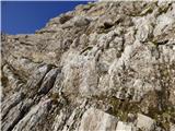 65
65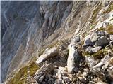 66
66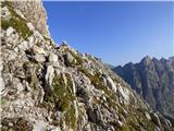 67
67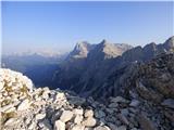 68
68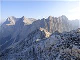 69
69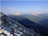 70
70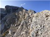 71
71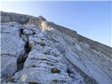 72
72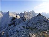 73
73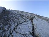 74
74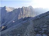 75
75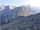 76
76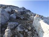 77
77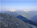 78
78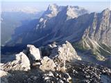 79
79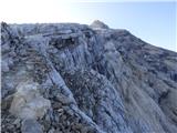 80
80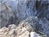 81
81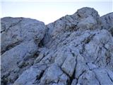 82
82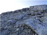 83
83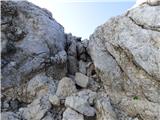 84
84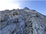 85
85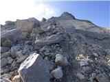 86
86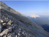 87
87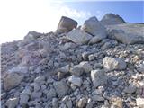 88
88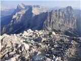 89
89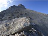 90
90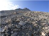 91
91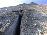 92
92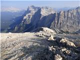 93
93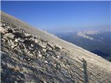 94
94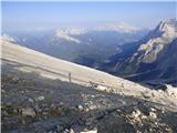 95
95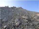 96
96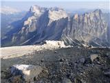 97
97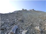 98
98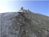 99
99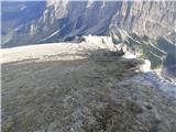 100
100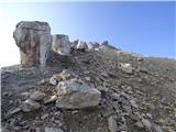 101
101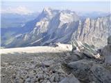 102
102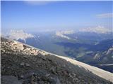 103
103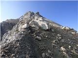 104
104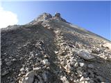 105
105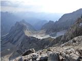 106
106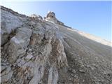 107
107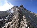 108
108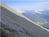 109
109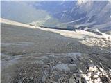 110
110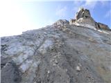 111
111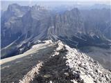 112
112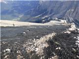 113
113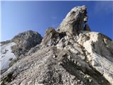 114
114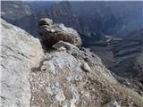 115
115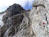 116
116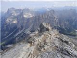 117
117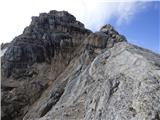 118
118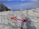 119
119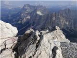 120
120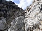 121
121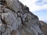 122
122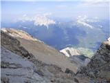 123
123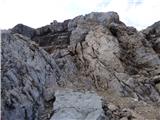 124
124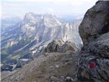 125
125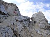 126
126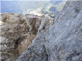 127
127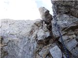 128
128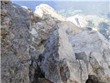 129
129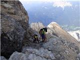 130
130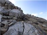 131
131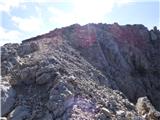 132
132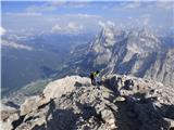 133
133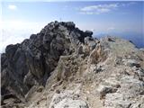 134
134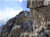 135
135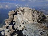 136
136 137
137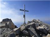 138
138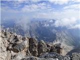 139
139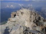 140
140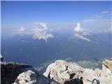 141
141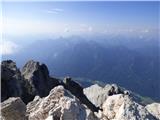 142
142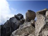 143
143
Discussion about the trip Baita Sun Bar - Monte Antelao (Via Normale)
|
| mirank2. 09. 2019 |
We were up there yesterday, but we didn't see those ropes (sl 128) anywhere
|
|
|
|
| mirank24. 06. 2025 15:18:59 |
Between picture 8 and 18 it's maybe 10min walk on the road, everything else is walking on trodden shortcuts through the forest. Nothing comes from trudging on macadam except sore soles
|
|
|
To post a comment you must log in:
If you do not yet have a username, you must first
register.