Bajgot - Mali Šumik waterfall
Starting point: Bajgot (1050 m)
Walking time: 35 min
Difficulty: difficult marked way
Elevation gain: -160 m
Elevation difference along the route: -160 m
Map: Pohorje 1:50.000
Recommended equipment (summer): helmet
Recommended equipment (winter): helmet, ice axe, crampons
Views: 9.866
 | 1 person like this post |
Access to starting point:
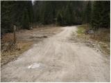
From Maribor or Dravograd we drive to Selnica ob Dravi, from where we continue driving towards the village Ruše. In Ruše we continue right and then left in the direction of Smolnik. An ascending road soon brings us to the mentioned village and only a few kilometers ahead to a crossroad, where we continue left towards the waterfall Šumik. Then we follow the road a good 100 m to the parking lot above the waterfalls Šumik.
Route description:
From the parking lot, we head onto an initially wide footpath in the direction of Mali and Veliki Šumik. Already after a few steps of walking a sign warns us that we will continue on a steep and dangerous for slipping path (compulsory hiking boots). The path ahead crosses the river Lobnica and starts gradually descending. Further, we descend on the path which is becoming steeper and steeper and in parts secured. When we get very close to Veliki Šumik, the path leads us over the hardest part of the path. With the help of steel cables we descend over a shorter steep wall, and then we cross steep slopes, mostly without fixed safety gear. The path then brings us to the spot, where there is a stamp (from here we already clearly see the waterfall). Next follows a steep descent to a nice vantage point on the waterfall.
From Veliki Šumik we continue on a path, which is still descending along Lobnica on locally steep slopes. A little further with the help of steel cables we cross the stream Verna, which at high water levels changes into several smaller waterfalls. And only a little further over a small bridge we cross the river Lobnica. Immediately after the bridge we notice a sign for the waterfall, which measures 9 meters. From the sign, we see the waterfall from above, and if we want to see it from below we continue on a path, which first ascends and then descends to a crossing. Here we continue right downwards on a steep path, which quickly brings us to the riverbed of Lobnica, from which a view opens up on the waterfall.

Photos:
 1
1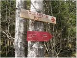 2
2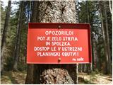 3
3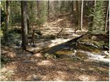 4
4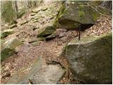 5
5 6
6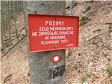 7
7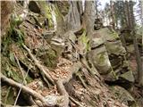 8
8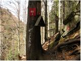 9
9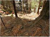 10
10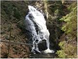 11
11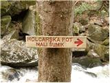 12
12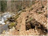 13
13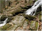 14
14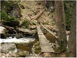 15
15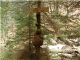 16
16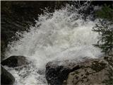 17
17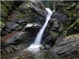 18
18
Discussion about the trip Bajgot - Mali Šumik waterfall
To post a comment you must log in:
If you do not yet have a username, you must first
register.