Bašelj - Dom na Kališču (on unmarked path)
Starting point: Bašelj (590 m)
| Latitude/Longitude: | 46,32100°N 14,40020°E |
| |
Route name: on unmarked path
Walking time: 2 h 40 min
Difficulty: easy unmarked way
Elevation gain: 944 m
Elevation difference along the route: 950 m
Map: Karavanke - osrednji del 1:50.000
Recommended equipment (summer):
Recommended equipment (winter): ice axe, crampons
Views: 1.020
 | 2 people like this post |
Access to starting point:
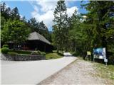
a) From the Ljubljana - Jesenice motorway, take the Kranj - east exit, then continue driving towards Jezersko. When arriving in Preddvor, leave the main road and continue left towards the centre of the mentioned place, from there follow the signs to the Bašelj settlement. Upon arriving in Bašelj, at the spot where the main road makes a long left bend, leave it and continue straight ahead towards Gamsova pot. Continue on the narrow asphalt road that leads between houses and along the Belica stream. Park at the parking lot by Turistično društvo Bašelj.
b) From the Jesenice - Ljubljana motorway, take the Kranj - west exit and at the first intersection continue left. Then drive through the underpass under the motorway, after which we arrive at a roundabout, from where we continue driving towards Golnik. The route ahead leads through the settlement Mlaka pri Kranju, we at the end of the settlement continue right towards the Srakovlje settlement. Follows the drive through Srakovlje, Spodnja Bela, Srednja Bela, Zgornja Bela (in Zgornja Bela we join the road from Preddvor) to Bašelj, where the main road makes a long left bend, leave it and continue straight ahead towards Gamsova pot. Continue on the narrow asphalt road that leads between houses and along the Belica stream. Park at the parking lot by Turistično društvo Bašelj.
Route description:
From the starting point, continue along the gravel road, which is closed to public traffic by a traffic sign. We ascend gently to moderately along the road, which takes us past the football and basketball courts and past the water supply facility to a marked junction.
From the junction, continue slightly left towards Partizanska bolnica Košuta and Kališče (right is a slightly shorter path to Kališče), where the path leads along a steeper cart track, from it after a short ascent go left onto the marked hiking trail. Follows ascent through the forest, on the section where we cross a clearing the path is somewhat overgrown. Follows some more ascent and we reach a gravel road, along which we ascend to a small pass, where Gamsova pot continues left, a few steps further a one-minute path branches right to the summit of Gradišče.
Continue along the road, which descends slightly, then turns right and brings us to a turning area, where it ends.
Here the poorer road, along which the marked path continues left, but we go straight ahead, where we notice an unmarked path, along which we continue. Follows ascent over a steep slope, then the slope flattens somewhat, but the path remains steep. Higher up the trail mostly follows an indistinct ridge, then crosses some cart tracks. Follows a few minutes of scenic ascent, then we return to the forest, where a chain assists us, but the passage would not be particularly difficult without it either.
A few steps above the chain, we return to the marked path, which continues to ascend quite steeply and at two points there are safety devices to assist (easy in dry conditions). Higher up the path turns slightly right and after a few more minutes of walking we arrive at Spodnje Kališče, or Planina Kališče, where there are a few huts and from where a nice view of Storžič opens up.
Continue along the eroded trail, which returns to the forest, in the forest we join the path from Mač. Follows a few more minutes of ascent through the forest, then the path from Zavetišče v Hudičevem borštu joins us.
Continue left towards Kališče and quickly ascend past a viewpoint to Dom na Kališču.
Starting point - end of road 0:15, end of road - road below Gradišče 0:25, road below Gradišče - turning area 0:10, turning area - Kisovec 0:50, Kisovec - Planina Kališče 0:45, Planina Kališče - Dom na Kališču 0:15.
Description and photos refer to the condition in 2019 (June).

Along the route: Konec ceste (679m), Cesta pod Gradiščem (825m), Obračališče (852m), Kisovec (1152m),
Planina Kališče (1450m), Razpotje pod Kališčem (1509m)
Photos:
 1
1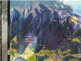 2
2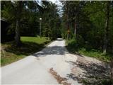 3
3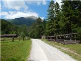 4
4 5
5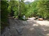 6
6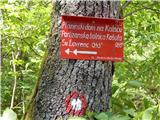 7
7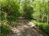 8
8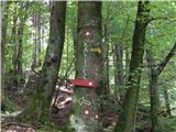 9
9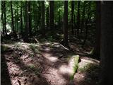 10
10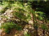 11
11 12
12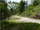 13
13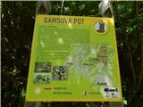 14
14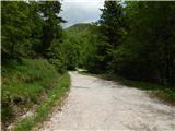 15
15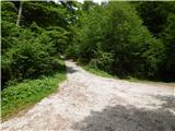 16
16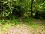 17
17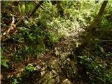 18
18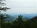 19
19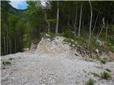 20
20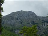 21
21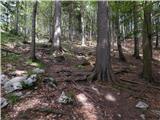 22
22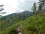 23
23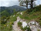 24
24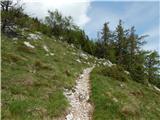 25
25 26
26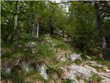 27
27 28
28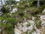 29
29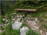 30
30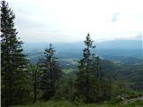 31
31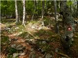 32
32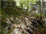 33
33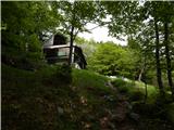 34
34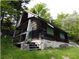 35
35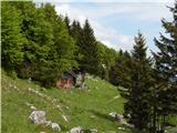 36
36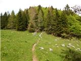 37
37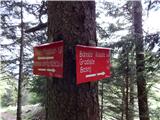 38
38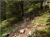 39
39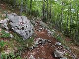 40
40 41
41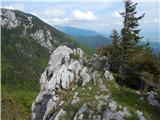 42
42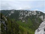 43
43 44
44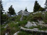 45
45 46
46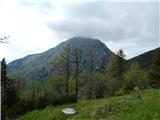 47
47
Discussion about the trip Bašelj - Dom na Kališču (on unmarked path)
To post a comment you must log in:
If you do not yet have a username, you must first
register.