Starting point: Bavšica (698 m)
| Latitude/Longitude: | 46,36990°N 13,62990°E |
| |
Walking time: 7 h 35 min
Difficulty: very difficult marked way
Elevation gain: 1947 m
Elevation difference along the route: 2200 m
Map: Julijske Alpe - zahodni del 1:50.000
Recommended equipment (summer): helmet, self belay set
Recommended equipment (winter): helmet, self belay set, ice axe, crampons
Views: 16.412
 | 3 people like this post |
Access to starting point:
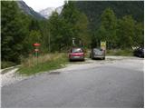
From the Bovec - Predel road, an asphalt road branches off to the right at Fort Kluže into the Bavšica valley. Head onto the mentioned road, which we follow in a moderate ascent to the parking lot in Bavšica (the parking lot is located by the TNP sign).
Route description:
From the parking lot, head left onto the poorer road towards Zavetišče pod Špičkom and Planina Bala (right Bavški Grintavec) and follow it for just under 5 minutes to the point where the markers direct us left onto an initially wide hiking path. The path soon narrows and leads us to a small junction, where the markers direct us sharply right onto a gradually steeper trail. The path soon levels out and takes us to the abandoned village of Logje (drinking water is just a few meters off the path).
From the village of Logje, continue on the marked trail, which continues across a gentle grassy slope. Further on, the path ascends somewhat more steeply and transitions to a partly rocky area (scree overgrown with tall grass). The path then levels out again and enters dense forest, continuing all the way to the abandoned Planina Bala.
From the alpine pasture, continue on the marked path, which then leads us through a strip of forest to the last spring along the path. Just a few 10 m beyond the spring, we notice the Bala hunting hut.
At the hunting hut, continue straight ahead and then ascend through the forest for a while longer. A short ascent follows across a grassy slope (Jezerce, 1389 m), then another ascent through the forest. When we emerge from the forest for the last time, only a short ascent remains to the indistinct saddle Prevala, 1560 m.
From the saddle, where there is also a poorly visible junction, continue straight along the valley, while a less trodden path branches off to the right towards Vrh Osojnika. Here we first descend a few steps and then continue along the initially very flat valley. Further on, the path becomes steeper and begins to ascend towards the saddle Čez Brežice.
At the saddle, continue right where a sign on the rock says “Špička”. First, ascend leftward along the fixed cable, then the path leads to a grassy slope, which we ascend for a while. When we reach below the cliffs of Mali Ozebnik, continue right and, with a slight ascent along the fixed cable, cross the precipitous slopes. In some places, there is also a lot of scree on the path, so extra caution is needed. The path then leads to a short very difficult section. With the help of the fixed cable and a few pegs, we ascend vertically, then cross a vertical slope to the right for a few more meters. Further on, the path ascends a somewhat less steep but unprotected slope, followed by an ascent over very scree-covered terrain to Škrbina za Gradom.
From the notch, descend across the scree below the walls of the peak Pelc nad Klonicami (2442 m). The path then leads through broken terrain past numerous rocks and boulders. In the final part, the path turns left and, after a short descent, takes us to Zavetišče pod Špičkom.
From here, continue right slightly downhill towards Jalovec (a bit further right leads the path towards the valley, i.e., Zadnji Trenti and Vršič), past a rock with an interesting inscription to the entry into the more difficult section of the path.
The path ahead ascends along an initially relatively well-protected rocky ridge, then steeply climbs the wall of the lesser-known Veliki Ozebnik (2480 m). The steepness then gradually eases, and the path turns slightly right, crossing steep and slippery slopes below Veliki Ozebnik. The path in this section is poorly protected and very exposed to falling rocks (helmet mandatory!). The path then crosses a shorter exposed gully and leads us into softer grassy terrain. The path then descends slightly and takes us to the high mountain plain called Jezerce. A short ascent follows, and from the right, the path from Jalovška škrbina joins us.
The path then ascends steeply again and, with some minor protections along a locally quite exposed path, takes us to the main ridge of Jalovec. Further on, we ascend along a narrow and occasionally very exposed ridge on a path that higher up leads to the point where the path from Kotovo sedlo joins from the left. Continue straight, and the scenic ridge path quickly takes us to the summit of Jalovec.
Bavšica - Logje 0:25, Logje - Planina Bala 1:05, Planina Bala - lovska koča 0:20, lovska koča - Prevala 0:45, Prevala - Čez Brežice 1:10, Čez Brežiče - Škrbina Za gradom 0:55, Škrbina Za gradom - Zavetišče pod Špičkom 0:40, Zavetišče pod Špičkom - Jezerca 1:25, Jezerca - Razpotje na grebenu Jalovca 0:45, razpotje na grebenu Jalovca - Jalovca 0:05.

Photos:
 1
1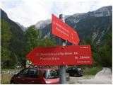 2
2 3
3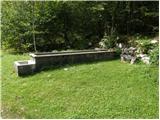 4
4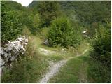 5
5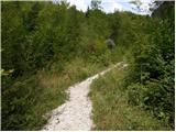 6
6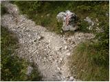 7
7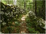 8
8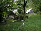 9
9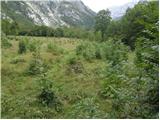 10
10 11
11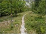 12
12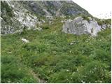 13
13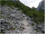 14
14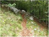 15
15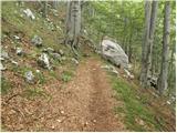 16
16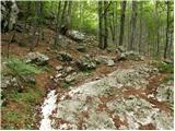 17
17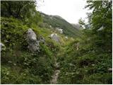 18
18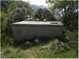 19
19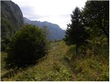 20
20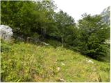 21
21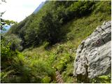 22
22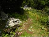 23
23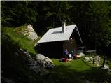 24
24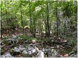 25
25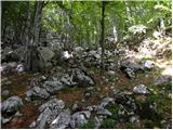 26
26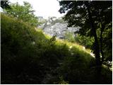 27
27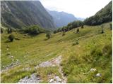 28
28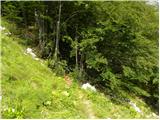 29
29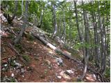 30
30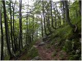 31
31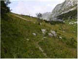 32
32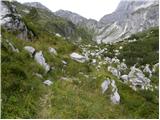 33
33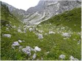 34
34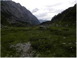 35
35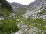 36
36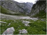 37
37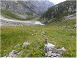 38
38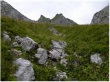 39
39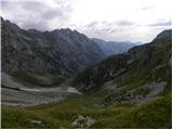 40
40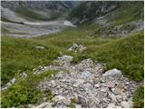 41
41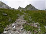 42
42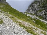 43
43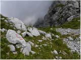 44
44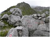 45
45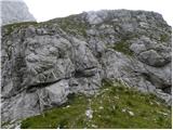 46
46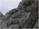 47
47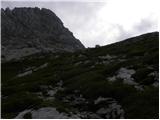 48
48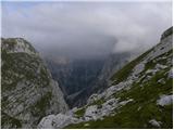 49
49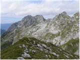 50
50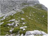 51
51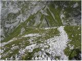 52
52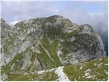 53
53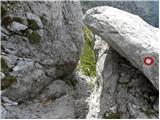 54
54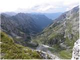 55
55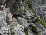 56
56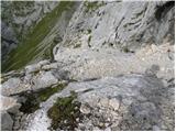 57
57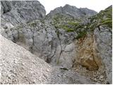 58
58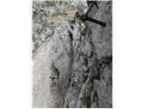 59
59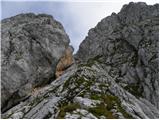 60
60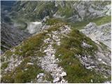 61
61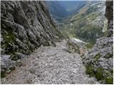 62
62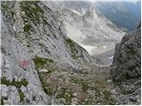 63
63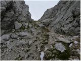 64
64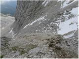 65
65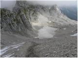 66
66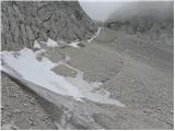 67
67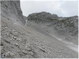 68
68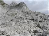 69
69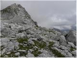 70
70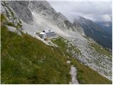 71
71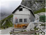 72
72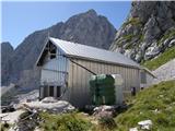 73
73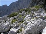 74
74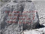 75
75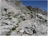 76
76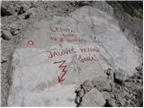 77
77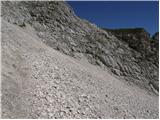 78
78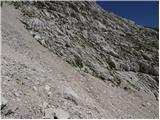 79
79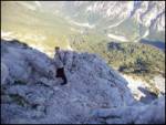 80
80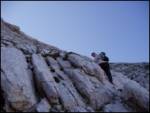 81
81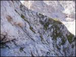 82
82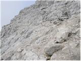 83
83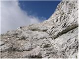 84
84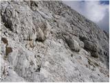 85
85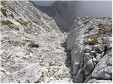 86
86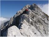 87
87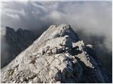 88
88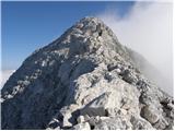 89
89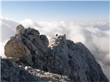 90
90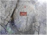 91
91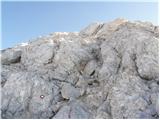 92
92 93
93
Discussion about the trip Bavšica - Jalovec
To post a comment you must log in:
If you do not yet have a username, you must first
register.