Begunje - Goli vrh (Cemarovnik)
Starting point: Begunje (611 m)
| Latitude/Longitude: | 45,82180°N 14,38370°E |
| |
Walking time: 30 min
Difficulty: easy marked way
Elevation gain: 205 m
Elevation difference along the route: 205 m
Map: Snežnik 1:50.000
Recommended equipment (summer):
Recommended equipment (winter):
Views: 5.574
 | 1 person like this post |
Access to starting point:
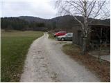
From the highway Ljubljana - Koper take the Unec exit and follow the road ahead in the direction of Cerknica. Just a little before Cerknica continue left in the direction of Begunje, then on a somewhat more winding road quickly arrive at the already mentioned village. In Begunje continue driving on the main road, then at the crossroads by the Mercator store continue straight on the macadam road next to which we notice signs for Špičasto Stražišče (left Bezuljak, right Selšček). We then follow the worse macadam road to a smaller parking lot by the village bowling alley.
Route description:
From the starting point, we continue on a worse macadam road which already after a few dozen steps of easy walking brings us to a crossing of three cart tracks. We continue on the leftmost (or also middle) cart track, which in a gentle ascent brings us to the next marked crossing. This time we continue on the right path (at the crossing there are signs for Špička left and right), which leads us along the upper edge of ample karst meadows. After a few minutes of walking, the blazes direct us to the left (straight Selšček) onto a somewhat steeper footpath, which gradually brings us onto the increasingly panoramic grassy slope. Up the mentioned slope we ascend straight upwards and follow the easy-to-follow path all the way to the edge of the forest, by which there is a pleasant bench (view on Begunje and surroundings). The path ahead starts to ascend a little more steeply through a belt of forest, then it flattens and after a few steps of further walking brings us to the panoramic summit.

Photos:
 1
1 2
2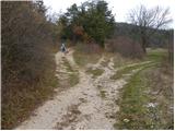 3
3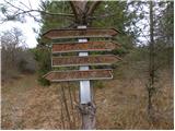 4
4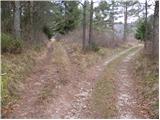 5
5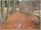 6
6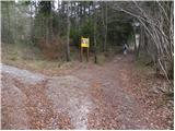 7
7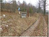 8
8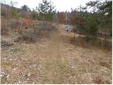 9
9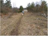 10
10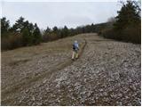 11
11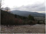 12
12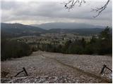 13
13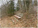 14
14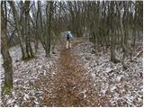 15
15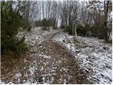 16
16 17
17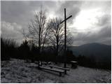 18
18
Discussion about the trip Begunje - Goli vrh (Cemarovnik)
|
| grega_p23. 12. 2009 |
Nice short trip in the land of bears with views of Javorniki, Slivnica and nearby villages. Also for winter days.
On the top a proper shrine.
|
|
|
To post a comment you must log in:
If you do not yet have a username, you must first
register.