Begunje (Krpin) - Sankaška koča (by ski slope)
Starting point: Begunje (Krpin) (585 m)
| Latitude/Longitude: | 46,38210°N 14,20300°E |
| |
Route name: by ski slope
Walking time: 50 min
Difficulty: easy marked way
Elevation gain: 282 m
Elevation difference along the route: 282 m
Map: Karavanke - osrednji del 1:50.000
Recommended equipment (summer):
Recommended equipment (winter):
Views: 9.350
 | 1 person like this post |
Access to starting point:
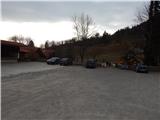
We leave the Gorenjska motorway at the Radovljica or Lesce exit, then follow the signs for Begunje na Gorenjskem. When we arrive in Begunje na Gorenjskem, we first still follow the signs for Tržič and Draga, then after the hospital turn left towards the recreation center Krpin, to which we arrive after approximately 100 meters of further driving. We park on the large parking lot next to the mentioned recreation center.
Route description:
Behind the bar Krpin, which is situated by the parking lot, there starts a well-beaten path which leads towards the church of St. Peter on Gora. The path at first runs on a gentle cart track, then passes to the right side of the ski slope, where it ascends along the edge of the forest. Further on, we ascend quite steeply for some time, then the path temporarily flattens a little past the shepherd's hut. A little further, on the upper part of the ski slope, the path turns right and continues on a cart track. From the cart track, we soon go left on a steep path, and after a few minutes we return to a poorer cart track.
When we again reach the cart track we follow it to the left, and it quickly brings us out of the forest, where we already see the church of St. Peter in front of us, separated from it by only a short moderate ascent with increasingly beautiful views.
From the church, we continue right in the direction of Sankaška koča, and the path ahead leads us on a wide and gentle cart track which runs to the right of the take-off site and viewpoint. When the cart track goes into the forest we continue on the left cart track, and continue in a gentle ascent along it. In the last part, the cart track becomes a little steeper, and we quickly reach Sankaška koča, from which a nice view opens up on the Julian Alps.
Description and pictures refer to the condition in the year 2017 (January, February).

Photos:
 1
1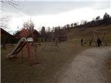 2
2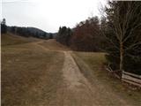 3
3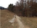 4
4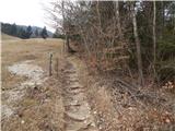 5
5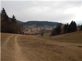 6
6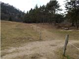 7
7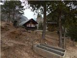 8
8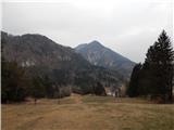 9
9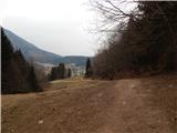 10
10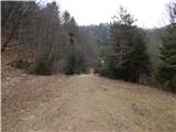 11
11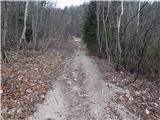 12
12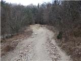 13
13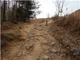 14
14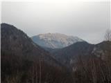 15
15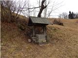 16
16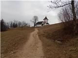 17
17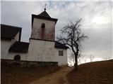 18
18 19
19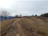 20
20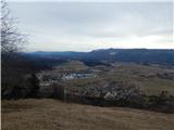 21
21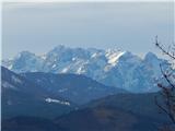 22
22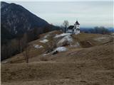 23
23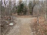 24
24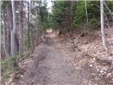 25
25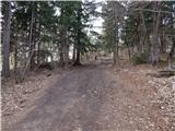 26
26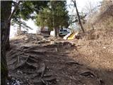 27
27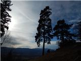 28
28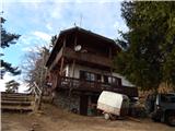 29
29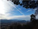 30
30
Discussion about the trip Begunje (Krpin) - Sankaška koča (by ski slope)
To post a comment you must log in:
If you do not yet have a username, you must first
register.