Begunje (Krpin) - Smokuški vrh (through Blatnica Gorge)
Starting point: Begunje (Krpin) (585 m)
| Latitude/Longitude: | 46,38210°N 14,20300°E |
| |
Route name: through Blatnica Gorge
Walking time: 1 h 40 min
Difficulty: easy unmarked way
Elevation gain: 537 m
Elevation difference along the route: 545 m
Map: Karavanke - osrednji del 1:50.000
Recommended equipment (summer):
Recommended equipment (winter): ice axe, crampons
Views: 2.800
 | 1 person like this post |
Access to starting point:
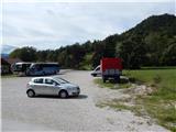
We leave the Gorenjska highway at the exit Radovljica or Lesce, and then we follow the signs for Begunje na Gorenjskem. When we get to Begunje na Gorenjskem, at first we still follow the signs for Tržič and Drago, and then at the hospital we turn left in the direction of the recreation center Krpin, to which we get after approximately 100 meters of additional driving. We park on a large parking lot by the mentioned recreation center.
Route description:
From the starting point, we continue on the asphalt road which lightly ascends and past the sign in a few minutes brings us to the water tank Mravlinc, where parking is also possible. Here on the asphalt road we cross the bridge and ascend to the last house, where the road becomes macadam and turns right. A little further we arrive at a junction, where to the left a path branches off leading to the church of St. Peter, we continue straight and past the water catchment arrive at the next junction, where to the left another path (road) branches off leading towards the church of St. Peter and Sankaška koča, we continue straight on the road which brings us into the gorge of Blatnica stream. Initially we ascend above the scenic stream, then gradually approach its bed completely. Further on the path leads us past one of the Blatnica waterfalls, then the path forks.
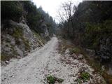
We continue left on the wider cart track which continues through the forest and leads us along the torrent stream (straight the path that runs along Globoki potok). A somewhat steeper ascent follows, at junctions we follow the wider path which higher brings us to a fork on the saddle Kališča, where we also reach the marked path St. Peter - Poljška planina.
We continue left towards St. Peter and begin to ascend parallel to the macadam road, which higher, shortly before its end, we also cross. Some ten steps further we leave the marked path which continues towards St. Peter and begins to descend, and continue slightly right on the unmarked cart track which continues across to the right. At the nearby junction we choose the lower cart track, then some slight traversing follows. When the traversing ends, the cart track turns into a forest path, along which we ascend to the panoramic summit in a few minutes.
The description refers to the conditions in October 2019, the photos are from various periods.

Along the route: Soteska Blatnice (800m), Kališča (980m)
Photos:
 1
1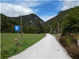 2
2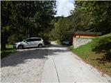 3
3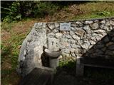 4
4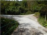 5
5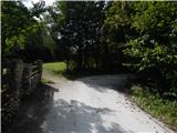 6
6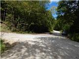 7
7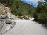 8
8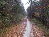 9
9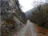 10
10 11
1112
 13
13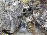 14
14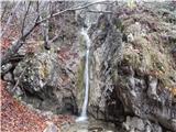 15
15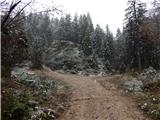 16
16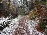 17
17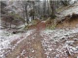 18
18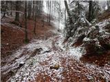 19
19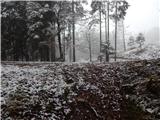 20
20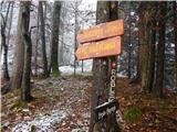 21
21 22
22 23
23 24
24 25
25 26
26 27
27 28
28 29
29 30
30 31
31 32
32 33
33 34
34
Discussion about the trip Begunje (Krpin) - Smokuški vrh (through Blatnica Gorge)
To post a comment you must log in:
If you do not yet have a username, you must first
register.