Bela Peč - Prevala (via Ojstri vrh)
Starting point: Bela Peč (840 m)
| Latitude/Longitude: | 46,25180°N 14,71610°E |
| |
Route name: via Ojstri vrh
Walking time: 1 h 40 min
Difficulty: easy unmarked way
Elevation gain: 323 m
Elevation difference along the route: 400 m
Map:
Recommended equipment (summer):
Recommended equipment (winter): ice axe, crampons
Views: 1.360
 | 2 people like this post |
Access to starting point:
A) From Kamnik or Vransko we drive into the Tuhinjska valley, where in the settlement Podhruška we turn towards the settlement Sela pri Kamniku. When we arrive in Rožično we go right, then we drive for some time through the settlement Sela pri Kamniku, where at the crossroads we follow the main road. After the village Znojile the road temporarily flattens, then from the settlement Trobelno we follow the signs for Bela Peč. There follows a transverse drive to the right, then we arrive at two successive crossroads, where a road towards Bela Peč branches off to the right. In both crossroads we continue left, then after the left hairpin turn we quickly arrive at a crossroad, where the forest road branches off to the right. We park at a suitable place by the crossroad.
B) From Gornji Grad we drive towards Kamnik, after the mountain pass Črnivec in one of the hairpin turns we turn towards Sovinja Peč. After Sovinja Peč we join the road from the Tuhinjska valley, and we follow it to the left. There follows a transverse drive to the right, then we arrive at two successive crossroads, where a road towards Bela Peč branches off to the right. In both crossroads we continue left, then after the left hairpin turn we quickly arrive at a crossroad, where the forest road branches off to the right. We park at a suitable place by the crossroad.
C) From Stahovica we drive towards the mountain pass Črnivec, then in one of the hairpin turns we turn towards Sovinja Peč. After Sovinja Peč we join the road from the Tuhinjska valley, and we follow it to the left. There follows a transverse drive to the right, then we arrive at two successive crossroads, where a road towards Bela Peč branches off to the right. In both crossroads we continue left, then after the left hairpin turn we quickly arrive at a crossroad, where the forest road branches off to the right. We park at a suitable place by the crossroad.
D) We drive to Luče, then continue driving towards Kamnik. When after the mountain pass Volovljek we join the road which leads from Stahovica towards Gornji Grad, we continue right, then in one of the hairpin turns we turn towards Sovinja Peč. After Sovinja Peč we join the road from the Tuhinjska valley, and we follow it to the left. There follows a transverse drive to the right, then we arrive at two successive crossroads, where a road towards Bela Peč branches off to the right. In both crossroads we continue left, then after the left hairpin turn we quickly arrive at a crossroad, where the forest road branches off to the right. We park at a suitable place by the crossroad.
Route description:
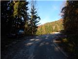
From the starting point we continue right on a side road which is closed to public traffic. Soon we arrive at a smaller crossroad, where we continue straight (the left road ends on the slopes of Tomanova planina), then the path brings us along the upper edge of the nearby pasture, from where a beautiful view opens towards the hills above the Tuhinjska valley. After the pasture we continue on the left upper road, then at the smaller crossroad straight. A little further the forest ends and we arrive at the upper edge of a larger panoramic hay meadow, from which a view opens on the surrounding hills.
A few steps before we step onto the mentioned slope, a cart track continues straight ahead, which we will also follow (further on the road Ovčje jame). After a short ascent we arrive at a junction of several cart tracks, and we continue slightly left on the cart track which continues ascending. Further on several junctions follow, and we choose intuitively those turn-offs where the path ascends most. After the last junction on the mentioned section, a short descent follows, then we bypass the nearby sinkhole, after which we ascend to the saddle between Podbevška peč and Seduc.
On the mentioned saddle, where there is also a cross with a logbook, we reach a marked path which leads from the mountain pass Črnivec towards Menina planina, which we follow to the right. A little further we step on another cart track, from which occasionally some view opens towards the north. The cart track narrows a little further into a wide path, which soon joins the next cart track, along which we walk to the pasture fence of the nearby planina Ravni.
After crossing the pasture fence we leave the marked path and continue with the path along the fence, along which we quickly arrive at the saddle between Ojstri vrh on the left and Seduc on the right. On the saddle some sort of footpath reappears, along which we begin to ascend the forested ridge. We follow the path, along which there are some yellow marks on the trees, to Ojstri vrh, from which some view already opens.
From the summit we continue along the pasture fence, and from the path which gently to moderately descends, beautiful views open towards Lepenatka, Golte and other surrounding mountains. After less than 10 minutes of descent we arrive at Prevala, where there are a cross, a statue of St. Mary and a logbook box.
Starting point - Ojstri vrh - 1:30, Ojstri vrh - Prevala 10 minutes.
Description and pictures refer to the condition in 2016 (November).

Photos:
 1
1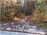 2
2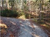 3
3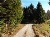 4
4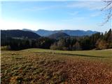 5
5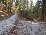 6
6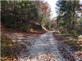 7
7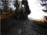 8
8 9
9 10
10 11
11 12
12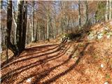 13
13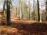 14
14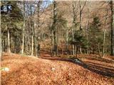 15
15 16
16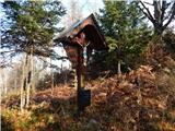 17
17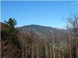 18
18 19
19 20
20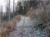 21
21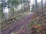 22
22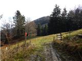 23
23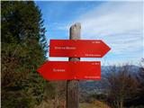 24
24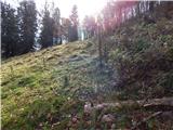 25
25 26
26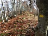 27
27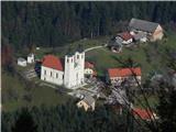 28
28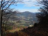 29
29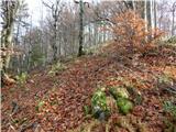 30
30 31
31 32
32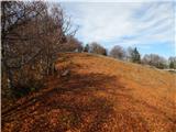 33
33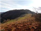 34
34 35
35 36
36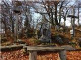 37
37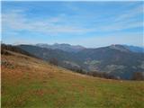 38
38
Discussion about the trip Bela Peč - Prevala (via Ojstri vrh)
To post a comment you must log in:
If you do not yet have a username, you must first
register.