Starting point: Belica (344 m)
| Latitude/Longitude: | 46,06590°N 14,34790°E |
| |
Walking time: 1 h
Difficulty: easy marked way
Elevation gain: 348 m
Elevation difference along the route: 348 m
Map: Ljubljana - okolica 1:50.000
Recommended equipment (summer):
Recommended equipment (winter):
Views: 5.884
 | 1 person like this post |
Access to starting point:
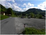
First, we drive to Dobrova near Ljubljana, and then we continue driving in the direction of Polhov Gradec. Just a little after the village Log pri Polhovem Gradcu, we will arrive at the village Belica, which is the starting point for our tour. But because in the mentioned village there are no appropriate parking spots, we drive another approximately 500 meters to the neighboring village Dvor, where we park on a large parking lot at the beginning of the village.
Route description:
From the parking lot in Dvor, we return on the main road to the village Belica, and there the mountain signposts direct us to the left (from the direction of Ljubljana, right) onto a somewhat narrower and macadam road, which gently ascends through the village. The road further gently ascends beside a trickling stream, and then brings us to a smaller junction, where we continue on the left poorer road or cart track. We cross the stream over which the left cart track goes with the help of a wooden bridge, and then we follow the cart track only a few meters. After a few meters, in fact, the blazes direct us to the right, where we again cross the stream (Veliki graben), and the path then leads us through a smaller meadow into the forest, where it gradually starts to ascend steeper and steeper. The relatively steep path brings us higher onto the initially indistinct ridge of Kregovnik, whose summit we reach after approximately one hour of walking.
Photos:
 1
1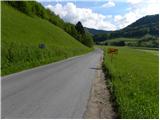 2
2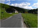 3
3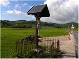 4
4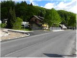 5
5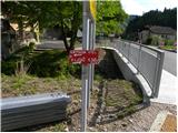 6
6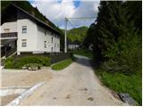 7
7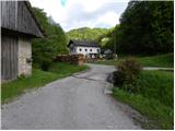 8
8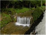 9
9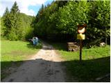 10
10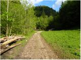 11
11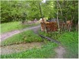 12
12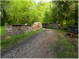 13
13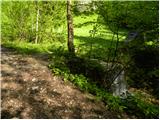 14
14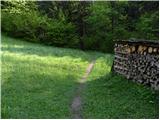 15
15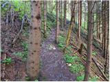 16
16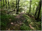 17
17 18
18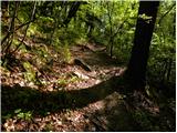 19
19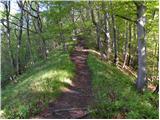 20
20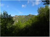 21
21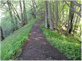 22
22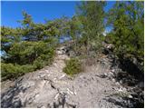 23
23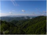 24
24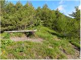 25
25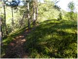 26
26 27
27
Discussion about the trip Belica - Kregovnik
|
| Lisica7. 02. 2011 |
Yesterday I went on this trail straight to Grmada, because I 'couldn't find' Kregovnik, not sure maybe I missed it but I didn't see even one sign for Kregovnik on the trail. The path was very muddy at the beginning. In Belica they arranged about 3-4 parking spots (right after the bridge, by the stream) Nice day, nice trip. Nice day, nice trip.
|
|
|
|
| emze24. 12. 2015 |
You can reach Kregovnik also via pathless routes.
1. By road from Belica after crossing the stream continue on the forest road, that is, through the Hudega graben valley. We have a fairly steep slope on the right all the time. At the confluences keep right. If it's not a rainy period, most of the path can be done along the streambed. When it no longer goes forward somehow, we dig right into the slope. Most likely we reach the path at the saddle between Kregovnik and Grmada. In this case, 25 meters of ascent to the top of Kregovnik await us.
2. By road from Belica DO NOT cross the stream, but turn right into the valley of Belski Graben (note, names are quite ad hoc). The road gradually turns across the stream to the left and sticks to the slope. The ridge and marked path are now on the left. The path becomes increasingly overgrown. If in doubt, climb higher. When the valley runs out, we are near the Kregovnik-Grmada saddle. Sharply left upwards. Then same as under 1.
You must be prepared that the first attempt fails and you have to return. Why not.
|
|
|
To post a comment you must log in:
If you do not yet have a username, you must first
register.