Belica - Polhograjska Grmada
Starting point: Belica (344 m)
| Latitude/Longitude: | 46,06590°N 14,34790°E |
| |
Walking time: 1 h 30 min
Difficulty: easy marked way
Elevation gain: 554 m
Elevation difference along the route: 565 m
Map: Ljubljana - okolica 1:50.000
Recommended equipment (summer):
Recommended equipment (winter): ice axe, crampons
Views: 33.703
 | 6 people like this post |
Access to starting point:
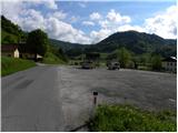
First, we drive to Dobrovo near Ljubljana, then we continue driving towards Polhov Gradec. Just a little after the village of Log pri Polhovem Gradcu, we arrive at the village of Belica, which is the starting point for our tour. But because there are no appropriate parking spots in the mentioned village, we drive another approximately 500 m to the neighbouring village of Dvor, where we park on a large parking lot at the beginning of the village.
Route description:
From the parking lot in Dvor, we return along the main road to the village of Belica, where the mountain signposts direct us to the left (from the direction of Ljubljana to the right) onto a somewhat narrower and macadam road that gently ascends through the village. The road continues gently ascending alongside a babbling stream, then brings us to a smaller junction, where we continue along the left poorer road or cart track. We cross the stream over which the left cart track passes with the aid of a wooden footbridge, then follow the cart track for only a few meters. After a few meters, the blazes direct us to the right, where we cross the stream again (Veliki graben), and the path then leads us across a small meadow into the forest, where it gradually begins to ascend more and more steeply. The relatively steep path brings us higher to an initially indistinct ridge of Kregovnik, whose summit we reach after approximately one hour of walking.
From Kregovnik (692 m), the path descends slightly, then resumes ascending more steeply, this time along the southeastern slopes of Polhograjska Grmada. The path, which in the meantime has transitioned from mixed forest to a somewhat sparser, mostly pine forest, offers us increasingly beautiful views of the surroundings. After a few minutes of further walking, we step onto a transverse path, which we follow to the left (to the right along the quite overgrown path of Gonte and Topol), but we walk along it for only about 3 minutes, after which the blazes for Grmada lead us to the right up the slope. We continue ascending across a panoramic slope, where after a short ascent we join a much more well-trodden path. This is followed by a steep ascent along a rocky path that partly resembles high mountains. Higher up, we cross a short strip of forest, after which a marked path from Dvor and Polhov Gradec joins us from the left. We continue along the right ascending path, which brings us to the next junction after just a few steps, where the path from Gonte and Topol also joins from the right. Here we continue to the left and after a few more steps reach the summit of the 898 m high Polhograjska Grmada.

The trip can be extended to the following destinations: Tošč
Photos:
 1
1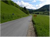 2
2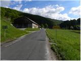 3
3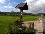 4
4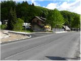 5
5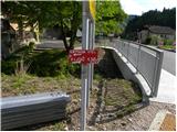 6
6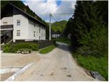 7
7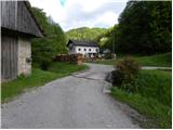 8
8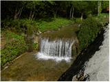 9
9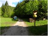 10
10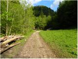 11
11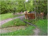 12
12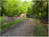 13
13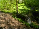 14
14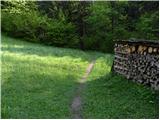 15
15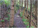 16
16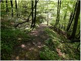 17
17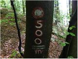 18
18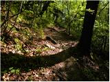 19
19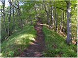 20
20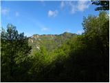 21
21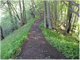 22
22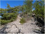 23
23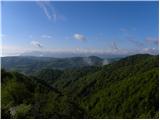 24
24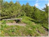 25
25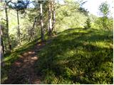 26
26 27
27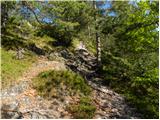 28
28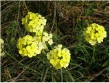 29
29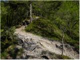 30
30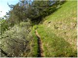 31
31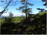 32
32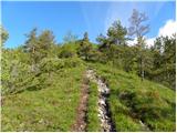 33
33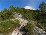 34
34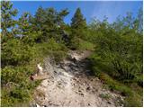 35
35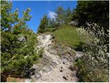 36
36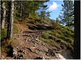 37
37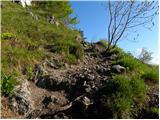 38
38 39
39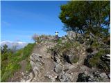 40
40 41
41 42
42
Discussion about the trip Belica - Polhograjska Grmada
|
| Gost2. 11. 2007 |
The weather was wonderful, the view of Triglav exceptional – lakota strahota. Tomorrow I'm going to the Karavanke too.
|
|
|
|
| MartinaZ5. 03. 2008 |
It was ideal weather on Sunday for this trip. One of the most beautiful paths I've hiked. There were so many flowers along the path that in some sections it was like a fairy tale...
|
|
|
|
| lakkon28. 12. 2012 |
Hello.
According to the weather forecast, the trip on Saturday, Sunday or Monday to Grmada could be a bullseye. Can you go to the top without any gaiters, crampons?
|
|
|
|
| ljubitelj gora28. 12. 2012 |
There is currently no snow in the Polhograjske Dolomites.
|
|
|
|
| svetilka14. 02. 2021 |
Visited in January 2021, suitable for crampons in the upper part of the path. Very nice trail that steeply ascends to Grmada after Kregovnik.
At the beginning, there is no bridge over the stream, it might be hard to cross dry if there has been a lot of rain.
|
|
|
To post a comment you must log in:
If you do not yet have a username, you must first
register.