Belopeška jezera / Lago di Fusine - Črni vrh / Colrotondo
Starting point: Belopeška jezera / Lago di Fusine (929 m)
| Latitude/Longitude: | 46,47340°N 13,67080°E |
| |
Walking time: 1 h 40 min
Difficulty: easy unmarked way
Elevation gain: 557 m
Elevation difference along the route: 560 m
Map: Julijske Alpe - zahodni del 1:50.000
Recommended equipment (summer):
Recommended equipment (winter): ice axe, crampons
Views: 6.891
 | 1 person like this post |
Access to starting point:
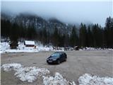
A) First, we drive to Kranjska Gora, then continue driving towards Rateče and further into Italy. When we arrive at the settlement Fužine / Fusine in Valromana, we will immediately after crossing Jezerski potok notice signs for Belopeška jezera / Laghi di Fusine (there are signs in Italian by the road). We continue left in the mentioned direction and continue driving on a somewhat narrower asphalt road, which we follow past Spodnje Belopeško jezero to the large macadam parking lot by Zgornje Belopeško jezero.
B) Via the border crossing Predel we drive to Italy, then continue driving towards Trbiž / Tarvisio and further towards Rateče. When we arrive at the settlement Fužine / Fusine in Valromana, we will just before the road crosses Jezerski potok notice signs for Mangartska jezera / Laghi di Fusine (there are signs in Italian by the road). We continue right in the mentioned direction and continue driving on a somewhat narrower asphalt road, which we follow past Spodnje Belopeško jezero to the large macadam parking lot by Zgornje Belopeško jezero.
Route description:
On the south side of the parking lot, look for the macadam road that continues towards the southwest; after crossing a stream it splits. Continue on the right road in the direction of Poldnik (Kopa) / Picco do Mezzodi and Remšendol / Val Romana (left Mangart and mountain hut Zacchi), which continues through the forest for a short time, then brings us to the lower part of Jezerska planina. A shorter crossing follows, then the road turns left and begins to ascend gently to moderately. Follow the fairly panoramic road with nice views to the upper part of the mountain pasture, where some older cottages stand.
We bypass the cottages on the right side; the road a little further passes into the forest, where at the marked junction we continue slightly right towards Poldnik and Remšendol (slightly left Plazje / Forcella della Lavina). The worse road splits again a little further; we choose right again, which turns into a cart track and brings us to a larger clearing where a hunting observatory stands. Here the path turns left and enters the forest, through which it begins to ascend steeply. In the forest, first cross a torrent, then ascend the slope, partly along an indistinct forest ridge. At 1400 m altitude we reach the saddle Črni vrh / Sella di Colrotondo, where we leave the marked path towards Poldnik and continue right on the easy-to-follow but no longer marked path, which initially continues along the ridge. From the ridge we temporarily get some views of the mountains rising above the head of Mangartske doline, then behind a small wooden cottage the path turns slightly left and joins the cart track leading from the valley of Črni potok and starting at the settlement Bela Peč / Villa Bassa.
Continue on the cart track, which ascends gently to moderately towards the north. Higher we reach the highest point of Črni vrh; we continue another approximate minute to a larger clearing where a hunting observatory stands and from which a nice view opens up.
Starting point - Jezerska planina 0:15, Jezerska planina - saddle Črni vrh 1:00, saddle Črni vrh - Črni vrh 0:25.
Description and pictures refer to the condition in 2018 (November).

Photos:
 1
1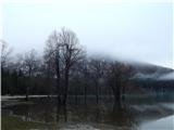 2
2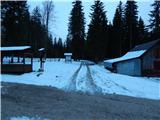 3
3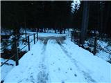 4
4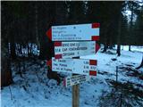 5
5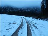 6
6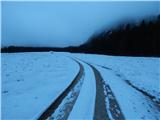 7
7 8
8 9
9 10
10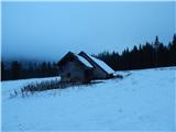 11
11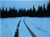 12
12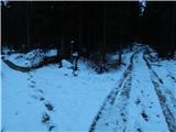 13
13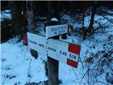 14
14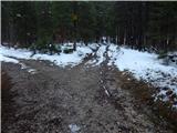 15
15 16
16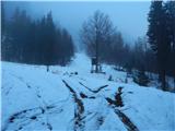 17
17 18
18 19
19 20
20 21
21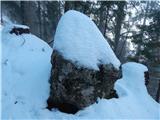 22
22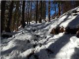 23
23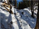 24
24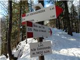 25
25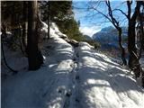 26
26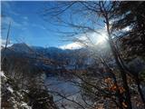 27
27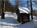 28
28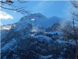 29
29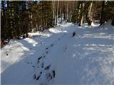 30
30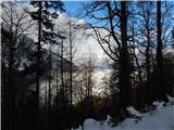 31
31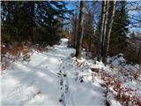 32
32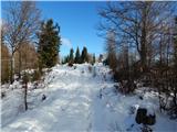 33
33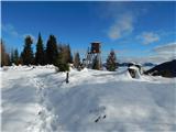 34
34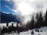 35
35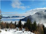 36
36 37
37
Discussion about the trip Belopeška jezera / Lago di Fusine - Črni vrh / Colrotondo
To post a comment you must log in:
If you do not yet have a username, you must first
register.