Belopeška jezera - Zadnja Ponca / Ponza di Detro
Starting point: Belopeška jezera (929 m)
| Latitude/Longitude: | 46,47330°N 13,67130°E |
| |
Walking time: 4 h 30 min
Difficulty: very difficult marked way
Elevation gain: 1313 m
Elevation difference along the route: 1350 m
Map: Julijske Alpe - zahodni del 1:50.000
Recommended equipment (summer): helmet, self belay set
Recommended equipment (winter): helmet, self belay set, ice axe, crampons
Views: 8.540
 | 2 people like this post |
Access to starting point:
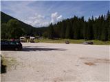
From Kranjska Gora over the border crossing Rateče we drive towards Trbiž / Tarvisio. Soon after the border crossing, the road in the direction of Belopeška lakes / Laghi di Fusine branches off to the left, which we then follow in a moderate ascent to a large parking lot at Zgornje Mangartsko (Belopeško) Lake.
Route description:
From the parking lot, we continue on the left side of the inn in the direction of the mountain hut Zacchi. The path at first runs on the forest road, which we leave after a few minutes, because the blazes point us to the left on a wide cart track. The cart track on which we walk changes a little higher into an ascending footpath. The relatively wide and well-marked path then in a moderate ascent through the forest in about an hour of walking from the starting point brings us to the mountain hut Zacchi (to here also possible on the forest road).
At the hut, we follow the signs »Ponza di Mezzo, Ponza Grande«. The path from the hut then for some time ascends through dwarf pines below the steep slopes of Ponca slightly to the right and soon brings us to the first steel cables on the path. Here the path turns a little to the left and then several times quite steeply ascends along the steel cable. When we get very close to the walls below Visoka Ponca, the path turns to the right and crosses a wide gully. A shorter ascent a little right from the gully follows, which brings us to a path junction. To the left branches off the direct very demanding climbing path (ferrata) to Visoka Ponca, and we head on the path to the right, which leads towards Srednja Ponca and to Visoka Ponca via a somewhat easier route. The path from the junction first in a gentle ascent crosses the slopes to the right, then turns to the left and ascends a steep grassy slope. The grassy slope is soon replaced by rocks and after a shorter ascent we are again at the path junction. To the left the path leads to Visoka Ponca, and we go right following the signs Tamar. From the junction then follows only a shorter ascent on the rocky slope to the top of Srednja Ponca, where wonderful views open up on all sides.
From the top, we continue along the ridge and already after a few meters we come to a junction. We continue along the ridge following the signs »Bivacco Tarvisio«, to the left the path goes into the Tamar valley. The ridge becomes ever narrower and a descent into Rdeča škrbina follows. At the notch the path turns to the Italian side and after a short exposed crossing ascends almost vertically along a narrow exposed pathlet. The fixed safety gear on this section of the path is destroyed and unusable, so considerable caution is required. The path then crosses steep slopes on the Italian side of the ridge and then ascends towards the ridge. A short ascent follows along the slightly exposed ridge to the top of Zadnja Ponca.

Photos:
 1
1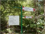 2
2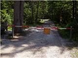 3
3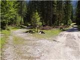 4
4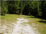 5
5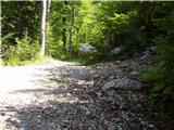 6
6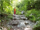 7
7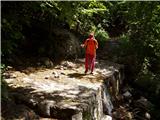 8
8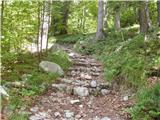 9
9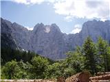 10
10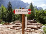 11
11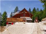 12
12 13
13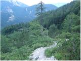 14
14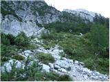 15
15 16
16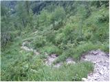 17
17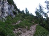 18
18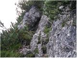 19
19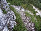 20
20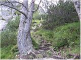 21
21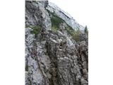 22
22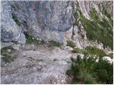 23
23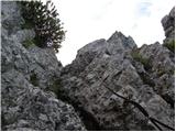 24
24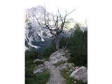 25
25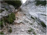 26
26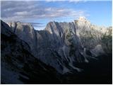 27
27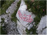 28
28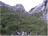 29
29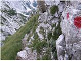 30
30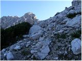 31
31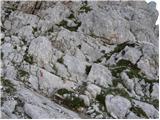 32
32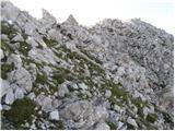 33
33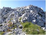 34
34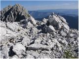 35
35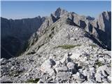 36
36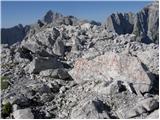 37
37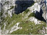 38
38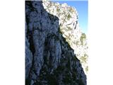 39
39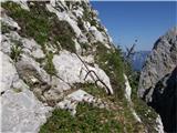 40
40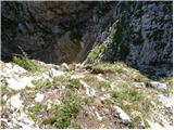 41
41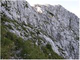 42
42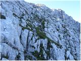 43
43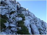 44
44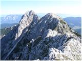 45
45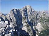 46
46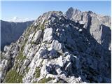 47
47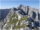 48
48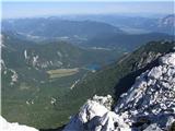 49
49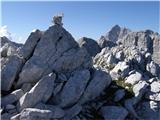 50
50
Discussion about the trip Belopeška jezera - Zadnja Ponca / Ponza di Detro
To post a comment you must log in:
If you do not yet have a username, you must first
register.