Belska Kočna - Mrzla gora
Starting point: Belska Kočna (968 m)
| Latitude/Longitude: | 46,40230°N 14,56640°E |
| |
Walking time: 5 h 40 min
Difficulty: very difficult marked way
Elevation gain: 1235 m
Elevation difference along the route: 1550 m
Map: Kamniške in Savinjske Alpe 1:50.000
Recommended equipment (summer): helmet
Recommended equipment (winter): helmet, ice axe, crampons
Views: 10.575
 | 1 person like this post |
Access to starting point:
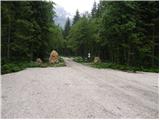
First, we drive to Jezersko, and then we continue driving in the direction of Austria. The road from Jezersko in a few hairpin turns ascends to the border crossing Jezerski vrh, and from there in numerous hairpin turns starts descending steeper. Lower at the settlement Bela / Bad Velach, we come to the marked crossroad, where we continue right in the direction of Belska Kočna / Velacher Kotschna. The road ahead crosses the stream Bela and only a few meters ahead brings us to the next crossroad. Here we continue straight on the right road and we continue driving by the already mentioned stream. We follow this road to the arranged parking lot by the gate, which prevents further driving.
Access is also possible over the saddle Pavličevo sedlo. In this case, at the settlement Bela we continue left. Further, we follow the description above.
Route description:
From the parking lot, we continue on the road, and after 3 minutes of walking, it brings us to a crossing. We continue straight, further on the road in the direction of the Logarska dolina valley (right Goli vrh). We follow the gently sloping road for less than 20 minutes to the spot, where the marked path branches off to the left upwards. Further, we ascend on at first a wide path, which through the forest in a moderate ascent brings us to a torrent stream, where the path turns right, crosses the stream and then brings us to a secured part of the path. With the help of steel cables we ascend on a slightly exposed ridge, which is short and in dry conditions undemanding. The path ahead ascends among the bushes with beautiful views on the surrounding peaks. Most noticeable is the pointed Storžek, to which we are getting closer. The path ahead runs past a pleasant spring after which we soon get to an old hunting cottage, which is surrounded by lush vegetation. The path then ascends for some time among bushes and thin forest, after which we step into the arms of larches. The terrain ahead becomes increasingly high-alpine and larches are replaced by scree, which due to the sheltered position remains under snow for quite a long time. Over the scree a fairly steep and increasingly panoramic path leads us, which after some time brings us to the Savinjsko sedlo saddle, where there is a marked crossing.
From the Savinjsko sedlo saddle we descend towards Okrešelj. After a few minutes of descent, we come to a smaller emergency bivouac, where we sign the logbook (bivouac pod Mrzlim vrhom). We continue descending and soon come to a crossing, where to the right on the scree upwards the climbing path to Koroška Rinka branches off, but we continue downwards. Soon left at 1700 m altitude the path to Mrzla gora branches off. The path first ascends through sparse dwarf pines and then brings us to a traverse across a rocky slab. Here we put on helmets, as the path ahead is very crumbly and exposed to falling rocks. From the traverse the path brings us into a gully which we only cross. Now we come to the climbing part of the path. The path is well secured at the beginning, but the fixed protections soon run out. There follows an unprotected ascent on a pyramidal slope. Since this part of the path is very steep, watch out for falling rocks. Before stepping onto the top of the pyramid we have the feeling that this is the summit. But when we step on the "summit" we see that it is not. There follows a highly exposed traverse of a narrow ledge without fixed protections. At the end of this ledge the path turns left up a moderately steep wall straight upwards (without fixed protections). Then we walk along the ridge, which is in places quite exposed. The path then turns slightly right and brings us to the summit in 30 minutes over fairly steep terrain.
Starting point - Savinjsko sedlo 3:10, Savinjsko sedlo - Mrzla gora 2:30

Along the route: Lovska koča Presteralše (1469m), Savinjsko sedlo (2001m)
Photos:
 1
1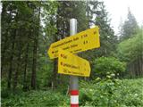 2
2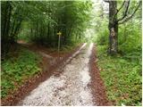 3
3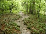 4
4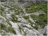 5
5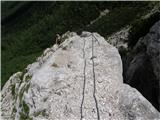 6
6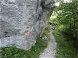 7
7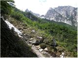 8
8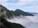 9
9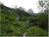 10
10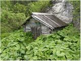 11
11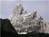 12
12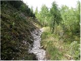 13
13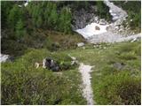 14
14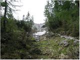 15
15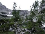 16
16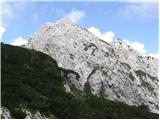 17
17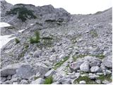 18
18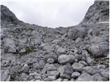 19
19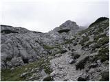 20
20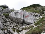 21
21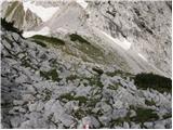 22
22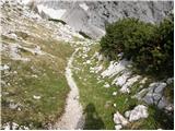 23
23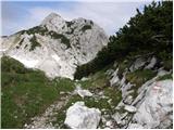 24
24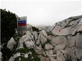 25
25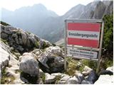 26
26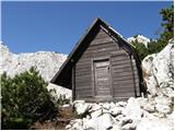 27
27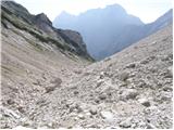 28
28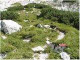 29
29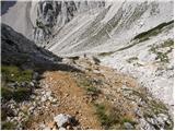 30
30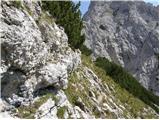 31
31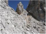 32
32 33
33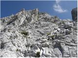 34
34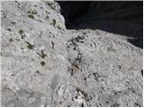 35
35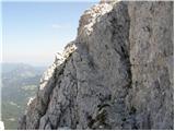 36
36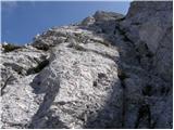 37
37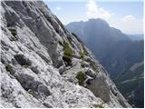 38
38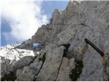 39
39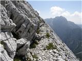 40
40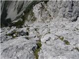 41
41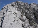 42
42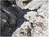 43
43 44
44 45
45
Discussion about the trip Belska Kočna - Mrzla gora
|
| Djuro18. 06. 2012 |
Once I went along this path to Belski turn (Storžek) and I remember that somewhere on the path (even lower, probably before the hunting hut) a path branches off into the wall. At that time I assumed it was the Austrian path to Mrzla gora. Does anyone know anything about it?
|
|
|
|
| garmont21. 08. 2014 |
In this description (photos) of the path, the ascent to Storžek is still incomprehensible to me, as the path simply bypasses it. It's an ascent to Mrzla gora after all!
|
|
|
|
| Tadej21. 08. 2014 |
By mistake, photos of Storžek were uploaded among the description photos. I have now removed them. Otherwise, thanks for the notice, sorry for the error.
Best, Tadej
|
|
|
|
| micamaca21. 08. 2014 |
@Garmont, look again  nowhere - neither in the text nor in the photos - does it say that the path to Mrzla gora goes via Storžek. But photo 21 does show the marked turn-off to Storžek (right, Klettersteig). nowhere - neither in the text nor in the photos - does it say that the path to Mrzla gora goes via Storžek. But photo 21 does show the marked turn-off to Storžek (right, Klettersteig).
|
|
|
|
| garmont21. 08. 2014 |
Micamaca, check Tadej's comment, he fixed the confusion.
|
|
|
To post a comment you must log in:
If you do not yet have a username, you must first
register.