Bistrica pri Tržiču - Gutenberk Castle (Hudi grad) (east path)
Starting point: Bistrica pri Tržiču (525 m)
| Latitude/Longitude: | 46,35530°N 14,29330°E |
| |
Route name: east path
Walking time: 25 min
Difficulty: easy unmarked way
Elevation gain: 138 m
Elevation difference along the route: 138 m
Map: Karavanke - osrednji del 1:50.000
Recommended equipment (summer):
Recommended equipment (winter):
Views: 936
 | 1 person like this post |
Access to starting point:
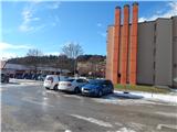
We leave the Gorenjska motorway at the Podtabor junction, and then we continue driving towards Ljubelj. In front of the gas station we turn right in the direction of Tržič, then after a short descent we go left towards Bistrica pri Tržiču. After the underpass, from the roundabout we turn right onto the first exit and then we park on the large parking lot near the main road.
Route description:
At the end of the northeastern part of the parking lot, we notice shorter stairs, on which we ascend, and then we continue between the sports field and the main road towards Ljubelj. We quickly reach a local road, which we follow to the left; when we reach the main road towards Begunje na Gorenjskem, we ascend on it to the left turn. At the crossroads a few dozen strides ahead from the turn we continue right on the road Pod gradom. During the ascent on the mentioned road we quickly reach a marked path from Tržič, which continues on the asphalt road on which we were already walking until now.
At the next crossroads, we follow the blazes and gradually ascend above the last houses, from where a beautiful view opens up. There follows some traversing towards the left, and then we arrive at a marked junction by a bigger chapel.
Before the chapel we continue right on a cart track in the direction of Dobrča and Bistriška planina (left leads a macadam road to villa Bistrica and the church of St. Jurij; behind the chapel a macadam road continues, which a little ahead joins the road Bistrica pri Tržiču - Begunje). After the nearby house the cart track passes into the forest and starts to ascend more steeply. For a few minutes we ascend steeply, and then we reach a small saddle, where we leave the marked path towards Dobrča and continue right on an unmarked but newly made path from 2018, on which we quickly ascend to the castle Gutenberk.
The description refers to the condition in 2018 (May), and the pictures are from various periods.

Photos:
 1
1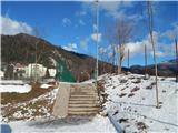 2
2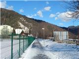 3
3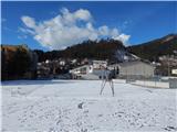 4
4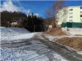 5
5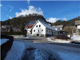 6
6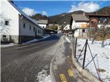 7
7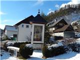 8
8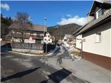 9
9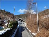 10
10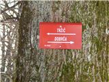 11
11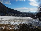 12
12 13
13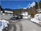 14
14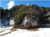 15
15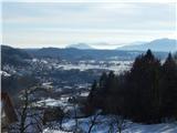 16
16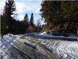 17
17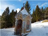 18
18 19
19 20
20 21
21 22
22 23
23 24
24 25
25 26
26 27
27
Discussion about the trip Bistrica pri Tržiču - Gutenberk Castle (Hudi grad) (east path)
To post a comment you must log in:
If you do not yet have a username, you must first
register.