Bistriški jarek (Verdinek) - St. Lorenzen ob Eibiswald
Starting point: Bistriški jarek (Verdinek) (452 m)
| Latitude/Longitude: | 46,65090°N 15,12340°E |
| |
Walking time: 2 h 45 min
Difficulty: easy marked way
Elevation gain: 495 m
Elevation difference along the route: 700 m
Map: Koroška 1:50.000
Recommended equipment (summer):
Recommended equipment (winter): ice axe, crampons
Views: 395
 | 1 person like this post |
Access to starting point:
A) We drive to Dravograd, and then continue driving towards Maribor. After the road sign 8.0 km, we need to pay attention, because a little behind the bus stop and pedestrian crossing, we turn left into the settlement Gortina (the turn-off from the main road is not marked). Immediately when we leave the main road, we arrive in the settlement Gortina, and then we drive in the direction of Muta, turning left at the marked intersection, where we notice signs for Bistriški jarek. The road then quickly brings us to Bistriški jarek, through which we gently ascend. After the homestead Verdinek and still before the road sign 6.0 km, a macadam road branches off slightly to the right, leading towards the homestead Štrigel. At the intersection, where a little to the right there are also red mountain signposts, the described path begins.
B) First, we drive to Maribor, and then follow the signs for Dravograd. When we are already crossing Mučka Bistrica, a little after the Tuš store we turn right towards the settlement Muta 1. The route ahead brings us to Muta, where at intersections we follow the priority road; from a somewhat larger intersection we go left, so that further on we drive towards Gortina. A little after the settlement Muta ends, from the marked intersection we turn right towards Bistriški jarek. The road then quickly brings us to Bistriški jarek, through which we gently ascend. After the homestead Verdinek and still before the road sign 6.0 km, a macadam road branches off slightly to the right, leading towards the homestead Štrigel. At the intersection, where a little to the right there are also red mountain signposts, the described path begins.
Route description:
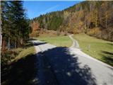
From the starting point, we continue even a little more to the right than where the side road branches off, on the footpath in the direction of Sveti Jernej and Bricnik. Initially the path ascends transversely across the pasture, then it passes into the forest, where at the symbol it flattens completely. For a short time we still cross the slopes to the right, then we continue along the stream. Higher along the stream, the state border also runs for some time, and higher the path brings us to a cart track, along which we ascend for a few minutes. From the cart track, the mountain signposts direct us sharply left, and we ascend through the forest for some time, before the homestead Lubej temporarily stepping onto the road.
Before the homestead we continue slightly to the right on a worse path, and above the homestead we reach the cart track, which we follow to the right. A well-marked path brings us a few minutes higher to a junction, beside which there is an information board with the description of the Knafelc marking with a green ring.
At the mentioned junction we leave the path leading to the church of Sveti Jernej and continue sharply left on the path that flattens completely and quickly passes to the Austrian side of the state border. The path soon turns right and brings us to an older chapel, where we continue left. A few steps further, a path branches off to the left towards Mlake / Laaken, and a little further we reach an asphalt road, which we follow to the right. Along the road we arrive at the farm Pušnik / Puschnigg, behind the farm we leave the road and continue right downhill across the pasture where the path is not visible, descending to the edge of the forest where the path and markings reappear. A short descent follows to the nearby stream, where the path leads us past the ruins of Pušnikov mlin / Puschnigg - Mühle, then an ascent follows to the macadam road a few minutes away. When we step onto the road we continue straight ahead, thus bypassing the nearby chapel on the right side. Behind the nearby homestead the road turns into a cart track, from the cart track we go right onto the marked path that descends into the forest and somewhat lower crosses another stream. A somewhat longer ascent through the forest follows, and higher we reach the road, which we follow to the right. At the nearby intersection we go straight, then the markings direct us left onto the footpath, along which we arrive at a few houses and where upon arriving at the road there is a marked junction.
From the junction we continue straight (sharply right Bricnik), then past houses and a chapel we arrive at the next junction, where we go slightly right in the direction of Sv. Lovrenc / St. Lorenzen. We quickly arrive at the mentioned settlement, where there is the church of Sv. Lovrenc and somewhat below it the church of Sv. Lenart.
Description and pictures refer to the condition in 2018 (October).

Photos:
 1
1 2
2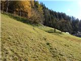 3
3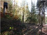 4
4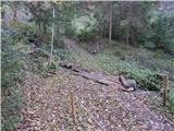 5
5 6
6 7
7 8
8 9
9 10
10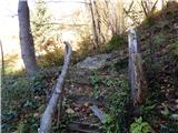 11
11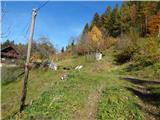 12
12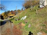 13
13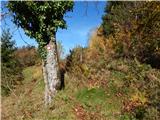 14
14 15
15 16
16 17
17 18
18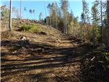 19
19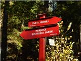 20
20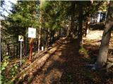 21
21 22
22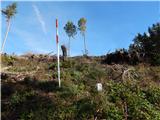 23
23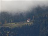 24
24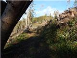 25
25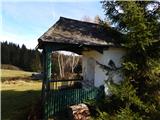 26
26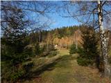 27
27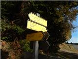 28
28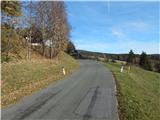 29
29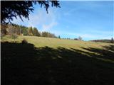 30
30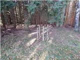 31
31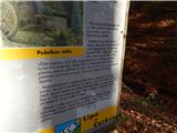 32
32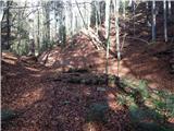 33
33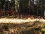 34
34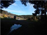 35
35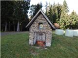 36
36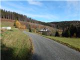 37
37 38
38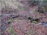 39
39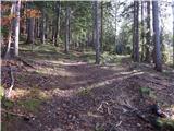 40
40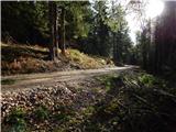 41
41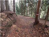 42
42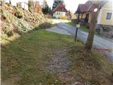 43
43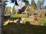 44
44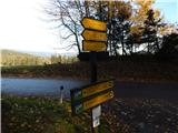 45
45 46
46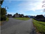 47
47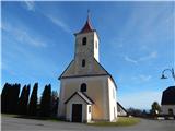 48
48
Discussion about the trip Bistriški jarek (Verdinek) - St. Lorenzen ob Eibiswald
|
| frover1. 06. 2025 16:45:04 |
Yesterday we walked this wonderful path, ideal for hot days as it runs almost entirely through the forest with plenty of streams and water springs. Thanks to the author for the detailed description, I suggest only adding that 100 m further from the path start there is a parking lot in front of the customs house. The path is exemplarily marked and well maintained on the Slovenian side, bravo markacisti , on the Austrian side the markings are less visible, the path harder to follow at times , on the Austrian side the markings are less visible, the path harder to follow at times We returned via the Koroška alpine path below Odernikov vrh and Primožev vrh and over Sv. Jernej. We returned via the Koroška alpine path below Odernikov vrh and Primožev vrh and over Sv. Jernej.
|
|
|
To post a comment you must log in:
If you do not yet have a username, you must first
register.