Bled (Velika Zaka) - Zgornji Goreljek (Pokljuka)
Starting point: Bled (Velika Zaka) (480 m)
| Latitude/Longitude: | 46,36240°N 14,08150°E |
| |
Walking time: 5 h 45 min
Difficulty: easy marked way
Elevation gain: 780 m
Elevation difference along the route: 1030 m
Map: TNP 1:50.000
Recommended equipment (summer):
Recommended equipment (winter): ice axe, crampons
Views: 1.881
 | 4 people like this post |
Access to starting point:
A) We leave the Gorenjska motorway at the Lesce exit, then follow the signs for Bled and Bohinj. A little before the end of Bled, we leave the main road towards Bohinj and continue slightly right in the direction of the camp. After approximately 1.5 km of additional driving, we arrive at Camp Bled, where we park at the edge of the camp on a paid parking lot. The parking fee is 3 EUR/h (November 2019).
B) We drive to Bohinjska Bistrica, then continue driving towards Bled. At the beginning of Bled, we go left in the direction of Camp Bled. After approximately 1.5 km of additional driving, we arrive at Camp Bled, where we park at the edge of the camp on a paid parking lot. The parking fee is 3 EUR/h (November 2019).
Route description:
From the starting point, we head onto a macadam road beside which there are signs for Bohinjska Bela, Stan, Rčitno and Pokljuka. At first we walk beside Camp Bled and the stream, then gradually approach the railway line, crossing to the other side through the underpass. After the underpass we go left, at the nearby marked junction choosing the right path towards Rčitno (straight ahead Bohinjska Bela). A few steps further we cross the stream over the bridge, after the bridge going right where we follow the blazes. This is followed by walking through the forest as we ascend along a cart track from which a view opens onto a torrent over which a larger waterfall falls during rainy periods. Here the path turns somewhat more to the left and mostly ascends transversely. Higher up we cross the torrent stream again, where crossing is quite difficult at high water levels; the path shortly afterwards turns right and leads us to a short panoramic section from which a fine view extends from Lake Bled to the Kamnik Savinja Alps. This is followed by traversing to the right where the blazes disappear for a while, but we spot them again when the cart track begins to ascend. When somewhat higher we reach the macadam road, we follow it left (right to Bled by road) ascending moderately along it. Higher we pass the trough below Križi, a little further on a path joins from the left from Bohinjska Bela.
We continue straight in the direction of "Rčitno" and continue ascending along the macadam road. Further on the road enters a small valley below Strešno brdo; when we leave the valley we move onto the slopes of Gače from where some views of the surrounding hills open up intermittently. The path ahead intermittently returns to the forest; when we leave it we soon reach Rčitno where a few huts stand.
In the middle of the lower part of the mountain pasture we continue left in the direction of Bohinjska Bela and along the road which soon turns into a cart track, ascending moderately to the upper southern edge of the mountain pasture where we continue right (straight Bohinjska Bela) past the hut into the forest. In the forest we quickly notice signs for Pokljuka as we ascend transversely to a forest road which we follow right (left to Galetovec). Along the road we descend slightly for a while, then signs and blazes direct us left onto a path which ascends transversely over somewhat steeper slopes. Higher we reach a cart track along which we ascend through a small valley, soon arriving at a junction by a small hut. Past the hut we continue right and the marked path leads us to the Forestry Hut Mali Vokel at 1145 m elevation.
We bypass the forestry hut on the right side, then blazes lead us into the forest through which we ascend more steeply. A few minutes higher we cross a macadam road, continuing straight and along the macadam road for a few dozen steps to the hunting hut.
We bypass the hunting hut on the left side and continue walking along a poorer road. When the road turns somewhat right we continue straight onto the marked cart track, further following the blazes and ascending to the former ski slope Zatrnik where we begin to descend (if continuing right we can ascend to the top of the Berjanca ski slope in a minute or two from where a fine view extends all the way to Triglav). This is followed by a short descent, then we cross the forest road and continue along the marked cart track. The cart track soon forks and we choose the upper right path which further ascends through spruce forest. A few minutes higher we go left from the cart track onto the marked path which soon begins descending to the northeastern part of Rečiška planina. This is followed by walking across Rečiška planina passing a few huts.
On the other side of the mountain pasture the path widens into a road, from the nearby junction continuing along the right road from which we soon go left onto the marked path. The path is initially fairly level then begins to descend moderately and lower reaches another road. To the right a marked path continues which semicircularly bypasses Grajska planina in whose centre a fine lake forms after heavy rain. On the other side of the mountain pasture the road enters the forest which we soon leave, continuing left along the marked mountain path which takes us to the edge of Močila bog along which we continue for some time. As the marked path in places is already part of the bog, a parallel track has formed somewhat to the right. When we leave the Močila peat bog area we reach the Bohinj–Pokljuka asphalt road which we follow left briefly, then blazes and signs for Šport hotel direct us right onto the continuation of the mountain path. This is followed by a longer walk through the forest where we follow blazes at junctions, eventually reaching the first huts at Zgornji Goreljek. A little further on when we reach the asphalt road we follow it right, then follow signs for Šport hotel arriving past numerous weekend houses, the chapel of St. Anthony the Hermit, the NOB monument and Hotel Jelka.
Starting point – Rčitno 2:00, Rčitno – Forestry Hut Mali Vokel 0:50, Forestry Hut Mali Vokel – Hunting Hut Mali Vokel 0:10, Hunting Hut Mali Vokel – Berjanca 0:10, Berjanca – Rečiška planina 0:35, Rečiška planina – Grajska planina 0:25, Grajska planina – Zgornji Goreljek 1:35.
Description and pictures refer to conditions in 2019 (November).

Along the route: Planina Rčitno (900m), Gozdarska koča Mali Vokel (1145m), Lovska koča Mali Vokel (1193m), Berjanca (1264m), Rečiška planina (1265m), Grajska planina (Ribšca) (1210m), Močila (1200m)
Photos:
 1
1 2
2 3
3 4
4 5
5 6
6 7
7 8
8 9
9 10
10 11
11 12
12 13
13 14
14 15
15 16
16 17
17 18
18 19
19 20
20 21
21 22
22 23
23 24
24 25
25 26
26 27
27 28
28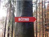 29
29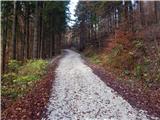 30
30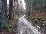 31
31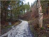 32
32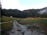 33
33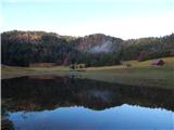 34
34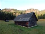 35
35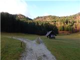 36
36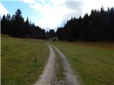 37
37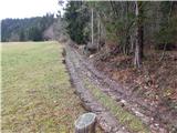 38
38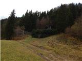 39
39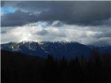 40
40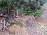 41
41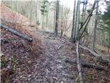 42
42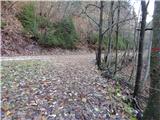 43
43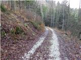 44
44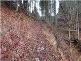 45
45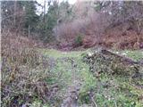 46
46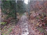 47
47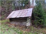 48
48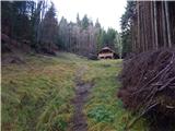 49
49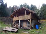 50
50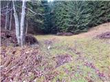 51
51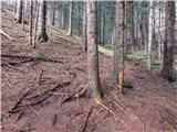 52
52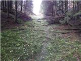 53
53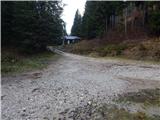 54
54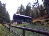 55
55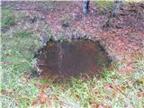 56
56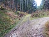 57
57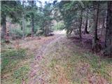 58
58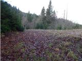 59
59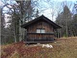 60
60 61
61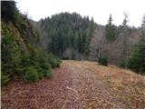 62
62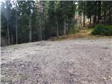 63
63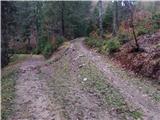 64
64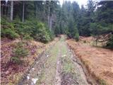 65
65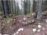 66
66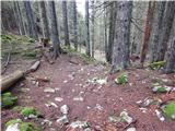 67
67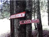 68
68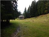 69
69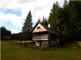 70
70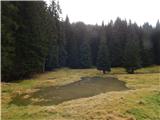 71
71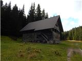 72
72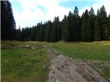 73
73 74
74 75
75 76
76 77
77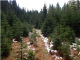 78
78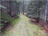 79
79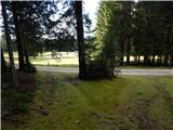 80
80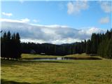 81
81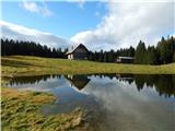 82
82 83
83 84
84 85
85 86
86 87
87 88
88 89
89 90
90 91
91 92
92 93
93 94
94 95
95 96
96 97
97 98
98 99
99 100
100 101
101 102
102 103
103 104
104 105
105 106
106 107
107 108
108 109
109 110
110 111
111 112
112 113
113
Discussion about the trip Bled (Velika Zaka) - Zgornji Goreljek (Pokljuka)
|
| lino9. 12. 2019 |
A very nice and interesting trip, probably a bit strenuous too. 
Picture 113 is probably anti-advertising for tourism and the beauties of Pokljuka. Maybe they were just finishing filming some military movie or it shows the aftermath of an attack by some commando group. 
|
|
|
To post a comment you must log in:
If you do not yet have a username, you must first
register.