Blejska Dobrava (pokopališče) - Hom at Bled (via Katarina)
Starting point: Blejska Dobrava (pokopališče) (560 m)
| Latitude/Longitude: | 46,40680°N 14,10660°E |
| |
Route name: via Katarina
Walking time: 1 h 25 min
Difficulty: easy unmarked way
Elevation gain: 274 m
Elevation difference along the route: 354 m
Map: TNP 1 : 50.000
Recommended equipment (summer): crampons
Recommended equipment (winter):
Views: 6.573
 | 4 people like this post |
Access to starting point:
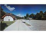
From highway Ljubljana - Jesenice we go to the exit Lipce, where we turn left (direction Blejska Dobrava and Spodnje Gorje). After 100 meters of driving, immediately after we drive through the railway underpass, we find ourselves at the next crossroad, where we go left uphill to Blejska Dobrava (right Bled, Gorje). When the road soon flattens, we drive straight through the village, where we follow the signs for Vintgar and cemetery. After approx 1 km we reach the railway tunnel. On its other side, where the road splits we turn right, and after a few hundred meters of additional driving, we get to a large parking lot, which is located near the cemetery.
Route description:
From the parking lot, we continue on foot in the same direction, straight past the cemetery and buildings next to it, on our right. Soon after we stepped on a macadam road, it turns right and starts slightly descending. The road soon brings us into a mixed forest, where through turns it continues slightly descending. Then, when it flattens and straightens, it brings us near the river Radovna and quite quickly to a bridge, where we cross the river. On the other side, we go right uphill (left hydropower plant), and we get to a parking lot, at the end of which we notice concrete stairs. Up them we ascend to a log cabin (in the season a bar and ticket sales to see the gorge) behind which on a bridge we can past the beam also see the waterfall Šum from top down. From the log cabin, we continue on stairs on the far left in the direction marked with "Katarina Bled". The path past a smaller abandoned house quickly brings us into the forest and first moderately ascends for a short time. Soon after it flattens, at the crossing we choose left and a little later we cross a smaller stream. Quickly we are again at a "junction", where we continue straight, and the path for a short time brings us to a clearing, behind which it slightly ascends a little to the left, back into the forest. A little higher by the path, we run into a hayloft and a smaller spring, then the path turns slightly right and soon brings us out of the forest onto open ground, where we see the church of St. Katarina. On our right there is a catering facility, and across the parking lot on the opposite side also benches, where we can rest and enjoy the view.
We continue right, past the mentioned catering facility, and left turn-off of the footpath towards Gorje and Vintgar, on a forest cart track in the direction of north-west. At first, it turns a little to the right in a gentle ascent. Further, we ignore any left turn-off and stick to the cart track all the way to its (seemingly) end on the open part of the forest, where at least two cart tracks ascend left on the slope. Here we continue slightly (not perpendicularly!) right, or straight, where we can notice that the cart track actually continues into the forest. Then, after the next open part brings us back into the forest, the cart track with moderate ascent narrows into a footpath. It soon brings us to a small saddle, where there is an unmarked junction. Here we leave the wider path and turn left onto the slope of Hom (straight: wrecked and dangerous path above the gorge, right: path downwards which vanishes). When the path brings us through the clearing, we step into the forest and quite steeply ascend the slope towards the summit. Even though the path on this part occasionally vanishes, it is not hard to follow the indicated direction. When we reach the top, the path turns slightly right and flattens for a short time, then takes us through a narrow strip of forest. Behind it follows the last moderate ascent along the edge of the north-western slope to the summit of Hom. Here we run into a large wooden cross and boxes with the logbook and summit stamp.

Photos:
 1
1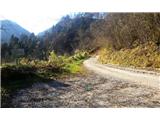 2
2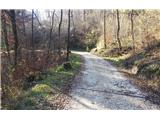 3
3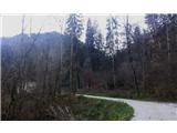 4
4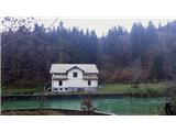 5
5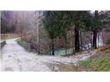 6
6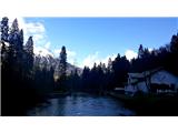 7
7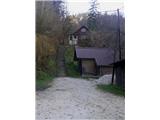 8
8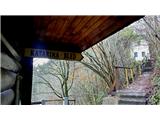 9
9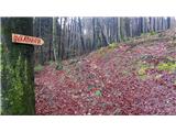 10
10 11
11 12
12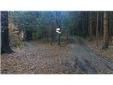 13
13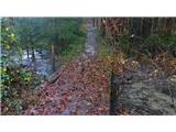 14
14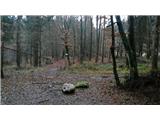 15
15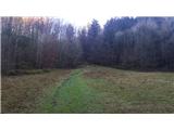 16
16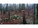 17
17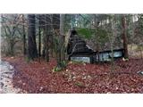 18
18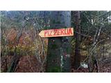 19
19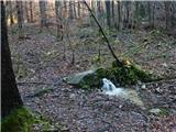 20
20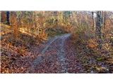 21
21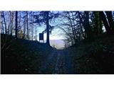 22
22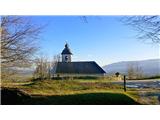 23
23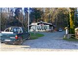 24
24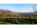 25
25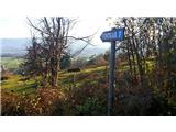 26
26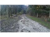 27
27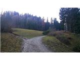 28
28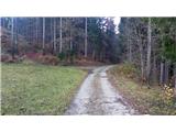 29
29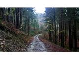 30
30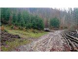 31
31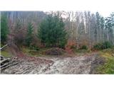 32
32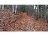 33
33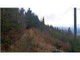 34
34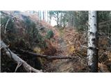 35
35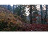 36
36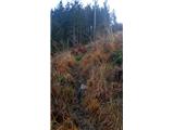 37
37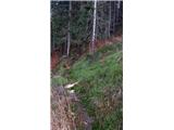 38
38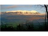 39
39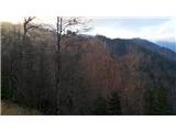 40
40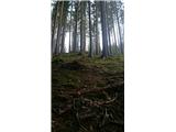 41
41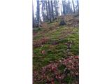 42
42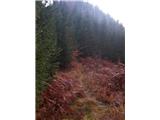 43
43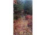 44
44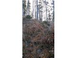 45
45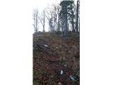 46
46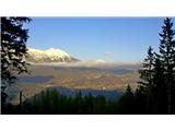 47
47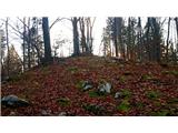 48
48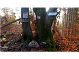 49
49 50
50
Discussion about the trip Blejska Dobrava (pokopališče) - Hom at Bled (via Katarina)
|
| heinz4. 12. 2019 |
Majda you didn't go exactly as per the description above, according to which the path approaches the top from the north/east.
|
|
|
|
| Majdag4. 12. 2019 |
Yes, heiz, I went by the markers, it was easier for me..
|
|
|
|
| Jusk6. 08. 2020 |
Today not exactly on this path, but on the path that turns left in picture 29, nice, marked and not too steep path in the upper part just before the summit and on the summit it is very overgrown. Return along the same path to Sv. Katarina and further around Hom to Vintgar, then through Strma back to Bl. Dobrava, this path is full of people now as they return from Vintgar back to Podhom
|
|
|
|
| Enka20. 04. 2022 11:16:42 |
On the slopes of Hom there should be some (quite overgrown) remains of the Rupnik Line. Has anyone noticed them?
|
|
|
|
| Majdag24. 04. 2022 14:12:50 |
stefanb thanks, the bunker above the railway track is still well preserved. No path, steep slope, but I didn't know it was also Rupnikova linija.
|
|
|
|
| Jusk24. 04. 2022 17:30:03 |
Majda, there is a path past the bunker above the track. It starts before the tunnel, climbs up past the bunker, and after a few minutes joins the marked path to Katarino. I've also found the path along the right bank of Radovna mentioned in the article. Well it's not really a path, more an overgrown track that due to poor condition and steepness I didn't dare explore. If it's that one at all of course.
|
|
|
|
| Majdag12. 03. 2023 18:28:20 |
11.3....The road to the bridge over the Radovna river is roughly asphalted. The bridge is closed. The hiking path is very well trodden, marked with posts and arrows. Completely different from the path description. From the church of St. Katarina we took the panoramic path to Podhomski rob. Nice dry path. Continued to the track for Hom. You can follow it all the way to the top. There's one shortcut in between, but no need to use it. We descended the other side, it's a wide path, marked on posts. And arrived back at the inn at St. Katarina. Nice ramble and the views to Podhomski rob are wonderful.
https://jelenkamenmajdag.blogspot.com/2023/03/pomlad-se-cuti-v-zraku-hom.html
|
|
|
To post a comment you must log in:
If you do not yet have a username, you must first
register.