Starting point: Bločice (623 m)
| Latitude/Longitude: | 45,76400°N 14,45500°E |
| |
Walking time: 1 h 15 min
Difficulty: easy marked way
Elevation gain: 234 m
Elevation difference along the route: 295 m
Map: Snežnik 1:50.000
Recommended equipment (summer):
Recommended equipment (winter): crampons
Views: 9.550
 | 1 person like this post |
Access to starting point:
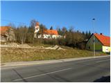
A) From the Ljubljana - Koper highway, take the Unec exit, then follow the road in the direction of Cerknica and further in the direction of Bloške Police, but drive along it only to the settlement Bločice, where our path begins. The path towards Križna gora starts immediately from the main road, but because there are no arranged parking spots here it is better to park on the parking lot by the church of St. Primož and Felicijan. We reach it by turning left from the main road into the village in the middle of the settlement, then twice right and we are already at the church.
B) We drive to Velike Lašče or Sodražica, from there continue driving in the direction of Nova vas na Blokah. From Nova vas we drive along the main road towards Cerknica, but we drive only to the place Bločice, where our path to Križna gora begins. The path towards Križna gora starts immediately from the main road, but because there are no arranged parking spots here it is better to park on the parking lot by the church of St. Primož and Felicijan. We reach it by turning right from the main road into the village in the middle of the settlement, then twice more right and we are already at the church.
Route description:
From the parking lot, we walk to the church and nearby cemetery, from there we descend to the main road, which we then carefully cross. On the other side of the main road we notice a side road that starts descending transversely among a few houses (the beginning of the path to Križna gora is not marked, it is located opposite the house with a yellow facade).
At the nearby house the road splits into two parts, we continue along the lower right road, which soon loses its asphalt surface and descends to Bločiško polje. We continue along the poor road, which further leads us along the left edge of the expansive uvala. A little further, initially still rare blazes lead us slightly left onto a cart track, which for a short time continues parallel to the road, then transitions into dense forest, through which it starts to ascend moderately. Higher, the poorer cart track levels out and leads us past a few junctions, where we carefully follow the blazes. The path continues through the forest for some time, then descends to a macadam road, which we follow to the left (right Žerovnica). Along the road we quickly reach a marked junction, where we continue right in the direction of Sveta Ana (left Križna jama 1 km), but from the junction we walk along the road only a few steps, as the blazes then lead us left into the forest onto a marked trail.
At first we walk along a nicely traceable cart track, which soon turns right and levels out completely. Here the blazes lead us slightly left onto a marked but quite poorly trodden path, which starts to ascend more steeply through the forest. Further on, the blazes are quite frequent, so despite the poorly trodden path there are no major orientation problems. Higher we temporarily walk along a somewhat wider path, but the blazes soon lead us onto a steep path that ascends towards Križna gora. After a few minutes the steepness eases and from the left a marked path from Križna jama joins us (the path from Križna jama is marked at most junctions but is not blazed).
Here we continue straight or slightly right along the path, which brings us to the summit of Križna gora in 3 minutes of moderate ascent, where the church of the Holy Cross stands.

Photos:
 1
1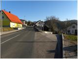 2
2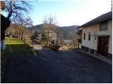 3
3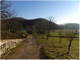 4
4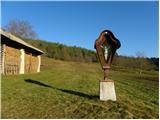 5
5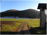 6
6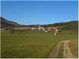 7
7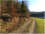 8
8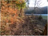 9
9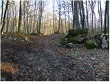 10
10 11
11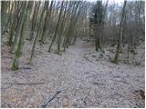 12
12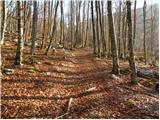 13
13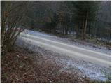 14
14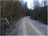 15
15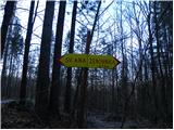 16
16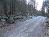 17
17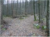 18
18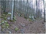 19
19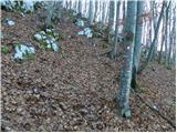 20
20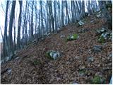 21
21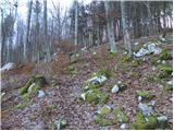 22
22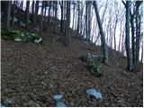 23
23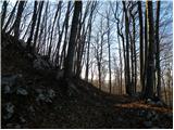 24
24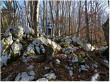 25
25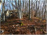 26
26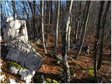 27
27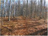 28
28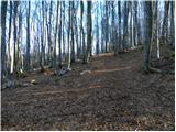 29
29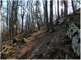 30
30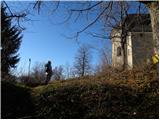 31
31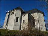 32
32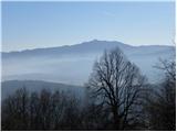 33
33 34
34 35
35
Discussion about the trip Bločice - Križna gora
|
| pinkimojca17. 07. 2025 18:38:37 |
The path today looks much more overgrown in the ascending section. The ascent is also much steeper than I expected.  Much more undergrowth and if there were no markings, I would seriously doubt that I was on the right path. Markings are nice, new and there are many. Much more undergrowth and if there were no markings, I would seriously doubt that I was on the right path. Markings are nice, new and there are many.
|
|
|
To post a comment you must log in:
If you do not yet have a username, you must first
register.