Bobrov center - Bobrov center (učna pot)
Starting point: Bobrov center (205 m)
| Latitude/Longitude: | 46,19023°N 15,64464°E |
| |
Route name: učna pot
Walking time: 15 min
Difficulty: easy marked way
Elevation gain: 0 m
Elevation difference along the route: 3 m
Map:
Recommended equipment (summer):
Recommended equipment (winter):
Views: 112
 | 1 person like this post |
Access to starting point:
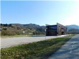
a) From the Mestinje - Podčetrtek road, at Sodni vasi turn left towards Vonarje (from the Podčetrtek direction right), then drive along a somewhat narrower road towards Rogaška Slatina. In the settlement Nimno we will notice Bobrov center on the right side, behind which we turn right onto the arranged parking lot, where we park.
b) Drive to Rogaška Slatina, from where we first follow the signs for Zagreb, later we turn right from the main road towards Brestovec and Rajnkovec, a little further we take the exit from the roundabout in the direction of the settlements Nimno and Pristavica. Continue driving along the Sotla river to Bobrov center, next to which we park in the arranged parking lot.
Route description:
At the parking lot we notice the start of the Bobrov Center Nature Educational Trail. The trail initially descends for a few steps, then turns left and continues almost without elevation differences. The trail leads us past educational panels, partly on wooden platforms, partly on compacted but sometimes marshy ground.
Soon we reach a junction where we choose the left direction (the loop can also be walked in the opposite direction). The trail later turns right in an arc, all the time accompanied by educational content and natural curiosities along the Sotla river. When we close the loop, we return to the mentioned junction, from where we return along the already known trail back to the starting point at Bobrov center.
The description and photos refer to the condition in March 2026.
Photos:
 1
1 2
2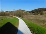 3
3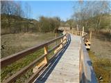 4
4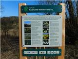 5
5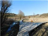 6
6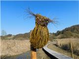 7
7 8
8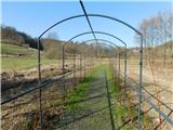 9
9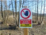 10
10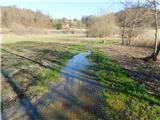 11
11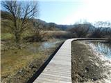 12
12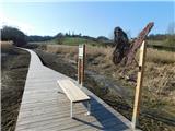 13
13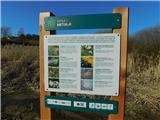 14
14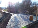 15
15 16
16
Discussion about the trip Bobrov center - Bobrov center (učna pot)
To post a comment you must log in:
If you do not yet have a username, you must first
register.