Podnar / Bodenbauer - Kosmatica / Kosmatitza
Starting point: Podnar / Bodenbauer (1052 m)
| Latitude/Longitude: | 46,46780°N 14,21520°E |
| |
Walking time: 1 h 45 min
Difficulty: easy marked way
Elevation gain: 607 m
Elevation difference along the route: 607 m
Map: Karavanke - osrednji del 1:50.000
Recommended equipment (summer):
Recommended equipment (winter): ice axe, crampons
Views: 3.820
 | 1 person like this post |
Access to starting point:
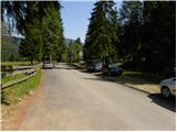
We drive to the border crossing Ljubelj and continue on the Austrian side. Soon after noticing a small church on the left side of the road, a road branches off to the left towards the village Poden / Bodental. At the crossroads after the village Slovenji Plajberk / Windisch Bleiberg, we turn left towards Poden / Bodental. In Poden / Bodental, we reach the mountain signposts for Celovška koča / Klagenfurter Hütte, one to the left and one to the right. We head left and drive along the road to the end of the asphalt, where we park in the parking lot near the grazing fences.
Route description:
From the parking lot, we head onto the traffic-closed forest road with signs »Marchenwiese«. The walking forest road through the forest in a gentle ascent brings us to a pleasant meadow, where a beautiful view opens up towards the northern walls of Vrtača and Palec. Further, we cross the meadow on which the footpath is hard to follow and on the other side we look for a cart track which goes slightly upwards into the forest. After a few minutes' walk on the cart track, the blazes direct us to the right onto a footpath which soon crosses a torrent along which it then ascends. The path then withdraws from the torrent a little to the right and brings us to a smaller clearing, where the marked path directs us even a little more to the right. The path ahead ascends steeper and after a good 30 minutes of walking it brings us to a junction, where we continue right (left Celovška koča). The path ahead ascends slightly and past a spring in a few minutes of walking brings us to the mountain pasture Vgrizeva planina, where there are a newer and an older hut and from where a beautiful view opens up.
We bypass the newer and older hut on the right side, then we leave the marked path and continue slightly left on an unmarked path which starts to ascend on a grassy slope. Higher, we reach the ridge and in a few minutes of additional walking we reach the peak of Kosmatica.
Podnar - Vgrizeva planina 1:30, Vgrizeva planina - Kosmatica 0:15.

Photos:
 1
1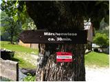 2
2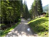 3
3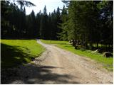 4
4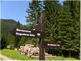 5
5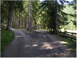 6
6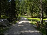 7
7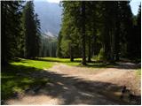 8
8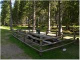 9
9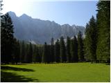 10
10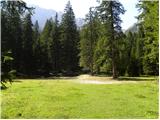 11
11 12
12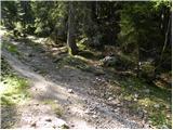 13
13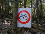 14
14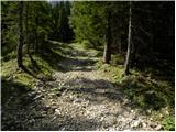 15
15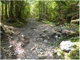 16
16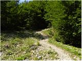 17
17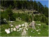 18
18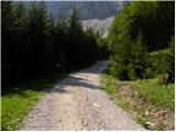 19
19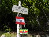 20
20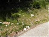 21
21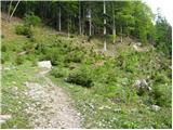 22
22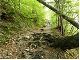 23
23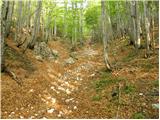 24
24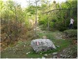 25
25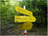 26
26 27
27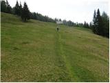 28
28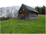 29
29 30
30 31
31 32
32 33
33 34
34 35
35 36
36 37
37 38
38 39
39 40
40
Discussion about the trip Podnar / Bodenbauer - Kosmatica / Kosmatitza
|
| Acibujl12. 12. 2025 16:19:27 |
We drove at the beginning of December over Ljubelj and further into Bodental/Poden. There at the Sereinig inn we continued and then turned left to the end of the village. Large parking lot full of small cars. We put 3€ in the box for the whole day. Lots of Slovenian license plates around. Start already on snow, yay. I put on small crampons. He goes without - okay, he has a better winter profile apparently. You can't miss the path, it's all trampled and also skied by skiers. Simply follow the sign for the walking path Marchenwiese, then markings towards Ogrisalm. You can ascend along the road next to the village, as there are tons of skiers. Or shorten the switchbacks via markings through the forest... when you climb high enough and Vgrizeva planina with a nice hut appears before you, you've almost won. Now just directly between rare larches to the nearby, otherwise not overly panoramic summit, good 10 minutes. To miss it, you'd really have to try 😂 Views towards Vrtača, Palec, Zelenjak... are beautiful already from the planina. You can also see nearby Rjavca, marked path to it from in front of the inn below. It's already planned 😉 Perfect path for a shorter, easier winter ascent! You extend it by less than an hour if you leave the car down in the village at the inn... Recommended. Suitable also for children and dogs...
|
|
|
To post a comment you must log in:
If you do not yet have a username, you must first
register.