Podnar / Bodenbauer - Vertatscha/Vrtača
Starting point: Podnar / Bodenbauer (1052 m)
| Latitude/Longitude: | 46,46780°N 14,21520°E |
| |
Walking time: 4 h 45 min
Difficulty: difficult marked way
Elevation gain: 1129 m
Elevation difference along the route: 1200 m
Map: Karavanke - osrednji del 1:50.000
Recommended equipment (summer): helmet
Recommended equipment (winter): helmet, ice axe, crampons
Views: 5.818
 | 1 person like this post |
Access to starting point:
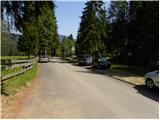
We drive to the border crossing Ljubelj and continue on the Austrian side. Soon after noticing a small church on the left side of the road, a road branches off to the left towards the village Poden / Bodental. At the crossroads after the village Slovenji Plajberk / Windisch Bleiberg, we turn left towards Poden / Bodental. In Poden / Bodental, we reach the mountain signposts for Celovška koča / Klagenfurter Hütte, one to the left and one to the right. We head left and drive on the road to the end of the asphalt, where we park on the parking lot near the grazing fences.
Route description:
From the parking lot, we head onto the traffic-closed forest road with signs »Marchenwiese«. The walking forest road through the forest in a gentle ascent brings us to a pleasant meadow, where a beautiful view opens up towards the northern walls of Vrtača and Palec. Further, we cross the meadow where the footpath is harder to follow and on the other side we look for the cart track that goes slightly uphill into the forest. After a few minutes' walk on the cart track, the markers direct us to the right onto a footpath which soon crosses a torrent along which it then ascends. The path then withdraws from the torrent a little to the right and brings us to a smaller clearing, where the marked path directs us even a little more to the right. The path ahead ascends more steeply and after good 30 minutes of walking brings us to a junction, where we continue left (right Vgrizeva planina 5 minutes).
The steepness here eases and the path emerges from the forest into the dwarf pines. Next follows crossing a scree field, then with the help of a steel cable we descend slightly downwards. From here onwards the path is exposed to falling stones. Further, the well-secured path starts ascending a steep rocky slope. At the top of this easier climbing part we come to the stamping box, where we register. The difficulty of the path then disappears and in a traversing ascent we reach the saddle Vrata. The path ahead starts descending and in a few minutes brings us to a junction, where we continue straight (right Ovčji vrh) and in a few minutes of gentle descent we come to Celovška koča.
At the hut, we head left in the direction of Prešernova koča na Stolu. The path ahead first crosses grassy slopes, then slightly descends to an indistinct saddle. The path ahead starts steeply ascending over scree to a somewhat vegetated part of the path. A little further, a steel cable helps us when crossing a steeper slope, but this part of the path causes no problems when dry. Further, we ascend again over scree all the way to the state border.
From the saddle Belščica, from where the path to Svačica branches to the left, we continue straight and proceed in the direction of Vrtača, Prešernova koča and Zelenica. For a few minutes we cross grassy slopes, then we arrive at the place where the inscription on the rock for Vrtača directs us left (straight downwards Stol). There follows a few minutes of relatively easy walking, then we arrive at a short but steep grassy slope, across which we descend transversely. When the descent ends we arrive at extensive scree fields, over which we start ascending in a semicircle. In the continuation, the worse-beaten and in several places exposed to falling stones path higher several times ascends more steeply, then turns even a little more to the right and brings us to the southwest shoulder of Vrtača, where we join the better-beaten path from Ljubelj and Završnica.
Here we continue left and start steeply ascending very steep and slippery-dangerous slopes. Higher the path brings us to the main ridge of the Karawanks, where it flattens. This is followed by approximately 20 minutes of walking on and along the ridge, which is somewhat exposed in places and slippery-dangerous throughout. We then follow this panoramic path all the way to the summit of Vrtača.

Photos:
 1
1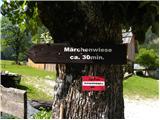 2
2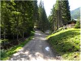 3
3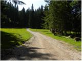 4
4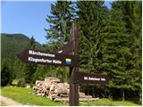 5
5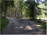 6
6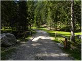 7
7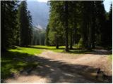 8
8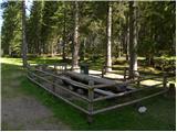 9
9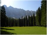 10
10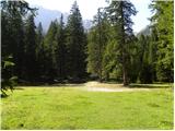 11
11 12
12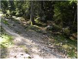 13
13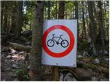 14
14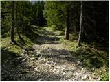 15
15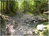 16
16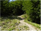 17
17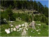 18
18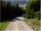 19
19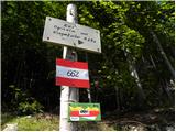 20
20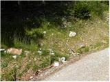 21
21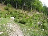 22
22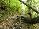 23
23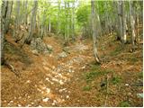 24
24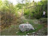 25
25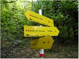 26
26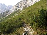 27
27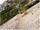 28
28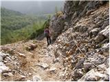 29
29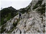 30
30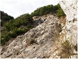 31
31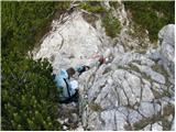 32
32 33
33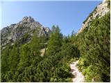 34
34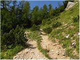 35
35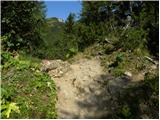 36
36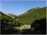 37
37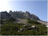 38
38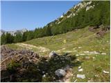 39
39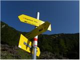 40
40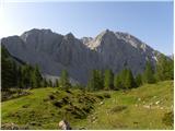 41
41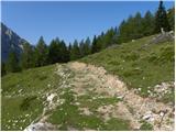 42
42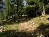 43
43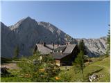 44
44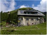 45
45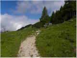 46
46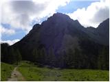 47
47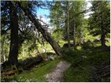 48
48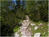 49
49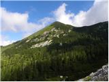 50
50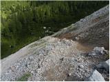 51
51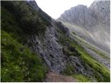 52
52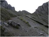 53
53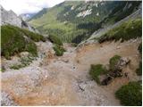 54
54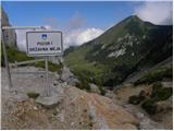 55
55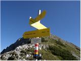 56
56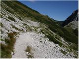 57
57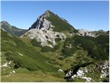 58
58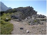 59
59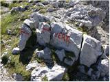 60
60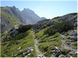 61
61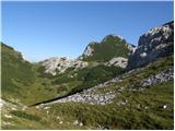 62
62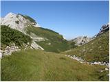 63
63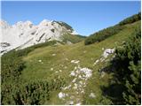 64
64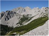 65
65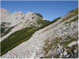 66
66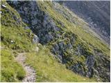 67
67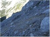 68
68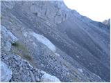 69
69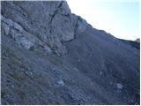 70
70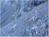 71
71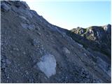 72
72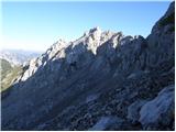 73
73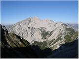 74
74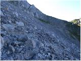 75
75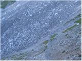 76
76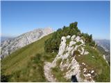 77
77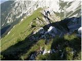 78
78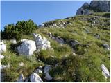 79
79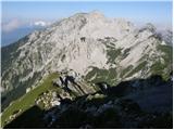 80
80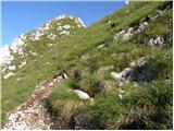 81
81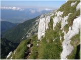 82
82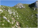 83
83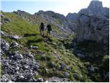 84
84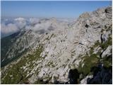 85
85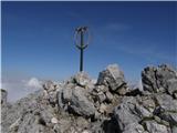 86
86 87
87
Discussion about the trip Podnar / Bodenbauer - Vertatscha/Vrtača
To post a comment you must log in:
If you do not yet have a username, you must first
register.