Bodonci (Varaš) - Griški vrh
Starting point: Bodonci (Varaš) (240 m)
| Latitude/Longitude: | 46,74574°N 16,11338°E |
| |
Walking time: 25 min
Difficulty: easy unmarked way
Elevation gain: 82 m
Elevation difference along the route: 82 m
Map: Pomurje 1:40.000
Recommended equipment (summer):
Recommended equipment (winter):
Views: 254
 | 1 person like this post |
Access to starting point:
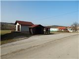
We leave the Pomurska motorway at the Murska Sobota exit, then first follow the signs for Murska Sobota, then the signs for Murska Sobota east. From the roundabout between the stores Lidl and Hofer we continue in the direction of Markišavci and Puconci. After Markišavci we cross a railway track (we don't turn right into Puconci), then we go right towards Šalamenci. In Šalamenci we go left and drive through the village to the settlement Bodonci. Through Bodonci we drive on the main road, where we go past the company Püngrad, farm Šukar and snack bar Špilak. A little further from the snack bar we arrive at a bus stop and a junction, where the road branches off to the right towards the settlement Pečarovci. At the mentioned junction the described path begins. At the starting point, there are no arranged parking spaces.
Route description:
From the bus stop we walk to the nearby junction, from where we head onto the road towards Pečarovci. At first, we ascend past a few houses, then continue the ascent with nice views on the nearby hills. Next follows a walk through a strip of forest, at the hunting observatory the road flattens, we leave it immediately after the observatory and continue right on a bad macadam road, which first leads us among fields, then transitions into the forest and turns into a cart track. Through the forest we gently ascend, at the smaller junction we go slightly right. Approximately 2 minutes of walking follow and we arrive at the hunting observatory on Griški vrh.
Description and pictures refer to the condition in February 2021.
Photos:
 1
1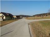 2
2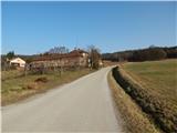 3
3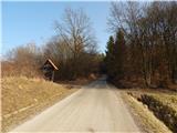 4
4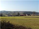 5
5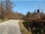 6
6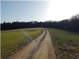 7
7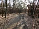 8
8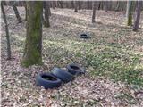 9
9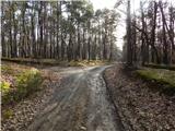 10
10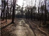 11
11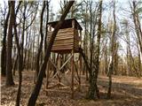 12
12
Discussion about the trip Bodonci (Varaš) - Griški vrh
To post a comment you must log in:
If you do not yet have a username, you must first
register.