Bogojina - Bukovniško jezero
Starting point: Bogojina (185 m)
| Latitude/Longitude: | 46,67800°N 16,27550°E |
| |
Walking time: 2 h 30 min
Difficulty: easy marked way
Elevation gain: 4 m
Elevation difference along the route: 250 m
Map: Pomurje 1:40.000
Recommended equipment (summer):
Recommended equipment (winter):
Views: 551
 | 2 people like this post |
Access to starting point:
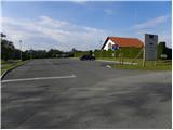
From the Pomurska motorway we take the Gančani exit and follow the road ahead in the direction of Moravske Toplice. After a few kilometers of additional driving the road brings us to a somewhat larger crossroad in Bogojina. Here we continue straight (left Moravske Toplice, right Lendava) and a somewhat narrower road quickly brings us to the center of the village Bogojina. We continue driving through the settlement, and we follow the signs for Plečnik's church. Only a little before the mentioned church we come to a smaller triangular crossroad, where we continue left towards the cemetery (straight Plečnik's church). After a short further drive we arrive at the mentioned cemetery, in front of which we park on a well-maintained parking lot.
Route description:
From the parking lot, we walk to Plečnik's church, then we head onto the road that leads between the church and the Alenka inn. At a few crossroads through the settlement we continue straight, when the settlement ends we go left. Further on, we walk along the road leading towards the village Bukovnica, at the marked crossroad we go right towards Trnavski breg, only a few dozen steps ahead the blazes direct us left onto an even narrower road, along which we ascend to a lonely homestead, which we bypass on the right side, above it passing into the forest. Through the forest at numerous junctions we follow the blazes, for a short time walking along a field, from where we get some views of the surroundings. When we leave the forest we reach a vehicular road, which we follow to the right, and it leads us through Filovski Breg. In the middle of the settlement the blazes direct us left onto a path leading among vineyards, quickly past the second house we reach another road, along which we descend slightly. From the road we soon go sharply left onto a cart track, a little lower, when we reach a somewhat wider cart track, we go left again.
The signs for the Pomurje mountain trail a little after the hunting observatory direct us right, where along the fields we easily descend to the forest, through which we continue. Through the forest we mostly ascend, when we reach the cart track we go left.
At the nearby junction of cart tracks we go straight, then the blazes direct us right onto a path that continues through the forest. When we leave the forest we step onto an asphalt road, which we follow to the right, walking among the houses of the settlement Gaj. When we arrive at the chapel we go left, a little lower right, then we descend past the last houses in the settlement too. When the settlement ends we go left onto a cart track leading along fields, when we approach the forest the signs lead us right into the forest, where over a small bridge we cross the stream Janderdol. On the other side of the stream there is some ascent through the forest, then the path levels out and takes us out of the forest, past the hunting observatory reaching the settlement Strehovski Breg, where at the shrine we go left. Through the settlement at crossroads we continue straight, when the settlement ends the road begins to descend through the forest. The path also leads past a gate and we arrive at the chapel of St. Vid.
At the chapel we continue slightly left (if we continue straight we descend to the parking lot somewhat below Bukovniško jezero) and first walk to the spring at St. Vid, from there through the forest descending to Bukovniško jezero.
Bogojina - St. Vid 2:25, St. Vid - Bukovniško jezero 0:05.
Description and pictures (except the first) refer to the condition in November 2021.

Photos:
 1
1 2
2 3
3 4
4 5
5 6
6 7
7 8
8 9
9 10
10 11
11 12
12 13
13 14
14 15
15 16
16 17
17 18
18 19
19 20
20 21
21 22
22 23
23 24
24 25
25 26
26 27
27 28
28 29
29 30
30 31
31 32
32 33
33 34
34 35
35 36
36 37
37 38
38 39
39 40
40 41
41 42
42 43
43 44
44 45
45 46
46 47
47 48
48 49
49 50
50 51
51 52
52 53
53 54
54 55
55 56
56 57
57
Discussion about the trip Bogojina - Bukovniško jezero
To post a comment you must log in:
If you do not yet have a username, you must first
register.