Bohinjska Bela (Podklanec) - Galetovec (western way)
Starting point: Bohinjska Bela (Podklanec) (550 m)
| Latitude/Longitude: | 46,33300°N 14,05840°E |
| |
Route name: western way
Walking time: 2 h
Difficulty: easy marked way
Elevation gain: 715 m
Elevation difference along the route: 715 m
Map: TNP 1:50.000
Recommended equipment (summer):
Recommended equipment (winter):
Views: 43.682
 | 2 people like this post |
Access to starting point:
From the highway Ljubljana - Jesenice we go to the exit Lesce and follow the road towards Bled and further towards Bohinjska Bistrica. 1 km after Bled we come to the crossroad, where we turn right towards Bohinjska Bela. Further, we drive through the village to the railway station near which a road in the direction of Galetovec branches off to the right upward. We follow this road to a crossroad, where we notice signposts and by them a smaller parking lot.
Route description:
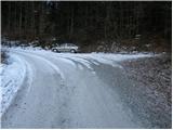
From the parking lot, we continue on the left road in the direction of Galetovec. Soon after a longer right bend a poorly marked cart track branches off to the left upwards. We continue the ascent on the cart track, which occasionally ascends quite steeply. The path ahead crosses a poor forest road, then we rejoin the road which we left. We follow the road to the left, which soon brings us to the right bend, in the middle of which we continue the ascent on a footpath. The path ahead crosses a forest road a few more times, then brings us over a grazing fence to the mountain pasture Planina za Jamo.
From the mountain pasture, we continue straight on the path which goes into the forest. A little further the poorly marked path turns right and ascends a smaller gully, after which we step on a road. Walking on the road takes place only a short time, as the path directs us right to two cottages. Between both cottages we notice a faded sign with the inscription Galetovec. The path ahead in a moderate ascent crosses a belt of forest and brings us to the next houses. The path, which further ascends on unvegetated slopes, brings us a little higher to a path junction.
We continue right in the direction of Galetovec on the path which goes into the forest after a few minutes. This is followed by approximately five minutes of walking through the forest to the top of Galetovec from which a beautiful view opens up.

Photos:
 1
1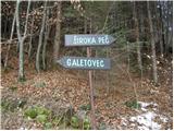 2
2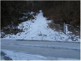 3
3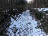 4
4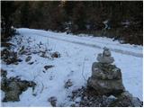 5
5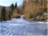 6
6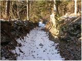 7
7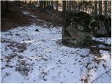 8
8 9
9 10
10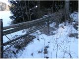 11
11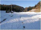 12
12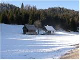 13
13 14
14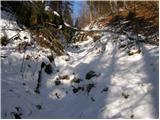 15
15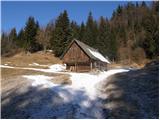 16
16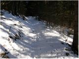 17
17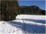 18
18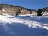 19
19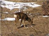 20
20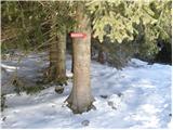 21
21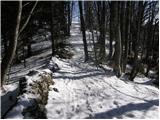 22
22 23
23
Discussion about the trip Bohinjska Bela (Podklanec) - Galetovec (western way)
|
| grega_p14. 03. 2010 |
With a colleague we headed to Galetovec from the junction of the road to Belska planina and onwards, but we made our own track a bit (went too far right) and ended up almost back at the road but a kilometer lower. We did reach the top, but I don't want anyone to follow us and complain - better to continue at the end of Belska planina straight to the marked path at Turn..
|
|
|
|
| Anathema2. 07. 2011 |
Obviously not many people go there. On a sunny Saturday morning with colleagues we didn't meet a living soul (except cows :P). The ascent isn't too strenuous, the view is really wonderful. Highly recommend.
|
|
|
|
| atoamac18. 02. 2013 |
Yesterday 16 pairs of legs made a decent track in the top 20 cm of powder on quite a hard base. From the inn in Boh. Bela to the top.
|
|
|
|
| Stane71. 01. 2015 |
Has anyone walked this path recently? How much snow is there?
|
|
|
|
| fonko28. 11. 2015 |
Today I was on Galetovec. There was about 25 cm of snow on the path. At the top, summit book box, stamp and divine view.
|
|
|
|
| zlatica14. 03. 2017 |
Majda, another nice hiking story.
|
|
|
|
| Majdag14. 03. 2017 |
...Zlatica at this time, when you don't know where to go, is quite a good choice..
|
|
|
|
| Darxta9. 10. 2017 |
Yesterday on Galetovec. Nice hike, excellent views.
The path is generally well marked, but missing marker at one junction. Between pictures 6 and 8, when at the right bend you continue left on the cart track, after cca 200m small branch left (right continuation on cart track). Here you need to turn left, right returns you to the road (from which you get back to marked path).
|
|
|
|
| alenansk19. 01. 2019 |
Has anyone walked this path today? How much snow is there?
|
|
|
To post a comment you must log in:
If you do not yet have a username, you must first
register.