Bohinjska Češnjica - Rudnica
Starting point: Bohinjska Češnjica (603 m)
| Latitude/Longitude: | 46,29440°N 13,94160°E |
| |
Walking time: 1 h 30 min
Difficulty: easy unmarked way
Elevation gain: 343 m
Elevation difference along the route: 365 m
Map: TNP 1:50.000
Recommended equipment (summer):
Recommended equipment (winter): ice axe, crampons
Views: 1.480
 | 1 person like this post |
Access to starting point:
A) From the road Bled - Bohinjska Bistrica, in the settlement Bitnje we drive sharply right (from the direction of Bohinj slightly left) in the direction of Pokljuka, Srednja vas and Jereka. A steep ascent follows, and when the road flattens we continue straight from the crossroad in the direction of Stara Fužina and Srednja vas (right Pokljuka, Koprivnik and Jereka). A little further, we already arrive in Bohinjska Češnjica, and the described path starts at the crossroad, where the road branches off left downwards towards apartments Čebelica. At the starting point, there are no arranged parking spaces.
B) We drive to Stara Fužina, and then we continue driving towards Srednja vas and further to Bohinjska Češnjica. At the beginning of Bohinjska Češnjica, we arrive at a crossroad, where the road towards apartments Čebelica branches off to the right. At the mentioned crossroad, where the described path begins, there are no arranged parking spaces.
Route description:
From the starting point, we head onto a side road that leads us past apartments Čebelica, and we descend a little lower along the road, where we cross the stream Suha. On the other side of the stream, we soon reach the cycling path Bohinj, and we follow the signs for Brod and Senožeta. When we arrive at a crossroad with wooden signposts we head left towards Brod (if we continue straight we arrive at the foot of the ski slope Senožeta and Srednja vas).
From the crossroad onwards, the road starts to ascend, and the asphalt quickly ends. The macadam path gradually approaches the route of the ski slope, where it turns left, higher up it gradually flattens and turns towards the south. A short descent follows to a crossroad, where we go right (left downwards we descend to Brod), then mainly in a gentle ascent we walk across expansive hayfields, where we walk mostly towards the west, and ahead of us we can already clearly see Rudnica. When the cart track brings us to a smaller saddle between Rudnica on the left and Kazanca on the right (peak with the hunting observatory), we go left and start ascending along the fence, where we follow a poorer path. Higher, when we leave the hayfields and the path enters the forest, the path becomes more distinct, a little further it also becomes very steep. A steep ascent follows through the slope, where there are several fallen trees, but there are no major difficulties with the passages, as the path mostly nicely bypasses them. The steep path, along which older blazes can also be noticed, brings us higher into a more plateau-like area, where we join a better-trodden path from Brod.
Here we continue right and along the edge of the precipice we continue the path (the path is somewhat distant from the edge, so there is no major danger of slipping). We then follow this panoramic path to the nearby summit of Rudnica, where there is a bench and a few steps further the stamping box.
Description and pictures refer to the condition in February 2020.

Along the route: Senožeta (656m)
Photos:
 1
1 2
2 3
3 4
4 5
5 6
6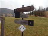 7
7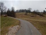 8
8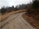 9
9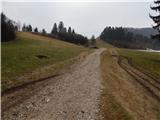 10
10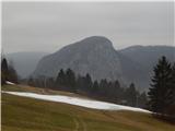 11
11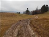 12
12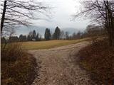 13
13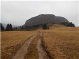 14
14 15
15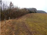 16
16 17
17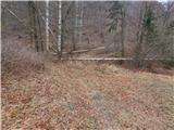 18
18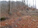 19
19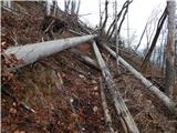 20
20 21
21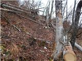 22
22 23
23 24
24 25
25 26
26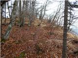 27
27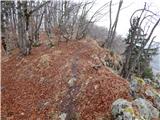 28
28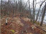 29
29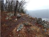 30
30 31
31 32
32
Discussion about the trip Bohinjska Češnjica - Rudnica
To post a comment you must log in:
If you do not yet have a username, you must first
register.