Bohinjsko sedlo - Kačji rob (Ovharn)
Starting point: Bohinjsko sedlo (1277 m)
| Latitude/Longitude: | 46,24090°N 14,01010°E |
| |
Walking time: 2 h
Difficulty: easy marked way
Elevation gain: 275 m
Elevation difference along the route: 315 m
Map: Škofjeloško in Cerkljansko hribovje 1:50.000
Recommended equipment (summer):
Recommended equipment (winter): ice axe, crampons
Views: 10.980
 | 1 person like this post |
Access to starting point:
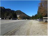
A) From the highway Ljubljana - Jesenice, we take the Lesce exit and follow the road towards Bled and further towards Bohinjska Bistrica. From Bohinjska Bistrica, we continue left in the direction of Tolmin and Soriška planina. We follow this road to a large parking lot near the ski center Soriška planina.
B) From Železniki, we drive towards Podbrdo or vice versa, but only to the spot where the signs for Soriška planina direct us onto an ascending road. We follow this road to a large parking lot at the foot of the ski area Soriška planina.
Route description:
From the parking lot below the ski center Soriška planina, we continue on the asphalt road towards Železniki and Podbrdo. Soon, i.e. after approximately 50 m, we will notice signs for Ratitovec on the left side of the road, which direct us to a marked footpath; this first descends along a cart track, then turns left and changes into a somewhat harder-to-follow path. The path ahead leads us across a larger grassy clearing, behind it crosses a strip of forest, then brings us to another clearing, where we step onto a wide cart track. We follow the cart track to the right and walk along it to the nearby road, which we reach right on the lower part of a short asphalted section. When we step onto the road, we first ascend, then gradually begin to descend towards the Mišji grund saddle, where we join the path from Soriška peč.
From here, we continue left on an initially steep cart track in the direction of Ratitovec, which gradually changes into a somewhat less steep footpath. Higher up, the path flattens even more and bypasses a somewhat larger watering place for animals on the right side. From here on, the forest becomes thinner, so that increasingly beautiful views begin to open up from the path on Porezen, Blegoš and other surrounding peaks. The path ahead ascends diagonally for some time, then passes onto a more extensive grassy slope, where we step onto a smaller indistinct saddle.
Here, a "path" branches off to the left to the nearby Žbajnek, to which it is less than 5 minutes of walking; we continue straight on the marked path, which turns slightly left and then ascends onto a smaller ridge.
When we step onto the ridge, we notice an inscription "stamp", which directs us right towards the summit of Kačji rob, which we reach after one more minute of walking.

Along the route: Mišji grund (1272m)
Photos:
 1
1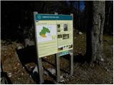 2
2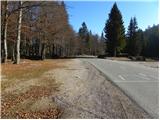 3
3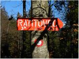 4
4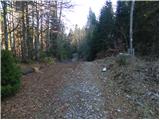 5
5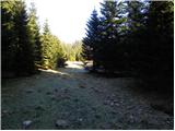 6
6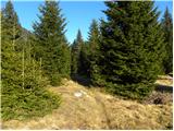 7
7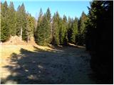 8
8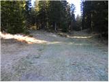 9
9 10
10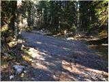 11
11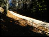 12
12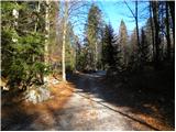 13
13 14
14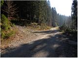 15
15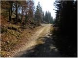 16
16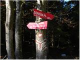 17
17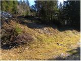 18
18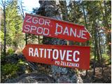 19
19 20
20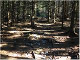 21
21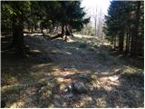 22
22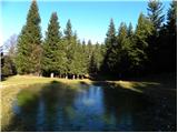 23
23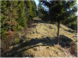 24
24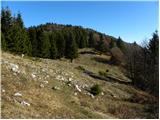 25
25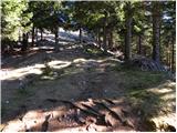 26
26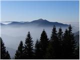 27
27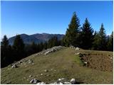 28
28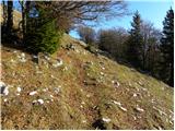 29
29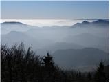 30
30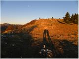 31
31 32
32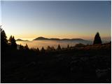 33
33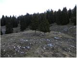 34
34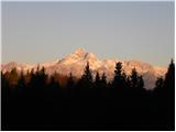 35
35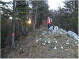 36
36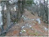 37
37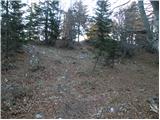 38
38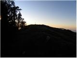 39
39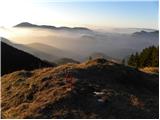 40
40 41
41
Discussion about the trip Bohinjsko sedlo - Kačji rob (Ovharn)
|
| natasja1. 04. 2017 |
Nice trail, but the markings are not the best. In some places, markings are missing, in others faded, in others hard to find. This is especially noticeable in snow, when the markings are under it.
|
|
|
|
| AndrejK27. 07. 2019 |
Markings have been renewed and there are no problems.
|
|
|
|
| Loerst2. 10. 2022 21:14:45 |
Although it's not really important, but the true height of the summit, measured with lidar (laser topography) is 1552 m, not 1520 m as written here, nor 1575 m as on OpenTopo map, nor anything else.
This is very obvious also on site, that Kačji rob is higher than the neighboring Žbajnek (1538 m).
There are plenty of elevation errors on maps anyway and for a couple of meters up or down I wouldn't comment, but 32 m is quite a lot after all.
|
|
|
|
| ločanka3. 10. 2022 05:07:19 |
The name has also changed. Now there is a sign at the top Ovharn, 1504 m.
|
|
|
|
| keti114. 01. 2024 09:06:32 |
I'm wondering if this path is usually trodden in winter?
|
|
|
|
| georgia14. 01. 2024 11:55:47 |
Yes, if they tread it  Wise to wait a few days after snowfall for more safety. First ones are usually ski tourers. We two once properly trod towards Erblec (path start same as towards Ratitovec) ... I recommend starting from Soriška peč (hunters' hut), which is a couple of turns before Soriška planina, there are P and direction signs by the road, much closer. The two paths soon join. Wise to wait a few days after snowfall for more safety. First ones are usually ski tourers. We two once properly trod towards Erblec (path start same as towards Ratitovec) ... I recommend starting from Soriška peč (hunters' hut), which is a couple of turns before Soriška planina, there are P and direction signs by the road, much closer. The two paths soon join.
|
|
|
|
| keti115. 01. 2024 10:25:13 |
Thanks for the information and advice
|
|
|
To post a comment you must log in:
If you do not yet have a username, you must first
register.