Bohinjsko sedlo - Možic (by Lajnar)
Starting point: Bohinjsko sedlo (1277 m)
| Latitude/Longitude: | 46,24090°N 14,01000°E |
| |
Route name: by Lajnar
Walking time: 1 h 30 min
Difficulty: easy marked way
Elevation gain: 325 m
Elevation difference along the route: 400 m
Map: Škofjeloško in Cerkljansko hribovje 1:50.000
Recommended equipment (summer):
Recommended equipment (winter): ice axe, crampons
Views: 63.398
 | 3 people like this post |
Access to starting point:
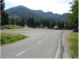
From the highway Ljubljana - Jesenice we take the exit Lesce and follow the road towards Bled and onwards towards Bohinjska Bistrica. From Bohinjska Bistrica we continue left in the direction of Tolmin and Soriška planina. We then follow this road to a large parking lot near the ski center Soriška planina.
From Železniki we drive towards Podbrdo or vice versa, but only to the spot where the signs for Soriška planina direct us onto an ascending road. We follow this road to a large parking lot at the foot of the ski slope Soriška planina.
Route description:
From the parking lot on Bohinjsko sedlo we head onto the macadam road in the direction of the Litostrojska koča mountain hut on Soriška planina. After less than 5 minutes of gentle ascent we arrive at the mentioned mountain hut from which a view opens up onto the nearby grassy slopes of the surrounding peaks.
From the hut we continue along the marked path in the direction of Šavnik, Možic and Lajnar. After a few dozen steps we reach a less noticeable junction where the path to Možic branches off slightly to the right, while we continue straight ahead towards Lajnar. The path ahead first ascends gently along the edge of the ski lift, then begins to ascend somewhat more steeply towards the saddle between Lajnar on the left and Mali Slatnik on the right.
After approximately half an hour of walking we reach the mentioned saddle, which is a junction of several paths. We continue right (left to Lajnar) in the direction of Slatnik, Možic, Šavnik and Črna prst along the marked path that leads to the Primorska side of the ridge (it is also possible to continue along the ridge). This is followed by a gentle ascent along a scenic mule track, after which the path takes us to the pass between both Slatnik peaks.
We continue slightly right (sharply right to Mali Slatnik 10-15 minutes) along the wide path that brings us slightly above the old military barracks in a gentle ascent.
We continue slightly left and somewhat downhill (sharply left along the grassy ridge to the Slatnik peak 5 minutes) along the path that begins to descend towards a smaller saddle where the next junction is.
We continue straight ahead (left downhill to Šavnik) along the old military mule track that begins to ascend gently. We then follow this pleasant path all the way to the summit of Možic, which we reach after a few minutes of further walking.

Along the route: Mali Slatnik (1600m)
Photos:
 1
1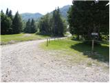 2
2 3
3 4
4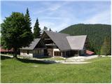 5
5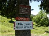 6
6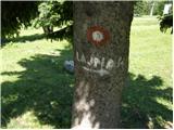 7
7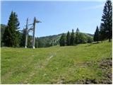 8
8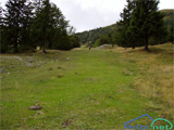 9
9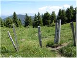 10
10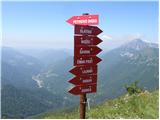 11
11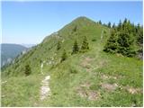 12
12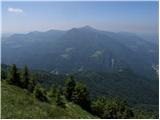 13
13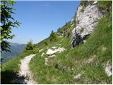 14
14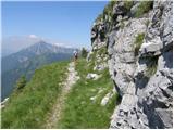 15
15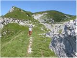 16
16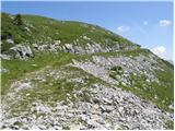 17
17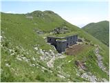 18
18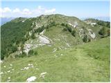 19
19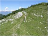 20
20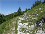 21
21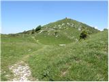 22
22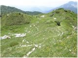 23
23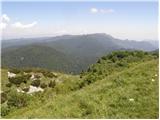 24
24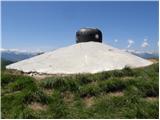 25
25 26
26
Discussion about the trip Bohinjsko sedlo - Možic (by Lajnar)
|
| katty15. 12. 2011 |
I'm deciding where to go on Sunday. I'm wondering if anyone knows how much time is needed for the circular path Lajnar-Dravh-Slatnik-Šavnik-Možic? Ok, conditions will surely be wintery, so I can say that the time I would need for this path will be disproportionately longer than in normal conditions, i.e. in dry conditions.
|
|
|
|
| GregorC16. 12. 2011 |
This spring (dry conditions) I hiked the path Litostrojska koča-Šavnik-Možic-Slatnik-Lajnar-Dravh-Litostrojska koča in under 4h. Without rushing. Only to Šavnik it drags a bit, because it's quite off the path. First you have to descend quite a bit from the saddle between Slatnik and Možic and then ascent to the top of Šavnik. Then you repeat everything in the opposite direction. I recommend starting with Šavnik.
|
|
|
|
| katty16. 12. 2011 |
Yeah, I really hope this will succeed for me . I hiked part of it once in my youth, and it tempts me a lot to do it again in the snow . I hiked part of it once in my youth, and it tempts me a lot to do it again in the snow . And a nice sunny Sunday is forecasted, so it should be taken advantage of. Thanks again to both of you for this. . And a nice sunny Sunday is forecasted, so it should be taken advantage of. Thanks again to both of you for this.
|
|
|
|
| Hribolazec813. 03. 2023 23:45:50 |
What's the situation like on the path to Možic?
|
|
|
To post a comment you must log in:
If you do not yet have a username, you must first
register.