Branček - Sveta Katarina above Novokračine
Starting point: Branček (607 m)
| Latitude/Longitude: | 45,49890°N 14,29020°E |
| |
Walking time: 30 min
Difficulty: easy marked way
Elevation gain: 68 m
Elevation difference along the route: 80 m
Map: Snežnik 1:50.000
Recommended equipment (summer):
Recommended equipment (winter):
Views: 2.714
 | 2 people like this post |
Access to starting point:
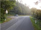
First, we drive to Ilirska Bistrica, and then we continue driving towards the border crossing Jelšane. After the settlement Jelšane we leave the main road towards Croatia and we continue left in the direction of the settlement Novokračine. There follows a little more than 1.5 km of driving on an asphalted and ascending road, and then we arrive at a smaller pass, where we notice signs for Sv. Katarina, and on the left side of the road a suitable place for parking.
Route description:
From the parking lot, we first cross the road, and then head onto the initially still asphalted road in the direction of Sv. Katarina. At the gate, the asphalt ends, and only a few steps further we arrive at the first station of the Way of the Cross. We then ascend along the forest road, accompanied by the already mentioned stations of the Way of the Cross. Between the tenth and eleventh station, an unmarked path from Novokračine joins from the right (in the description starting point Rjavi bg), and we continue slightly left along the road, which shortly afterwards leads out of the forest. There follows a somewhat flatter and partly scenic path which quickly brings us to the hunting cottage.
From the hunting cottage there follows only a short ascent along the road or the nearby path, and we soon reach the chapel of St. Katarina, located on a panoramic summit.
The description and pictures refer to the conditions in 2014 (September).
Photos:
 1
1 2
2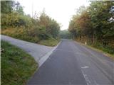 3
3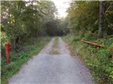 4
4 5
5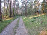 6
6 7
7 8
8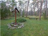 9
9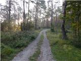 10
10 11
11 12
12 13
13 14
14 15
15 16
16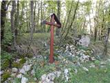 17
17 18
18 19
19 20
20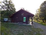 21
21 22
22 23
23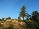 24
24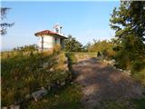 25
25 26
26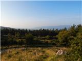 27
27
Discussion about the trip Branček - Sveta Katarina above Novokračine
To post a comment you must log in:
If you do not yet have a username, you must first
register.