Starting point: Breg (189 m)
| Latitude/Longitude: | 46,04381°N 15,24247°E |
| |
Walking time: 3 h 15 min
Difficulty: easy marked way
Elevation gain: 804 m
Elevation difference along the route: 850 m
Map:
Recommended equipment (summer):
Recommended equipment (winter): ice axe, crampons
Views: 118
 | 1 person like this post |
Access to starting point:
a) From the direction of Zasavje, drive towards Radeče, then along the left bank of the Sava River; in the settlement of Obrežje, leave the main road that continues over the bridge and proceed on the side road towards Lisca, Breg, and Loka. Continue driving through the settlements of Loka pri Zidanem Mostu and Račica to the settlement of Breg, where the described trail begins at the sports field.
b) From the direction of Posavje, first drive to Boštanj, from where at the roundabout head towards Sevnica; immediately after the bridge over the Sava River, from the roundabout at the Lidl store turn "left" onto the exit towards Breg. Continue driving along the Sava River to the settlement of Breg, where the described trail begins at the sports field.
Route description:
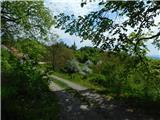
From the starting point at the sports field, continue along the asphalt road towards the northeast; after crossing the stream, turn left towards Lisca and Jurkloštra. In a gentle ascent, continue past a few houses, then the road forks and you continue on the left road, alongside which there are signs for the mountain trail to Lovrenc (straight to Lisca); bypass the football field on the right side. Then continue on the path for quite some time along a gentle road that leads through the valley of the Podvinski stream. Further on, at a few smaller intersections, continue straight or follow the markers; the road then begins to ascend more steeply and leads past a few houses and ponds, and later the Azaleja restaurant.
At the closed restaurant (data from May 2025), the road turns right, but a bit further at the marked junction, leave it and continue left onto the marked cart track, which turns into a fairly overgrown footpath on the meadow. This is followed by an ascent through a strip of forest, reaching the access road right of the nearby house.
Just cross the road and continue on the marked path, which mostly continues through the forest; higher up, it leads past individual houses, crossing some access roads or walking on them briefly.
Higher up, reach a somewhat wider gravel road, follow it to the right (left to Loka pri Zidanem Mostu); on it, quickly ascend to a marked junction where there is also a stamping box and stamp for Lovrenc.
Here, if continuing right, reach the church of sv. Lovrenc in one or two minutes; otherwise, continue left towards Veliko Kozje, bypassing the Centrih farm on the left side.
Behind the farm, the path forks again; continue straight (sharply right to the Gračnica valley).
The path ahead leads along a gentle cart track, from which a view towards Lisca opens on a short section looking back; however, do not walk the wider cart track for long, as before the nearby small quarry, where farmers usually store hay bales, turn left onto the mountain path. This is followed by a short ascent towards Kozlov hrib; the path bypasses the highest point of the summit on the left, southern side. Then some gentle descent and arrive at a forest road, reached at a small intersection. Continue straight on the noticeably poorer road, which leads past a viewpoint with a bench; later, the road first becomes a cart track, then a footpath. A bit further, transiently reach another cart track, from which markers quickly lead to the marked path that brings you to the marked junction Gole, where the path to Radeče branches left; continue towards Veliko Kozje.
The path ahead becomes quite steep in places, but flattens where a marked path from the settlement Gračnica joins from the right.
Here too, follow the signs for Veliko Kozje; after about ten minutes of moderate ascent through the forest, reach the highest point of Veliko Kozje, where there is an information board for Poti cerkva.
Although this is the mountain's highest point, the mountain markers for Veliko Kozje lead along the ridge further, descending to the next junction, where another path from Radeče and the path from Zidani Most join from the left.
Continue straight along the gentle path that follows the ever-narrower ridge and in a few minutes arrive at a nice viewpoint with a stamping box, logbook, and stamp.
Breg - Sveti Lovrenc 1:45, sv. Lovrenc - Centrih 0:05, Centrih - Gole 0:50, Gole - Razpotje na JV grebenu V. Kozja 0:15, Razpotje na JV grebenu V. Kozja - Veliko Kozje 0:20.
The description and photos refer to the condition in May 2025 and April 2026.

Along the route: Radež (418m),
Sveti Lovrenc (above Okroglice) (722m), Centrih (697m), Kozlov hrib (752m), Petelinji greben (746m), Razgledišče nad Žirovnico (760m), Razpotje Gole (828m), Razpotje na JV grebenu V. Kozja (929m),
Veliko Kozje (993m), Razpotje na SZ grebenu V. Kozja (973m)
Photos:
 1
1 2
2 3
3 4
4 5
5 6
6 7
7 8
8 9
9 10
10 11
11 12
12 13
13 14
14 15
15 16
16 17
17 18
18 19
19 20
20 21
21 22
22 23
23 24
24 25
25 26
26 27
27 28
28 29
29 30
30 31
31 32
32 33
33 34
34 35
35 36
3637
 38
38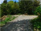 39
39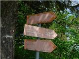 40
40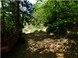 41
41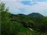 42
42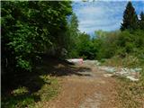 43
43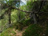 44
44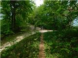 45
45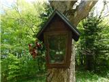 46
46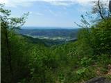 47
47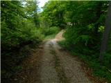 48
48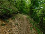 49
49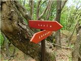 50
50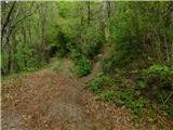 51
51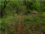 52
52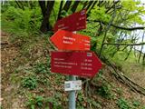 53
53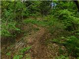 54
54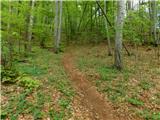 55
55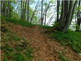 56
56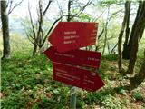 57
57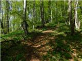 58
58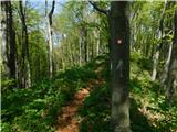 59
59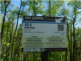 60
60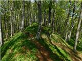 61
61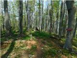 62
62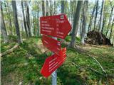 63
63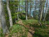 64
64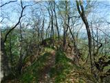 65
65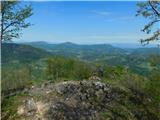 66
66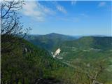 67
67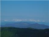 68
68
Discussion about the trip Breg - Veliko Kozje
To post a comment you must log in:
If you do not yet have a username, you must first
register.