Breginj - Muzec - Musc (Mali Muzec)
Starting point: Breginj (550 m)
| Latitude/Longitude: | 46,26200°N 13,42590°E |
| |
Walking time: 2 h 55 min
Difficulty: partly demanding marked way
Elevation gain: 1062 m
Elevation difference along the route: 1070 m
Map: Julijske Alpe - zahodni del 1:50.000
Recommended equipment (summer):
Recommended equipment (winter): ice axe, crampons
Views: 20.497
 | 3 people like this post |
Access to starting point:
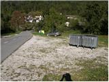
First, drive to the center of Kobarid, then continue driving towards the Robič border crossing. Near the village of Staro Selo, leave the main road leading to the Robič border crossing and continue right towards Breginj. Further, follow the mainly ascending road to Breginj, where you park on the parking lot near the church.
Route description:
From the parking lot, continue past the church (bypassing it on the right side) and continue the ascent on the asphalt road towards Stola and Muzec. The road first ascends through the village, following it at intersections in the known direction. Higher up, the road loses its asphalt surface and takes us past an old mill to a marked intersection, continuing slightly right (left to the Church of Mary of the Snows). The road, continuing to ascend moderately, soon brings us to a marked junction where a marked hiking trail to Muzec (Musc) branches left.
Head onto the mentioned trail, which ascends moderately through the forest. Further, the trail leads to a small spring (drinking water source), then turns slightly left and begins to ascend more steeply. Higher up, the trail levels out and leads to a small junction, continuing right (straight to Plazi). The trail then ascends steeply again through the forest, leading to a sharp and crumbly ridge. An exposed path leads over this ridge, crossing it in a few minutes into the forest belt. Upon exiting the forest, the trail leads to grassy slopes, arriving at a marked junction after a few more minutes of walking.
Continue left (slightly right to Klatnica - drinking water source) on the increasingly steep mountain trail. Higher up, the trail reaches a scenic and very steep side ridge, ascended for some time. Higher, reach a small unmarked junction, continuing on the left less steep trail (right extremely steep trail leads directly to Muzec). The left trail ascends transversely, passing a small chasm to the main Muzec ridge. Here continue right (left to bivouac under Muzec 2 minutes) and along the scenic ridge trail arrive at the Muzec summit in 10 more minutes of walking.

Photos:
 1
1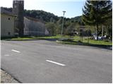 2
2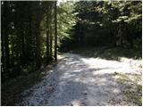 3
3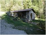 4
4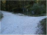 5
5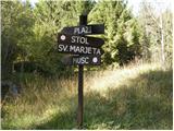 6
6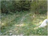 7
7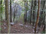 8
8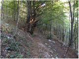 9
9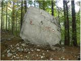 10
10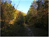 11
11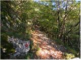 12
12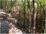 13
13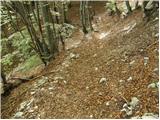 14
14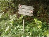 15
15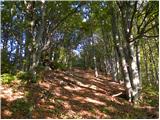 16
16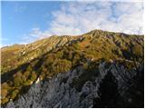 17
17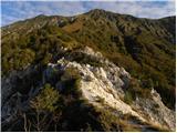 18
18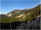 19
19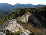 20
20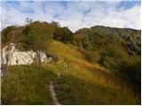 21
21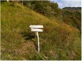 22
22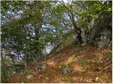 23
23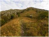 24
24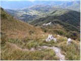 25
25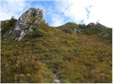 26
26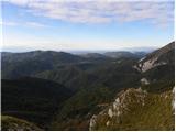 27
27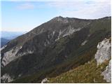 28
28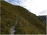 29
29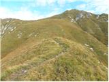 30
30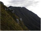 31
31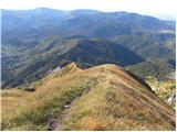 32
32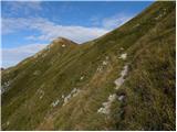 33
33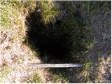 34
34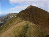 35
35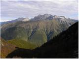 36
36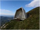 37
37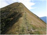 38
38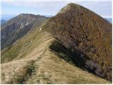 39
39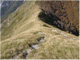 40
40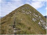 41
41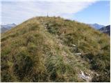 42
42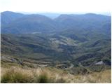 43
43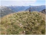 44
44
Discussion about the trip Breginj - Muzec - Musc (Mali Muzec)
|
| fred25. 05. 2009 |
the path is easy and well-marked according to mountaineering classification (no chimneys or climbing) but otherwise it's strenuous especially in summer when you have to go on this tour very early in the morning because when the sun hits your back on the last 400 meters of ascent all ease ends
|
|
|
|
| lubadar7. 01. 2023 13:22:25 |
On the crumbly ridge, pictures 18 and 20, at one point the path is collapsing and great caution is needed to avoid slipping.
|
|
|
|
| zaspanka29. 09. 2023 10:50:57 |
Stamp collectors informed that unfortunately there is no stamp at the summit, nor a box. Only the lid and a bag remain in which there are 2 ballpoint pens and a soaked former logbook.
|
|
|
To post a comment you must log in:
If you do not yet have a username, you must first
register.