Starting point: Breginj (550 m)
| Latitude/Longitude: | 46,26200°N 13,42590°E |
| |
Walking time: 30 min
Difficulty: easy marked way
Elevation gain: 115 m
Elevation difference along the route: 115 m
Map: Julijske Alpe - zahodni del 1:50.000
Recommended equipment (summer):
Recommended equipment (winter):
Views: 3.068
 | 1 person like this post |
Access to starting point:
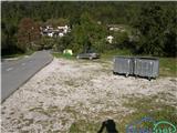
First, we drive to the center of Kobarid, and then we continue driving towards the border crossing Robič. Near the village Staro selo, we leave the main road which runs towards the border crossing Robič and we continue driving right in the direction of Breginj. Further, we follow a mainly ascending road to Breginj, where we park on a parking lot near the church.
Route description:
From the parking lot, we continue past the church (we bypass it on the right side) and we continue the ascent on an asphalt road in the direction of Stol and Muzec. The road at first ascends through the village, at the crossroads we follow it in an already known direction. Higher, the road loses an asphalt covering and past an old mill brings us to a marked crossroad, where we continue slightly right (left church of Marija Snežna). The road which continues to moderately ascend, soon brings us to a marked crossing, where a marked footpath to Muzec (Musc) branches off to the left.
We continue in the direction of Stol and we still continue the ascent on a macadam road, and it soon brings us to the next marked crossroad. The path turns right and after a few steps, we get to the source of the Bela.
Photos:
 1
1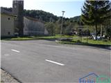 2
2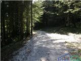 3
3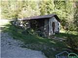 4
4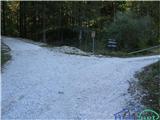 5
5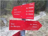 6
6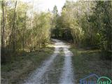 7
7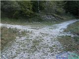 8
8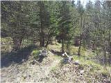 9
9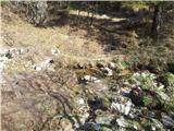 10
10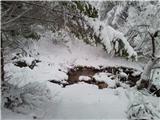 11
11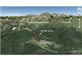 12
12
Discussion about the trip Breginj - Source of Bela
To post a comment you must log in:
If you do not yet have a username, you must first
register.