Breitalm - Tonneggerkogel
Starting point: Breitalm (1245 m)
| Latitude/Longitude: | 47,36000°N 15,46825°E |
| |
Walking time: 15 min
Difficulty: easy unmarked way
Elevation gain: 98 m
Elevation difference along the route: 98 m
Map:
Recommended equipment (summer):
Recommended equipment (winter): ice axe, crampons
Views: 116
 | 1 person like this post |
Access to starting point:
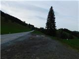
From the border crossing Šentilj we continue driving on the highway towards Graz and further towards Linz and Salzburg. We soon leave highway A9 and we continue driving slightly right in the direction towards Vienna / Wien and we continue driving on the fast road S35. We leave the mentioned fast road at the exit for Mixnitz, and then from the roundabout we go to the exit in the direction of Teichalm. Further, we still follow the signs for Teichalm. At the end of the settlement St. Erhard we once again turn right towards Teichalm, and then we start ascending steeply. When we reach the mountain pasture Breitalm, the road at the saddle stops ascending, and on the right, we notice a smaller marked parking lot where we park.
Route description:
From the parking lot, we head towards the west, where we first walk to the nearby stable, and then start ascending diagonally on a grassy path that leads us through a grazing area. When, with beautiful views, we reach the indistinct southern ridge of the peak Tonneggerkogel, we turn right and in less than three minutes of further walking, we ascend to a scenic peak with a cross and a bench.
The description and pictures refer to the condition in June 2025.
Photos:
 1
1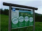 2
2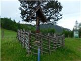 3
3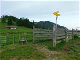 4
4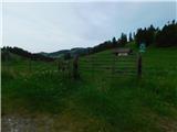 5
5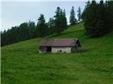 6
6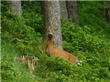 7
7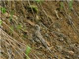 8
8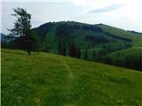 9
9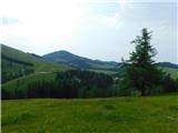 10
10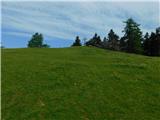 11
11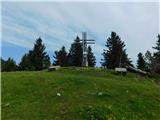 12
12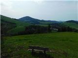 13
13
Discussion about the trip Breitalm - Tonneggerkogel
To post a comment you must log in:
If you do not yet have a username, you must first
register.