Brezje pri Dobrovi (Pavliček) - Strmca
Starting point: Brezje pri Dobrovi (Pavliček) (330 m)
| Latitude/Longitude: | 46,03080°N 14,35690°E |
| |
Walking time: 30 min
Difficulty: easy marked way
Elevation gain: 142 m
Elevation difference along the route: 142 m
Map: Ljubljana - okolica 1:50.000
Recommended equipment (summer):
Recommended equipment (winter):
Views: 3.738
 | 2 people like this post |
Access to starting point:
A) From the highway Ljubljana - Koper, we take the exit Brezovica, then continue driving towards Dobrova. From the roundabout in Dobrova, we drive towards Horjul, then continue driving to the settlement Brezje pri Dobrovi. Just a few tens of meters before the road sign marking the beginning of the settlement, we turn left onto a local road which soon crosses the stream Horjulščica. On the other side of Horjulščica, the road starts ascending towards the nearby homestead Pavliček. At the starting point, there are no appropriate parking spots.
B) From the highway Koper - Ljubljana, we take the exit Vrhnika, then continue driving towards Horjul. In Horjul, we turn right towards Dobrova and Ljubljana, but we follow the main road to the settlement Brezje pri Dobrovi. Just a few tens of meters after the sign marking the end of the settlement Brezje pri Dobrovi, a local road branches off to the right, which soon crosses the stream Horjulščica. On the other side of Horjulščica, the road starts ascending towards the nearby homestead Pavliček. At the starting point, there are no appropriate parking spots.
Route description:
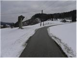
From the bridge over Horjulščica we continue on the asphalt road, which quickly takes us to a hamlet of a few houses. Above the last house we head onto a marked cart track, which we follow to the beginning of the forest. When the cart track enters the forest, we will notice on the left the start of a marked path, which begins to ascend through the forest. Higher up, the path joins an old cart track, which we soon leave as the blazes direct us left onto a marked footpath, which we follow up to a marked junction.
At the junction we continue right towards Ferjanka (left Debeli hrib) and continue the ascent on a gentle path, which soon brings us to the next junction. Here a path branches off to the left to the homestead Ferjanka, while we continue slightly right on the path that brings us to the indistinct, forest-covered summit of Strmca in a few minutes of further walking.
Photos:
 1
1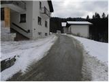 2
2 3
3 4
4 5
5 6
6 7
7 8
8 9
9 10
10 11
11 12
12 13
13 14
14 15
15 16
16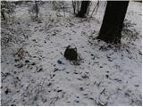 17
17
Discussion about the trip Brezje pri Dobrovi (Pavliček) - Strmca
To post a comment you must log in:
If you do not yet have a username, you must first
register.