Brezje pri Tržiču - Koča na Dobrči (Po robu)
Starting point: Brezje pri Tržiču (677 m)
| Latitude/Longitude: | 46,35890°N 14,27870°E |
| |
Route name: Po robu
Walking time: 2 h 30 min
Difficulty: easy marked way
Elevation gain: 801 m
Elevation difference along the route: 815 m
Map: Karavanke - osrednji del 1:50.000
Recommended equipment (summer):
Recommended equipment (winter):
Views: 56.005
 | 6 people like this post |
Access to starting point:
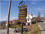
From the highway Ljubljana - Jesenice we go to the exit Ljubelj and follow the road ahead in the direction of Tržič. Just before the gas station at Tržič we turn right (direction Tržič) and then immediately left (direction Begunje) and drive ahead to the village Brezje pri Tržiču, where we park on the parking lot near the church.
Route description:
From the parking lot, we continue on the road towards Begunje, but only to the spot where it starts descending. Here the road which leads to the mountain pasture Bistriška planina branches off to the right (by the crossroad there are also signposts for Dobrča), we walk along it only for a few minutes, and then at the crossroad we go left in the direction of Dobrča (right road leads to the mountain pasture Bistriška planina).
From the crossroad ahead we continue on a somewhat rougher road, on which we walk approximately 1 minute, and then the blazes lead us to the right on a footpath which continues along the fence. For some time we moderately ascend along the fence, and then after approximately 20 minutes of walking from the starting point we arrive at a wide but steep cart track. Up the cart track we ascend to a somewhat thinner forest, where the blazes direct us sharply right upward. We then steeply ascend through the forest and after 15 minutes of additional walking we arrive at an abandoned watering place for animals. Here the path turns to the left and gently ascends below the indistinct peak Vaško. A little further we arrive at a smaller saddle between the already mentioned peak on the right and the slopes of Dobrča on the left.
Next follows a short ascent and the path brings us to the spot where we cross the nearby forest road (we cross the road right at the spot where it ends). Further we ascend for some time on a wide forested ridge, on which we walk all the way to the paragliding takeoff point, which is located on the southern slopes of Dobrča.
Here a wide path branches off to the right, which continues towards the mountain pastures Lešanska and Bistriška planina, and we continue straight and at first walk along the edge of the forest. Quickly we return into the forest and then ascend relatively steeply in zigzags. At an altitude of approximately 1400 meters above sea level we arrive at the cart track, which we only cross, then a little higher we arrive at a marked junction, where a path from Lešanska planina joins from the right, straight ahead the path continues towards the summit Dobrča, and we continue left in the direction of the mountain hut Koča na Dobrči. Next follows a short descent and the path returns to the previously mentioned cart track (the cart track which we only crossed), on which we walk only a short time, since then the blazes lead us a little to the left. Further, without major changes in altitude, we cross the slopes of Dobrča towards the west, and then we step out of the forest onto the panoramic mountain pasture Podgorska planina.
From the mountain pasture, from which we already see the mountain hut Koča na Dobrči, we first slightly descend and then ascend to the nearby mountain hut.

Photos:
 1
1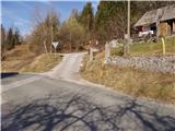 2
2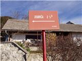 3
3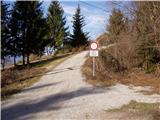 4
4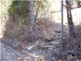 5
5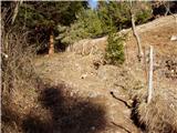 6
6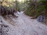 7
7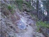 8
8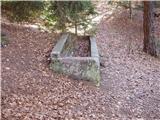 9
9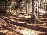 10
10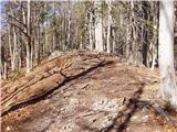 11
11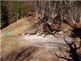 12
12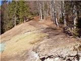 13
13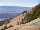 14
14 15
15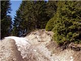 16
16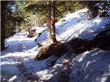 17
17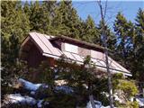 18
18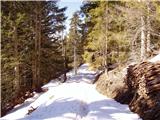 19
19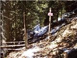 20
20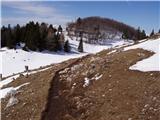 21
21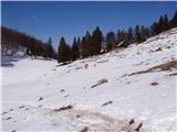 22
22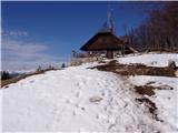 23
23
Discussion about the trip Brezje pri Tržiču - Koča na Dobrči (Po robu)
Show older messages
|
| Gost2. 09. 2006 |
Hikers with their own brought food are not welcome in the hut?! This is a peculiarity of the caretakers who shouldn't allow themselves this!
|
|
|
|
| Gost8. 09. 2006 |
With voluntary actions the huts were built. Now they rent them to people who play at tourism. Their motto is to earn as much as possible. If you don't have money, you have nothing to look for in this hut. Shame on those who support it.
|
|
|
|
| Gost29. 10. 2006 |
Yes, today we with friends were also at the hut and they chased us out because we wanted to eat a sandwich in the hut. I think this is an issue that PZS should sort out and take away the catering from such people and chase them down to the valley.
|
|
|
|
| Gost29. 10. 2006 |
If there is any justice in this world, PZS should have sorted out this issue long ago, obviously it's not in their interest. 
|
|
|
|
| spod'Kriške30. 10. 2006 |
This hut seems to me almost like a local inn, it's a shame that alpine pastures are open so little time. My advice therefore doesn't apply this time, but you can try next summer - the alpine pasture on Lešanska planina is something completely different - friendly people, nice view, the detour on the way to the summit is not big at all.
|
|
|
|
| Gost13. 12. 2006 |
I also have a similar experience as previous guests, even though I'm a local from Brezje. I only go to the top of Dobrča now.
|
|
|
|
| Gost17. 12. 2006 |
With this hut keeper I couldn't shake the feeling that he sees me only as an object of profit. We never spent a lot in the hut anyway. So we don't even go there for that coffee anymore. And we used to love sitting there in front of the hut.
|
|
|
|
| Otto17. 12. 2006 |
Same feeling in the same hut. I went to the hut and saw the sign that you're not welcome if you have your own food, and it completely put me off, even though I didn't have food with me. So even the beer that I wouldn't have drunk. This simply isn't the right way to run a hut.
|
|
|
|
| Kriška18. 12. 2006 |
If we "bombard" PD Tržič with calls, letters, emails (instead of just "whining" here), maybe someone will finally get moving and do something about it. Let's try!
PD TRŽIČ
Balos 4
4290 TRŽIČ
INFO POINT:
Tržič Tourist Promotion and Information Center
tel.: 04/59-71-536
E-mail: informacije@trzic.si
|
|
|
|
| Gost18. 12. 2006 |
I'm convinced that PZS is also the right address for complaints. The question is whether anyone from PZS reads this website. I've long noticed myself that in the huts, when they were managed by caretakers and not tenants, it was much, much friendlier. Well, here and there, there is still a bright exception. But there are really very few of them.
|
|
|
|
| Gost18. 12. 2006 |
Yes, unfortunately it's really as you write, but there are still many such huts in our mountains. And such caretakers aren't that rare either, who have no clue about their surroundings, if you ask about the condition of some path - they just cook and serve..., and earn. We apparently really are too small a nation to have everything arranged...
|
|
|
|
| Gost19. 12. 2006 |
that's how the caretaker should be replaced
|
|
|
|
| Gost25. 12. 2006 |
Yeah, yeah PZS will do something, they have plenty of work with their chairs, then they'll deal with the caretakers
|
|
|
|
| Gost27. 12. 2006 |
Guys, I think you're all exaggerating a bit, as we regularly visit this hut and the situation is not at all as you portray it. That someone would chase someone out because of a sandwich (hello), ask your conscience why you're lying, that the caretaker has no idea about his surroundings was written by another arrogant person, if he had only asked, the caretaker would surely have told him, but the truth is that this is not an info office, as one should first take care of information themselves before heading to the mountains or take a guide to lead them around by the hand. Regarding earnings, yeah who works for free these days??? The problem is only that some show it, others quietly hide it behind a smile, even though everyone works for profit!!!, most of it they invest in cleaning up the mess (washing tablecloths,...) left behind by sandwich eaters and the like, who lack basic mountaineering etiquette but are the loudest on forums. I suggest that if you don't like it here, go elsewhere, but I recommend this hut to everyone else, as it's not as some write, who would need to be carried by hand even in the mountains and create envy over earnings, and see nothing else in the mountains but that!! DON'T MAKE ME LAUGH!
|
|
|
|
| Gost27. 12. 2006 |
I simply have to respond to this. Was this "guest" perhaps the tenant of this hut?
It hasn't happened to me that they chased me out because of a sandwich, but for that (when ordering food there) I listened to the waitress (?) complaining about how some are rude to come and want to eat their own food. That happened to me this summer. I'm from the area, so for conditioning walks I usually go either to Dobrča or Kriška gora, so I'm a regular visitor, and I can confirm everything my predecessors wrote about their impressions before this "guest" chimed in, who obviously sees things completely differently. Actually, I got the impression that it's either the tenant himself or one of his "regular bar customers".
PS. And no, hikers certainly don't expect to be "carried by hand" somewhere in the mountains - at least real ones don't.
|
|
|
|
| Gost28. 12. 2006 |
Girl, that guest was neither the tenant of the hut nor a drunkard at the "bar" (I haven't seen anyone standing at the bar in the mountains for a long time, let alone anyone drinking there??), whom someone prompted to write this, so your impressions are completely off, just like your entire post!
First of all, I'm glad that someone who has no idea about mountaineering has chimed in and only confirms my thesis that only those who would need to be carried by hand in the mountains complain, a real mountaineer would never write that. It's sad that a person goes to the mountains only to two stops and even that for conditioning with eyes on the ground or signs in at the top on the hour and rushes back to the valley without thinking for a moment about the beauty and warmth of nature surrounding him, and on top of that thinks he's a real mountaineer (hello). As for waitresses, I can take you somewhere else to hear what others say, just they don't say it so directly, of course we'll go to enjoy and not be joggers building stamina!
But I really don't know why you're all so picky if a person wants to earn their daily bread with work - better stay home or go where they don't exploit you e.g. go to the sea in Croatia and pay for just lying in the sun, let alone drinking and eating, then chime in on forums.
We Slovenes are like that, we give to foreigners who exploit us and stay quiet, but when we give to our own who tries, even if not to everyone's taste, he must be destroyed, BECAUSE WE DIE OF ENVY!
Girl, build stamina in the gym instead!
|
|
|
|
| Gost28. 12. 2006 |
P.S.
I forgot to write that statistics show that 80% of real hikers eat in mountain huts, where a main course and drink cost approx. 1000-1200 SIT (depending on needs) while buying sandwiches and drinks, plus some chocolate and canned drink costs approx. 800-1000 SIT! Is it worth the effort to carry all that into the mountains for a difference of approx. 200-500 SIT and then spit on the hut caretakers who try to serve you to the best of their ability!
|
|
|
|
| Gost28. 12. 2006 |
Dear mountaineering colleague, this claim that 80% of real hikers eat in huts is nonsense. Prices are still too inflated though. I hike a lot in the mountains and wouldn't dare claim that the percentage is that high. A true mountain lover avoids huts and their crowds: there are still so many peaks where paths don't go past huts, and there peace and quiet reign. And this about hut supplies: there's a big difference between a tenant and a caretaker. The caretaker is paid by the mountaineering club managing the hut, the tenant works for their own profit. Here PZS made a big mistake. Huts no longer serve their original purpose: essential supplies, modest accommodation... there was always a friendly word, good advice at home. But today that's no longer the case anywhere in life, and sadly it's moved to the mountains too. You older ones will remember mama Angela from Vodnikova hut, or Franceljna from the shelter below Špička, and the very friendly caretakers in the hut at the source of Soča and the lady who was at Kamniško sedlo years ago. Don't hold it against those who provided us friendly shelter in huts in those times that I omitted them from the list. To those still alive, a friendly greeting; to the deceased, fond memories.
It's a shame to argue about Dobrča: whoever doesn't like it, go past. The tour itself is beautiful and food from the backpack tastes good on the grass behind the hut too.
For next year, safe hiking and happy return to the valley to all who go to the mountains. MiR
|
|
|
|
| Gost28. 12. 2006 |
Madam, you've said it beautifully and I agree with you, except that the caretaker also works for their profit, as they take a good % of the sold items!
Indeed, harmony and friendliness are lacking, but what can we do, time moves on and can't be stopped, so let the caretakers and tenants do their best, and we'll go where it suits us best.
|
|
|
|
| Gost28. 12. 2006 |
I agree with the previous ones!
On the other hand.... put yourself in the caretakers' shoes, and you'll see that with all the costs of work, transport, rent payment, every brought sandwich is the biggest enemy!
But yeah, no one can do anything to you if you eat it on the bench in front of the hut!
|
|
|
|
| Gost2. 01. 2007 |
Such a nice, clean and good food at Dobrča we haven't had for a long time. Just remember the previous caretakers... Now that everything is running nicely, it bothers someone. Who has ambitions to take over the caretaking of this hut?
And bring your sandwich to a restaurant in the valley and eat it there. Try it, I'm curious about the tenants' or owners' reaction.
|
|
|
|
| pbastic15. 01. 2007 |
It's true, in the valley no one thinks of going to a tavern, restaurant or hotel laden with their own food and drink. But I can't defend the strange attitude towards many hikers that the keepers almost established. Not all wallets are that thick, so some mountain visitors have to bring their own snack. There are bypass paths past the hut (if the stamp isn't the only goal) and rather enjoy your brought meal (clean up after yourself) somewhere in the beautiful nature! I've been doing that on Dobrča for a while. Let the tenant stay without the mulled wine, tea or (then) that we sometimes treated ourselves to in that hut after our own sandwich. Thank God not everyone (at least most are NOT) profiteers. And a reliable, firm mountaineering step in 2007 I wish all hiking enthusiasts!
|
|
|
|
| Gost5. 01. 2007 |
It's true, most keepers in mountain huts aren't profiteers and I think we really need to distinguish between keepers (paid by the PD) and tenants who work for their profit. I believe many tenants aren't even hikers and thus don't know "mountaineering etiquette" at all, they think they have a tavern on lease - which mountain huts definitely aren't (or shouldn't be). It's sad only that mountaineering associations don't act in such cases, even though warned. Hikers will find other paths, we'll go where we feel good not only in nature but also at/by the mountain hut. I tell you, I often go places also because I like the atmosphere in a particular hut and the keeper knows more than just selling food and drink. And luckily there are still many like that, both in the foothills and high mountains!
|
|
|
|
| Gost14. 01. 2007 |
I completely agree with those who oppose the inappropriate behavior of the hut keepers just because mountaineers and hikers bring their own food and want to have a snack in the hut in the warm!
|
|
|
|
| Gost15. 01. 2007 |
On Sunday I plan to go to Dobrča. I'm really curious if everything I read online is true. Regarding the friendliness and unfriendliness of the staff in the hut.
|
|
|
|
| Gost15. 01. 2007 |
I hope it has improved so that we can finally start praising too. After all, the purpose of these forums is like that, right?
|
|
|
|
| Gost16. 01. 2007 |
Well, let me tell you, the previous hut keeper was sometimes in a bad mood, but there was no lack of hospitality or good food, which is not the case with this one. I fully agree with those before me who say he's just a profiteer strutting like a peacock. In September he had it closed so I sent 4 hikers to Vili's to sleep because it was already dark and the hut was closed. When I used to come to the hut on Sunday mornings, there were regularly 11 of us every Sunday regardless of the weather, now only Marjan and Marjan and Cilenšek still persist. It pleased me to find Miha and Silvo in the hut on 7.1., and of course Majrček was there too, who used to be a regular guest, and I could list more, but not anymore. Grah himself knows well how the numbers have dropped, if it weren't for the so-called foreign hikers it would be empty, but on Kriška they are still good and cheerful, we go there. In summer Lešenska planina and Bistriška below are also happy for visitors and friendly hikers. It's sad that mountaineering associations don't act in such cases even though they are warned. Hikers will just stand a bit on the porch in front of the hut or under it if they don't chase us away from there too.
|
|
|
|
| Gost16. 01. 2007 |
Yes, I completely agree, I no longer meet the people I used to on Dobrča, it's high time something is done so that we can happily go to the hut again and that they welcome us as people, not as money carriers, because you have to work for money.
|
|
|
|
| Gost16. 01. 2007 |
I can tell you things won't change, if you don't like it go elsewhere because here it will stay as it is since the contract is already signed
|
|
|
|
| Gost16. 01. 2007 |
Question for PD Tržič: Do you really not care???
|
|
|
|
| kolesar16. 01. 2007 |
I was at the top today because I had a day off. I thought I wouldn't meet anyone because it's a workday and the hut is closed. But I met 15 hikers by 10:30 when I returned to Brezje. So Dobrča is still quite well visited. It's true that fewer and fewer hikers go to huts, not only on Dobrča, I think everywhere in the mid-mountains. The reason I think is that when you enter a hut sometimes you really don't know where you've come, to a village inn or a mountain hut.
|
|
|
|
| Gost16. 01. 2007 |
Please go wash your dirty laundry somewhere else, leave this page to HIKERS. So many huts in Slovenia and only Dobrča and Kriša appear in a bad light. Strange?????
|
|
|
|
| TheEdge16. 01. 2007 |
What is happening on Dobrča or what you write is really worth thinking about. Capitalism does its thing! Has anyone tried ordering a beer and eating their own sandwich? 
|
|
|
|
| Gost16. 01. 2007 |
The only strange thing is that these are the huts of PD Tržič, where everyone knows how the caretakers are recruited.
|
|
|
|
| Gost17. 01. 2007 |
That's not correct. PD Tržič "manages" the hut on Dobrča, the one on Kriška gora is PD Križe.
|
|
|
|
| Gost17. 01. 2007 |
We didn't have bad experiences in the Dobrca hut this Saturday. We ordered tea and excellent coffee, ate our sandwiches, sunbathed and continued the trail. We'll come again sometime. Best regards 
|
|
|
|
| Gost17. 01. 2007 |
Well, then all this written above has fallen a bit flat!
|
|
|
|
| Gost17. 01. 2007 |
Tea for 1 euro, that short one for 1.5 euros thank you very much, anything more is too much so they won't see me anymore, what a look it was when I took out my snack, looks like the guy has a good day so he can, but nothing, that's why there's a nice view from Roblek too, I'll walk there. Safe step in 2007 and a better caretaker on Dobrči.
|
|
|
|
| Gost17. 01. 2007 |
Yes, it's a bit more expensive but not that bad after all, but when I think that he brings it by car while to some huts they carry it, it's really too much
|
|
|
|
| Gost17. 01. 2007 |
PD Tržeč will really have to intervene or not, since they chose him, right?
|
|
|
|
| Gost18. 01. 2007 |
Name me some huts where they still carry it up? They drive to Kriška and tea is 1 euro without any explanation for the price increase. That would be for Kutinovo too. Only individuals have such criticism and I think personal frustrations are behind such bashing of the caretaker on Dobrči. The hut is clean and nice, food is tasty, I find it strange that someone doesn't like it at all, why waste energy around Dobrča. Let them have the balls and talk to the caretaker and PD in person if there's really something so controversial. It's easy to criticize on the forum. Better enjoy the mountains like real hikers do.. and you'll slowly turn from dissatisfied people and grumblers into good hikers. If you're so much better than the current caretaker, apply for the tender and you can do it yourselves as your conscience dictates. There's no caretaker in huts here and abroad who would work with people out of sheer joy and happiness. as we see with quite difficult and dissatisfied people, especially with themselves.
|
|
|
|
| Gost18. 01. 2007 |
I agree with the guest before me. Good mood and nice hikes instead of such ugly discussions.
|
|
|
|
| Gost18. 01. 2007 |
When I read the previous comments, I think that Dobrča is the most visited mountain point in all of Slovenia, and the hut on Dobrči the most popular mountain hut far and wide. You don't have to be particularly clever to realize that almost all comments are "whining" from the same person, all have the same common denominator: replace the caretaker (tenant) of the hut! Those hikers who have no personal interests or ambitions regarding the hut on Dobrči are happy that it's finally clean there too, tidy, good food, and we have no complaints about service either. Regarding terms like profiteer, profit etc., let me ask you: don't we all work to earn something, or to survive? What about the work invested to improve the appearance of the hut on Dobrči considerably? Would anyone work for free out of sheer humanitarianism? Let's be human, let's also say if there's something good around the hut on Dobrči, because there surely is. Greetings!
|
|
|
|
| Gost20. 01. 2007 |
Yes I must say that things have turned for the better after the new yearwhich makes me happy maybe I will start returning again.
|
|
|
|
| Gost20. 01. 2007 |
To the guest before me: how do you know it has turned for the better if you will maybe only start returning?
With this I mean that it is said only that people talk and criticize without real basis and reason. On Dobrča it is as it hasn't been for a long time. Clean, tidy and pleasant. What someone drinks and eats they decide themselves. I think that only the Tržič people argue among themselves and want to annoy the one who "succeeds" with effort. Whoever found it more pleasant with the previous manager, well all who have been to Dobrča know why. Judging by the articles, I think it's one and only writer....with two similar dissatisfied people.
|
|
|
|
| Gost21. 01. 2007 |
Just came back from Dobrča read the comment before me because I convinced myself that there is no good mood in the hut but only a couple of dissatisfied people I won't return anymore.As for the writing before me I wouldn't agree that it's the work of the same writer because of different views I would say that the praises might be from the same writer or maybe from the caretaker or his children.Why it wouldn't have been pleasant before I wouldn't know because he was always in good mood sometimes even too much and the lady also served excellently which now I wouldn't say because I haven't seen her welcome anyone although I ate a very good ješprenj today,as for arguing who was the better caretaker I don't know but I know that for friendliness and service I would give the point to the previous one.Of course because of that there is no need to change the caretaker just a little less arrogance and a little more good mood would be welcome and I hope I am not a dissatisfied one because of that a nice mountaineering greeting to all.
|
|
|
|
| Gost21. 01. 2007 |
I was there today too and I was satisfied with the service and friendliness of the caretaker, I didn't see the lady but has anyone thought that she might have been cooking, and that very goulash that you ate, and that's why she has no time for visitors. After all, the cook in a restaurant doesn't come to greet the guests either, the waiter does.
|
|
|
|
| Gost22. 01. 2007 |
Quite by chance I came across this page and I can't believe it - pure nonsense! I've been to the hut on Dobrča twice, once I ate there. Everything was OK and they are very clean, which is most important to me, elsewhere it's often a mess that makes you nauseous.
|
|
|
|
| Gost22. 01. 2007 |
Someone is certain: a real mountaineer always has something to eat and drink in their backpack, not to deprive the hut renter or caretaker of earnings or get on their nerves, but because you never know when trouble comes. On Dobrča this is clearly visible, that brought food is not welcome, and even if you order your own sandwich, they look at you angrily. No point arguing about prices, for his effort, but let's say it as it is: huts were built with volunteer labor, do you think it was a volunteer who carried a 4-meter stove up the mountain? No, but they carried it with joy so that in the following years their visits would be served and desired (for payment, of course). I think our volunteers should go incognito to see what's happening with their effort. And one more thing: when I was there in June 2006, Swiss mountaineers asked him about that other peak or viewpoint that the local from Podbrezje told them about (Šentanski vrh), but Mr. Grah had no idea where it was directed, yet he foolishly asked: Have you drunk something or eaten something? You know, today you really feel good. Because there are only two directions from the hut marked ahead to the top (to the top, just look for the sign that will lead you to the Šantanski viewpoint), and even that he commented: But up there you'll get it from me too. I think he should change his attitude towards visitors, best to leave this job to someone else who will manage it from the heart and mountaineers will be satisfied, return to the valley smiling (not grumpy) with beautiful memories in their hearts. To all mountaineers and hikers in 2007 I wish safe steps and plenty of enjoyment in these beautiful mountains. Disappointed Tržič resident over the beginning of Dobrča's tenant.
|
|
|
|
| Gost22. 01. 2007 |
Wow, for this I'd almost need a translator!
|
|
|
|
| Gost24. 01. 2007 |
Really great writing in dialect. Also content-wise. I completely agree with the content. For refreshing the dialect (it really had to be read very slowly) thanks. Good luck to all!
|
|
|
|
| Gost24. 01. 2007 |
I agree with the content too, shame on him.
|
|
|
|
| Gost24. 01. 2007 |
I like both the dialect and the content; both are quite realistic, unfortunately for many hikers, although some of you praise the tenant so much, I cannot. I'm really sorry, but I also visit other huts, so on a scale of 1 to 10, he gets at most a poor 3 from me. No hard feelings to those who praise him so much; in 20 years that I've been going over Dobrča to Sveto Neža and then also to Kriško, this is so far the worst tenant. I wish all others safe travels ahead and a nice mountaineering greeting.
|
|
|
|
| Gost24. 01. 2007 |
I read the impressions of hikers who are horrified (horrified), that the pleasant trip to wonderful Dobrča is spoiled by the hut tenant with his strange attitude towards visitors. Because of him, I won't visit Dobrča any less, but
I will stick to other paths, because I don't want any more close encounters with him. Otherwise, similar cases can be found elsewhere, for example at Obolno. This is a very nice excursion point above Ivančna Gorica or above Šmartno pri Litiji. Why this farm tourism is so little visited, I have convinced myself several times personally and I no longer want to be an unwelcome guest, almost pushed away with reluctance. I know that many gladly visit the LAND OF THE TENTH BROTHER and it would be delightful if we also had nice memories of OBOLNO, like we can have from LAVRIČEVA KOČA on Gradišč, where they always serve you with good will and wonderful tidiness, where we will always gladly stop, chat a bit and leave with pleasant
feelings. Thank God most tenants or caretakers are praiseworthy.
|
|
|
|
| Gost25. 01. 2007 |
In the opposite direction of our Mr. GRAH, I think they deserve praise for their effort (reception and service of hikers) especially KOČA NA KRIŠKIH PODIH AND ZAVETIŠČE POD ŠPIČKO. I apologize to the other caretakers I omitted from the list as there are too many. To Mr. GRAH I warmly RECOMMEND visiting THESE TWO HUTS AND CONVINCING HIMSELF OF THEIR WAY OF WORKING AND GUEST RECEPTION.. HIKER AND MOUNTAIN LOVER.
|
|
|
|
| Gost26. 01. 2007 |
I hope Grah reads this and takes it into account too
|
|
|
|
| Gost26. 01. 2007 |
I don't believe he's too tall
|
|
|
|
| Gost27. 01. 2007 |
I agree especially with that part about his height
|
|
|
|
| Gost28. 01. 2007 |
Let me tell you today they offered roast but I got Kranjska sausage and cabbage..
|
|
|
|
| Gost30. 01. 2007 |
Obviously doesn't distinguish, good thing you didn't get ribs.
|
|
|
|
| Gost31. 01. 2007 |
Some of you really have a GRUDGE in your stomach let me tell you Sunday morning I was up there too just no regulars the only old-timer was Majrčk but he's an eater and if he ate it it's not bad.Those who know him already know what I mean otherwise my spritzer was just fine so I think you're just a bit too scared no hard feelings.
|
|
|
|
| Gost31. 01. 2007 |
Well well judging by Majrčk will be hard he never takes offense anyway but really he is an eater and if it's not good he doesn't eat it.I myself ate goulash and it was very good I think you're all exaggerating a bit.Seems we all know each other but never talk those who know me just come up to me and we'll chat.
|
|
|
|
| Gost31. 01. 2007 |
Listen it's strange to me if you all know me why no one says anything directly to me I don't know if you're all hypocrites or what. I don't like everything either but I'll say it myself when the time comes for those things.That's it for today I find the page very interesting so please sign your comments.Have a nice day further.Majrčk
|
|
|
|
| Gost31. 01. 2007 |
HEY KUGA TIME WOULD BE BASED ON THIS COMMENT TO DECIDE FOR SOME OTHER BOY, BECAUSE FOR THIS TEACHER YOU'RE NOT CAPABLE. (REGARDING COMMENTS.) IT'S A PITY YOU DON'T GET IT.....
|
|
|
|
| Gost2. 02. 2007 |
ARE WE REALLY GORENJCI SO "FOLŠERITNI" AS YOU SHOW, YOU WHO DON'T KNOW NICE WORDS EXCEPT THAT YOU HARM OTHERS? FIRST CLEAN UP YOUR "PIZDARIJE" AND THEN ATTACK OTHERS. OF COURSE THIS FORUM IS NOT FOR THAT,
THERE ARE DESIGNATED PEOPLE FOR WHATEVER YOU THINK AND THROW IT IN THEIR FACE. THIS IS JUST GOSSIPING (WELL THERE IS AN OLD SAYING THAT EVERYTHING IN TRŽIČ WOULD BURN IF "FOVŠARIJA" WAS BURNING).
NOTHING STRANGE THAT HIKERS ARE DECLINING EVERYWHERE BUT ONLY BECAUSE OF PEOPLE LIKE YOU WHO JUST GOSSIP AND HAVE NO OTHER WORK.
EVERYONE CAN HAVE A HUT AND MANAGE IT ACCORDING TO THEIR ABILITIES AS ALSO THIS CARETAKER AT DOBRČA.
BUT IF SOMEONE AMONG YOU ILL-THINKERS MAYBE THE CARETAKER, I HOPE HE WILL GLADLY TELL WHERE HE HAS THE HUT AND WE WILL SEE HOW HE WILL REACT TO SUCH STUPID STATEMENTS THAT YOU WRITE.
SHAME ON YOU.
THE MOUNTAINS ARE NOT FOR SUCH PEOPLE AT ALL.
I PERSONALLY HAVE NO SUCH EXPERIENCES AND HAVE BEEN TO DOBRČA MANY TIMES BUT NEVER HAD SUCH EXPERIENCES, ONLY GOOD, AND EVEN IF I HAD THEM I WOULDN'T STOOP SO LOW AND GOSSIP AROUND LIKE YOU ARE CAPABLE OF.
P.S.
AND THE WAITRESS WAS ALSO SYMPATHETIC AND FRIENDLY TO ME.
Andrej
nice hiking greeting to real hikers
|
|
|
|
| Gost2. 02. 2007 |
For those who write with capital letters on: just a small note: on the internet this form of writing is considered shouting (which probably wasn't the intention of the writers?). Besides, writing in all capital letters is much more unpleasant to read, so the writers are not doing themselves a favor either, as many probably just skip such texts. No hard feelings, please, I see that you are mostly quite emotionally engaged here
|
|
|
|
| Gost5. 02. 2007 |
Come on, come on, now it would really be high time to leave Dobrča and the conditions up there aside a bit. Whoever feels comfortable up there, let them go and enjoy the hospitality of the hut, whoever doesn't, let them go somewhere else. We have so many mountains that there is enough space for everyone.
|
|
|
|
| Gost9. 02. 2007 |
Given that I like to go to the mountains because my old dad enthused me for it, things like this at Dobrča bother me a lot. And when my old dad also tells me that the same happened to him at Dobrča, it's really bad from the caretaker. Considering that dad was for years an active member of PD Tržič as a marker and maintainer of mountain paths and did a lot of other volunteer work. Among other things, he did a lot of shock worker hours during the renovation of the hut at Dobrča. In the morning to work and then to Dobrča! And I also know that Mr. Grah knows my dad well. Secondly, grandma is ill with Celiac disease which requires a special diet, which Mr. Grah doesn't offer. (understandable since it's a mountain hut!) But then he could allow eating brought food in the hut. Anyway, let's hope the conditions improve. Lots of mountaineering pleasures and friendly caretakers like "Vrbanova" lady years ago at Korošica. She could be an example to many. Nice greetings Gašper!
|
|
|
|
| Gost11. 02. 2007 |
Come on, people, what problems you have. Do I really have to remind you AGAIN that hiking in the mountains is meant for other things than judging side issues. After all, probably even in the valley there is someone (for you/us) not to your liking, so what!!!
Friendly or unfriendly caretaker up or down, the important thing is that a person rests the soul, the rest, to put it bluntly, HANGS LOW!
|
|
|
|
| Gost21. 02. 2007 |
One shouldn't boast about volunteer work....., Vrbanova gospa was really good, but Gašper you're still a bit too young to know that yourself....
|
|
|
|
| Gost24. 02. 2007 |
No one boasts about voluntary work. Facts speak for themselves! Just look at the markings on the surrounding peaks. If you think what Mr. Grah is doing is right, then ask yourself why PZS does not approve of it. Facts speak for themselves too, because people prefer to stop at Lešanski or at Mr. Janez on Bistrica pasture!!! Vrbankova lady put me to sleep in her room already at three years old so no worry that I wouldn't know her. Many more mountaineering pleasures. Best regards Gašper!
|
|
|
|
| Gost1. 03. 2007 |
I haven't been to this hut yet, which is talked about so much, but the situation is similar elsewhere. Everyone only looks at profit, there's no friendly word or heartfelt welcome anywhere anymore. Almost nowhere are you welcome if you don't eat and drink a lot.
Best regards, Joca
|
|
|
|
| Gost3. 03. 2007 |
That's not true for those who want to see what a welcome is like, go to Valvasorjev dom, then you can say they're all the same, and the hut keeper from Dobrča could learn something there too. Best regards Dragica from Radovljica.
|
|
|
|
| Gost3. 03. 2007 |
Joca. First visit the hut at Dobrča and convince yourself how it is. Don't speak based on "hearsay". Not all hut keepers are unfriendly. Be specific, don't just rant about everything. If you're not welcome anywhere, ask yourself if there's something wrong with you and your friendliness. Drink and eat huge amounts in mountain huts? Your claim.
But go to the hut at Dobrča and convince yourself it's really pleasant and friendly, and you won't need to drink and eat huge amounts. Whoever criticizes everything everywhere, I think is first and foremost most dissatisfied with themselves, that's why nothing is right for them and they always find something inappropriate and unfriendly. If not, don't spread "gossip" around.
|
|
|
|
| Gost6. 03. 2007 |
When I arrived, I immediately knocked back one of those shorts. I hadn't even sat down properly when I downed some blueberries in schnapps. It hits even harder if you drink another one right away. One beer to rinse and another to quench thirst. The third one so we don't have an empty table. With drinks, some semi-dry or even a half-litre of red. While waiting for the beans, I gulped a beer and quickly downed that short. After the beans I was thirsty so I had an export beer, a good burp, and ordered some jota. With jota, wine goes better than beer; for rinsing, a spritzer is fine. In the mountains, you have to sit in front of the hut and enjoy the beautiful view, and nothing's better if you don't wash it all down with some good red wine. Then there's strudel and another one. It's really good! But you already need something to drink with it. I started dozing off a bit, so I drank half a coffee and threw in a little rum. Still, I dozed a little and woke up thirsty as hell. For thirst, beer is good but it has to be cold. It'll shake on the way down, so for the descent I took three beers and a dry sausage, and it was just barely enough! I TELL YOU PEOPLE, I HAD ABSOLUTELY NO PROBLEMS!
|
|
|
|
| Gost6. 03. 2007 |
Bravo!!! Finally someone a bit more cheerful. You are all such damn smartasses and conceited. And nothing but nonsense from you. What kind of memories three-year-olds have from that, I'd rather not talk about.
|
|
|
|
| Gost6. 03. 2007 |
Oh look, the one "guest" has spoken again, in the same style (very recognizable), who always, whenever he appears, announces "nonsense" and "purity" (forgot the latter this time). He's also recognizable by his considerable problems with correct typing, and from this message on by something even more obvious - he didn't understand the point of the previous poster's message at all, he he! To the guest who nicely described what kind of "hikers" have no problems, my congratulations on the sympathetically written contribution and may he post again (not necessarily in this discussion) with his very sympathetic "upper dialect"!
|
|
|
|
| Gost15. 03. 2007 |
I was at Dobrča, the hut was closed but in front of the hut it was very nicely arranged. You have to make an effort to find a cigarette butt on the ground. As for cleanliness, I can praise it, otherwise I don't know because it was closed. "real mountaineer"
|
|
|
|
| Gost16. 03. 2007 |
Like most other huts, the one on Dobrča is also open during the season on weekends.
|
|
|
|
| Gost30. 03. 2007 |
Now you've got me excited and I'll go check it out myself too.
|
|
|
|
| Gost9. 04. 2007 |
Today we were (4 friends) at Dobrča, 3 of us for the first time and I admit, we were a bit scared of the hut keepers when we read the comments on this forum the day before... HOWEVER! THE HUT KEEPERS AT THE HUT WERE MORE THAN FRIENDLY!
|
|
|
|
| Gost9. 04. 2007 |
Oops, to continue (the previous post is mine, just not finished). The hutkeeper served us at the table (we didn't have to go fetch food and drinks, but he brought everything to us). In addition, after we cleared up after ourselves and settled the bill, he treated us "on the house" with five blueberry schnapps for the successful descent to the valley!!! Whoever reads this, previous posts talking about unfriendliness and similar things are PLAIN LIES or DO NOT TAKE THEM INTO ACCOUNT for your decision to visit the hut. The trip to Dobrča is excellent and I recommend it to all mountain lovers!
|
|
|
|
| Gost10. 04. 2007 |
Well, the point is that "you didn't have to go fetch food and drinks". No one ever said that those who come to eat and drink are not served friendly!
|
|
|
|
| Gost15. 04. 2007 |
Dobrča is the law you highlanders I really don't understand though not that I want to offend anyone you can be glad it's like it is those "sandwiches" really don't interest me nor your problems and personal grudges I would eat if I could be up there every weekend and no mistake I'm not some sympathizer of Mr. and Mrs. Grah or anything not some enemy either I just love Dobrča even more Neža aja Dobrča is the law David the HomBoy (love u whichyB...ch!) greets from Kosovo (and make an email)
|
|
|
|
| Gost30. 04. 2007 |
how expensive the coffee on Dobrča, my god
|
|
|
|
| Gost1. 05. 2007 |
Yesterday I went to Dobrča with my friend. The friendly hutkeeper gave us košutnik for free, and we got it with the snack we brought ourselves. Gorenjci are really
|
|
|
|
| Gost6. 05. 2007 |
All those who call yourselves hikers and then with full backpacks of sandwiches and cans of drinks crawl to the hut, there empty the contents and leave the waste to the hut keeper or tenant, know that you haven't seen a real hiker yet. If you already carry everything with you, then eat it somewhere along the path, and put the waste back in the backpack and home to the trash. I'm really curious who of the vacationers who take all their food to Croatia dares to eat it in the hotel???
|
|
|
|
| Gost6. 05. 2007 |
Oh please, regarding waste I agree, but we will eat nicely like humans, at the table at the hut and not somewhere along the path on the ground!!! And since when are a mountain hut and a hotel comparable???
|
|
|
|
| Gost8. 05. 2007 |
Ate at the table-sandwich from backpack, drank beer-from backpack, crumbled and dirtied the tablecloth in the hut, then said thanks for the hospitality and left.Thanks for such visitors.ps. hut or hotel, everywhere the goal is not to work for beauty's sake, but to get something out of it!
|
|
|
|
| Gost8. 05. 2007 |
So humanely at the table.But we have to clean up after ourselves. marija
|
|
|
|
| Gost8. 05. 2007 |
We do that at home, but when we go to a pub, inn, hut, restaurant.. we order and eat. And pay at the end.
|
|
|
|
| Gost8. 05. 2007 |
Mountaineering associations are non-profit organizations.
|
|
|
|
| Gost9. 05. 2007 |
True. But the tenants of mountaineering huts are not.
|
|
|
|
| Gost9. 05. 2007 |
On Stol I liked that they have some tables for those with their own food and it's marked on the wall and separately for those who order food in the hut.
The thing is simple as beans. Everyone who enters sees it and end. No problems, discussions, bad mood, gossip ........... I hope the caretaker of the Dobrča hut has already taken it to heart, I haven't been in the hut for more than a year.
I won't write what all I heard from those who built the hut.
|
|
|
|
| Gost9. 05. 2007 |
Is this already discrimination?
|
|
|
|
| Gost10. 05. 2007 |
Yes, maybe it's discrimination but you also have to understand the tenant. I like it better, at least you know what the order is. Not when you're already at the table and have the cutlery spread out, then the tenant teaches order, looks sideways and I don't know what else.
If the tenant at Dobrča had done that right away and explained everything nicely instead of making long faces and acting as if we were some uneducated people.
|
|
|
|
| Gost3. 06. 2007 |
Today visited Dobrča summit. Nice excursion. We also stopped at the hut, ate well and were very satisfied with service, cleanliness, friendliness. The comments surprise me. I don't think friendliness is returned with friendliness. Keep it up.
|
|
|
|
| Gost6. 06. 2007 |
Oh no, not again! Visitors to these pages are really fed up with this far-fetched "discussion", which (see the previous two messages) is actually just hidden advertising by which the tenant tries to increase visits. I would be grateful to the site administrator for blocking and removing such messages, and I'm probably not the only one.
|
|
|
|
| Gost12. 06. 2007 |
I AGREE WITH MOST WHO COMPLAIN ABOUT THE DOBRČA HUT, BUT THERE ARE MORE SUCH HUTS IN OUR MOUNTAINS. FIVE YEARS AGO I COMPLAINED TO PZS ABOUT MR. DANILO/IN WRITING-ABOUT INSOLENCE IN RIBNICA HUT ON POHORJE/, AND TO THIS DAY NO REPLY. PURE MAFIA, LIKE REZA ON KOFCE AND HER....! MOUNTAIN PEOPLE, TAKE YOUR BACKPACKS AND BYPASS SUCH HUTS. LET THEM REALIZE THEY ARE THERE FOR US AND NOT US FOR THEM. CARETAKERS OFTEN DON'T EVEN KNOW HOW TO GREET OR DON'T GREET AT ALL./WHAT WILL YOU ORDER/ MOUNTAIN LOVER
|
|
|
|
| Gost12. 06. 2007 |
Dear God, stop gossiping about this Dobrča already. Whoever likes it goes up, those with bad experiences avoid it like the devil avoids holy water. And it'll be right for everyone.
|
|
|
|
| Gost13. 06. 2007 |
Where you buy, eat there and occupy the space. Many of us eat at huts because it's not worth carrying the weight to the mountains, and because of these carriers we don't get to the table, benches in the hut. Most often these are failed hikers who only go to one hut. Leave the hut and enjoy alone with your snack in nature and then clean up after yourself!!!
How ungrateful you are to the person who has the hut open so you can be safe and so he can sell you something and earn a little for his daily effort. When it's rain and storms, no one thinks of these people.
|
|
|
|
| Gost14. 06. 2007 |
Dear tenant of the Dobrča hut - ENOUGH!!!
We all know your style already, we all know your sentences by heart, stop it already!!!
|
|
|
|
| Gost14. 06. 2007 |
Dear guest before me, now you've gotten a bit tangled. The comment before yours was definitely not written by the Dobrča hut tenant, simply because he's on vacation, faaaar away, far away. And there he surely has no internet!
|
|
|
|
| Gost14. 06. 2007 |
Since you're so well-informed, maybe you're the author of these always identical "contributions to the discussion" instead of the tenant?
|
|
|
|
| Gost14. 06. 2007 |
thanks, friends, I think the same as you, but the supervisor of this site deleted me after 12 minutes
|
|
|
|
| Gost28. 06. 2007 |
More or less the same messages are repeating from someone who is annoyed that the hut warden is not himself. That's your own policy. The reasons why the hut warden does not allow eating brought food in the hut are mainly economic; you occupy and dirty the areas intended for visitors who will actually eat something, pay for the service and thus cover other operating costs of the hut warden himself. Look a bit further than your nose. Try bringing your own potatoes and steak to a restaurant. You won't enjoy it for long. And the offer of food and drinks as one of the basic activities of the mountain hut, think about it.
And to the one who said that "you are tired of messages from one and the same person, for advertising" or something similar. I am COMPLETELY independent and writing to this section for the second time. Regarding satiety I could say the same about you or thee. That I am tired of posts pushed by one and the same person with monotonous spitting over this hut. If you don't like it, confront personally or file an official complaint. Don't challenge over the internet in the lowest, anonymous ways whose purpose everyone recognizes. I hope they close this section. Instead of giving possible suggestions for improvement, you just spit and make things worse. Who would then bother for such people?
|
|
|
|
| Gost28. 06. 2007 |
Quite by chance I was browsing the web and came across this website. Very commendable. As for the Koča na Dobrči, I think everyone has their own opinion and should use that opinion to raise the quality both of the hut wardens and the attitude of hikers towards them. Lately, however, I notice that those who criticize a lot do nothing, quite the opposite. When something needs to be done voluntarily, they hide in their dens. Suggestion to those who criticize "Join the association, present your view of the problems and their solutions." Important in this matter is that in such associations work is done voluntarily.
best regards
|
|
|
|
| Gost28. 06. 2007 |
Bravo! Finally a smart one. Congratulations!
|
|
|
|
| Gost28. 06. 2007 |
I see that some still don't understand that mountain huts where caretakers employed by individual mountaineering associations work are something different. Something else are huts that mountaineering associations have rented out. The tenant has nothing to do with the mountaineering association other than the lease contract and works for his own profit. So don't talk about joining the association and voluntary work. Some of us have been members for decades, a huge amount of voluntary work has been done for the good of the associations and membership, but that has nothing to do with how some innkeeper behaves towards guests in the "inn" that he has rented.
|
|
|
|
| Gost29. 06. 2007 |
Run for caretaker, or don't go there if it's not to your liking. Change something, but not just anonymously. Times of volunteering are over. What all we did, so what if others now profit from it. You'll worry less, it will be easier for you.
|
|
|
|
| Gost29. 06. 2007 |
Thanks for the advice, but: No, I won't run, hospitality has never attracted me, my profession is quite different. And if I wanted to rent some inn, it would be one in the valley, past which the road leads.I haven't been going there for some time anyway, why would I, there are still many other hills and mountains and I see no special point in returning to the same places. Changing something not only in discussions - I've tried that too, without success.
|
|
|
|
| Gost29. 06. 2007 |
If the mountaineering association rents its hut to some innkeeper, it can even annul the lease contract, of course if it is written as it should be. The association as the owner must be aware that regardless of not managing the hut themselves, it is still their property and mountaineers don't care whether it is rented or managed by the association. The attitude when receiving a mountaineer, service and food quality increases or decreases the reputation of the association and the alpine association in general, so the association has or should have a great interest that their huts are friendly, hospitable and tidy. But that is the decision of the association's board, not the owners. So it is the association's board that gave consent to the lease contract, where hospitality, reputation and tidiness are one of the main points of the contract. That's where you as a voluntary worker of the association come in.
PS. There are still many people who work voluntarily but obviously you don't see them.
Regards
|
|
|
|
| Gost30. 06. 2007 |
pd tržič takes various comments into account. please take into account the agreement reached with the hut owner.
|
|
|
|
| Gost30. 06. 2007 |
It's really not nice to boast about voluntary work. Obviously you Tržič people have this polemic among yourselves, have the courage, sit down together and clear it up. From the letters we conclude it's about grudges, intolerance and we all have to follow that. I haven't been to Dobrča since the new caretaker, but I'm really curious what this "terrible caretaker" is like. The previous one was so drunk when we arrived that he sent us out, saying he had nothing to drink. Whoever walks in the hills and sometimes stops at a hut should know that all sorts of things happen. Good and bad. The good remains, with the bad time quickly does its thing. Solve the problem if it exists, because Dobrča is a beautiful mountain worth visiting.
|
|
|
|
| sector25. 07. 2007 |
1. it bothers me that almost no one signs with their name (only <guest>
2. I go to the hills/mountains for my soul, not because of huts and their keepers
3. I have been to Dobrča many times, but have no negative experiences
Best regards, Andrej
|
|
|
|
| Gost8. 08. 2007 |
the mountaineering association is nothing
|
|
|
|
| Lucy1. 08. 2010 |
The hut at Dobrča is very nice, the staff is very friendly from my experience. Food portions are quite generous and also tasty. Of course you have to understand that during greater rush you have to wait a little to get served. I was at the hut today and very satisfied with the day trip. Maybe they could mark the accesses to the hut a bit better.
|
|
|
|
| Kriška1. 08. 2010 |
Since negative opinions were accumulating (until 2007), many things have changed - among others, the team in the hut has completely changed already a while ago, and I think all visitors from then on write only praising comments, which matches the current situation.
|
|
|
|
| mitzi3. 08. 2010 |
Yesterday I was on Dobrča, the day was gorgeous, staff and service in the hut excellent. Thanks and keep it up!
|
|
|
|
| jprim3. 08. 2010 |
I have one remark - about the hut's opening hours; on the PZS website there were incorrect data this winter, so we stayed only a few minutes at the top in the cold wind.
It would be good if they update the data on the PZS website.
|
|
|
|
| jprim3. 08. 2010 |
Oops - my mistake, it's really super there, praiseworthy ...
what I wrote applies to the neighboring peak, Kriška gora.
Cheers!
|
|
|
|
| leskom11. 01. 2014 |
Hello mountain lovers. Today I was at Dobrča first at the summit, then also at the hut, the weather was cloudy and partially foggy at the top otherwise super. Friendly staff, good food, I ate štruklji, I tell you such a portion for two lp K.
|
|
|
|
| Freespirit1. 04. 2014 |
Last weekend we were at the hut and based on the comments, we were a bit skeptical... On the path we met hikers returning who told us that this hut is known far and wide for very friendly hosts and excellent food. I thought they might be sarcastic. However, everyone was very friendly and we had a great time. Even though we had our own food and only ordered beer. On Facebook next to the photos we commented how surprised we were at the friendliness, given the comments here. And others also commented that this hut is known for exceptional friendliness and good food. Maybe the hosts changed. Only happily to Dobrča and without concerns, like we had at first. Happy trails under the gojzarji
|
|
|
|
| robter1. 04. 2014 |
Freespirit, if you look, the comments are 7 years old. A lot has changed since then.
The hut has now been the Best Hut of the Year for two years in a row according to the readers' choice of Delo and PZS. It is known for good food, large portions and friendliness of the caretakers.
|
|
|
|
| Ajda_Zitnik3. 05. 2017 |
I visited the hut yesterday and can only confirm that the caretakers are still friendly; even though I ate my own food, they didn't chase me out of the hut.
The mentioned path is nicely groomed, but currently a bit greasy, which is no surprise with abundant rain.
|
|
|
|
| keti16. 02. 2019 |
I'm wondering if anyone has walked to Dobrča in the last few days? Path condition? The hut is supposed to be open on weekends? Thanks for all information
|
|
|
|
| stanko17. 02. 2019 |
The Koča na Dobrči hut is open from Thursday at 12pm to Sunday afternoon regardless of weather conditions.
|
|
|
|
| Josephine26. 02. 2019 |
Does anyone know if the path is suitable for children at this time? The youngest are 5 years old and used to walking. I'm mainly interested in the conditions, is it still icy?
|
|
|
To post a comment you must log in:
If you do not yet have a username, you must first
register.